
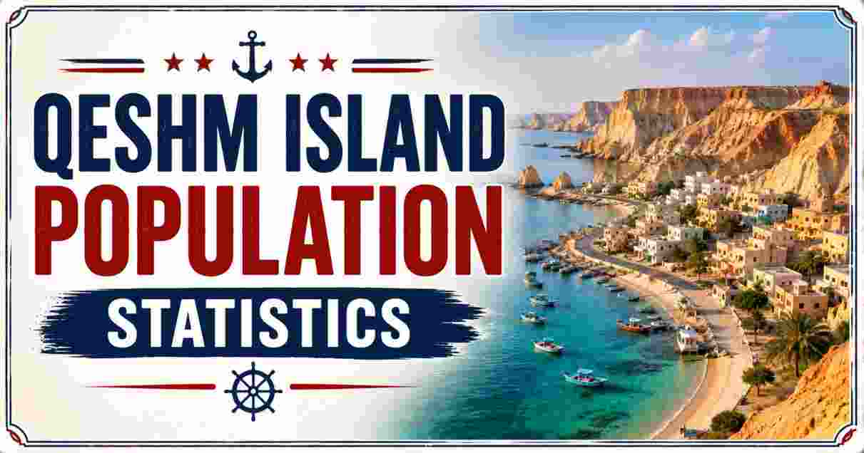
Qeshm Island Population 2026
Qeshm Island Population describe the demographic profile of the largest island in the Persian Gulf, a 1,491-square-kilometer landmass sitting in the Strait of Hormuz just 2 kilometers off the southern coast of Iran’s Hormozgan Province. Home to an estimated 180,000 residents spread across 59 towns and villages, Qeshm has seen its population climb from 103,881 at the 2006 census to 148,993 in 2016 — a 43% increase in a single decade — driven largely by the pull of its Free Trade Zone, established in 1991, and a booming tourism economy built around its status as the Middle East’s only UNESCO Global Geopark.
Located at coordinates 26°50′N, 56°0′E, directly across the Clarence Strait (Khuran) from the naval port city of Bandar Abbas, Qeshm’s population sits at one of the most strategically sensitive locations on earth — the gateway through which over 20% of the world’s oil supply passes daily. This report breaks down the latest verified Qeshm Island Population Statistics 2026 — covering census trends, settlement-level breakdowns, density, area, and location data — using figures from the Statistical Centre of Iran, Wikipedia’s Qeshm County records, and the UNESCO Global Geopark Programme.
Interesting Facts About Qeshm Island Population Statistics 2026
| Fact Category | Details |
|---|---|
| Estimated 2026 Population | ~180,000 residents |
| 2016 Census Population | 148,993 |
| Population Growth, 2006–2016 | +43%, from 103,881 to 148,993 |
| Total Area | 1,491 km² (576 sq mi) |
| Population Density (2016 census) | 97.96 to 173.71 people per km², depending on boundary definition |
| Largest Settlement | Qeshm City, population 40,678 (2016) |
| Number of Towns and Villages | 59 |
| Distance from Iranian Mainland (closest point) | 2 kilometers |
| Non-Resident Workforce (2026 estimate) | ~30,000 additional daytime residents |
| Effective Daytime Population (2026) | ~210,000+ |
Data Source: Statistical Centre of Iran, Wikipedia (Qeshm County), UNESCO Global Geopark Programme
Qeshm’s population growth trajectory places it among the fastest-expanding island communities in the Persian Gulf region, with each census since 2006 recording double-digit percentage gains. The jump from 103,881 residents in 2006 to 148,993 by 2016 reflects the direct pull of the Qeshm Free Trade Zone, which has drawn workers, entrepreneurs, and their families from across Iran to an island that, prior to the 1990s, was a comparatively sparse fishing and trading community. The 2026 estimate of approximately 180,000, drawn from UNESCO Geopark reporting, would represent a further significant increase, though it has not yet been confirmed by a formal national census.
What makes Qeshm’s population data particularly notable is the gap between resident population and effective daytime population. An estimated 30,000 additional workers — administrative staff, industrial employees, and students commuting from the mainland or residing temporarily for Free Zone employment — push the island’s functional population above 210,000 at peak working hours, a figure that strains housing, water, and municipal infrastructure built for a smaller resident base. This dynamic, common to free-trade-zone islands worldwide, is central to understanding why Qeshm’s population statistics matter well beyond simple headcounts.
Qeshm Island Census Population Trend Statistics 2026
| Census/Estimate Year | Population | Households | % Change from Prior Census |
|---|---|---|---|
| 2006 Census | 103,881 | 22,642 | — |
| 2011 Census | 117,774 | 28,798 | +13.4% |
| 2016 Census | 148,993 | 40,506 | +26.5% |
| 2026 Estimate (UNESCO Geopark) | ~180,000 | Not available | ~+20.8% (implied) |
| Average Household Size (2016) | ~3.68 persons | — | — |
| Cumulative Growth, 2006–2026 | +73.3% | — | Over 20 years |
Data Source: Statistical Centre of Iran National Census Records, Wikipedia (Qeshm County)
Qeshm Island Population Growth by Census Year
2006  |####################                    | 103,881
2011  |#######################                 | 117,774
2016  |##############################          | 148,993
2026* |####################################    | ~180,000 (est.)
The census-by-census trend line for Qeshm Island shows accelerating, rather than slowing, population growth across each measurement period. The 2011-to-2016 interval recorded the steepest jump — a 26.5% increase, nearly double the pace of the preceding 2006-to-2011 period’s 13.4% gain — coinciding with a wave of infrastructure investment in the Free Trade Zone, including expanded port capacity and the island’s first heavy crude oil refinery development phases. If the 2026 UNESCO estimate of roughly 180,000 holds up against Iran’s next formal national census, the island’s cumulative growth since 2006 would exceed 73% over two decades, a pace of demographic expansion far outstripping Iran’s national population growth rate of under 1% annually.
This divergence between Qeshm’s island-level growth and Iran’s national demographic slowdown — where fertility has fallen well below replacement level and annual births recently dropped below one million nationally for the first time since 1955 — underscores that Qeshm’s population increase is being driven overwhelmingly by internal migration rather than natural increase. Workers and families relocating from other Iranian provinces to take advantage of Free Zone employment, tax exemptions, and tourism-sector jobs account for the bulk of the island’s net population gain, a pattern consistent with free-trade-zone islands elsewhere in the Gulf region.
Qeshm Island Area and Location Statistics 2026
| Geographic Parameter | Data |
|---|---|
| Total Surface Area | 1,491 km² (576 sq mi) |
| Alternative Area Figure (Qeshm County, incl. Hengam/Larak) | 1,521 km² (587 sq mi) |
| Island Length | 135 km (83.9 mi) |
| Maximum Width | 40 km (25 mi) |
| Minimum Width | 9.4 km |
| Comparative Size | ~2.5 times the size of Bahrain |
| Distance from Mainland (closest point) | 2 km, across the Clarence Strait (Khuran) |
| Distance from Bandar Abbas (city center) | 22 km |
| Coordinates | 26°46′3″N, 55°46′21″E (island); 26°50′N, 56°0′E (county center) |
| Province | Hormozgan, Iran |
Data Source: Wikipedia (Qeshm Island, Qeshm County), Statistical Centre of Iran
Qeshm Island Area Compared to Bahrain (km²)
Bahrain      |################                        |   787 km²
Qeshm Island |########################################| 1,491 km²
Qeshm’s area and location data explain why the island commands such outsized demographic and strategic attention relative to its population. At 1,491 square kilometers, it stretches 135 kilometers in length — roughly the distance from London to Birmingham — while narrowing to as little as 9.4 kilometers at its tightest point, an elongated, arrow-like shape that gives the island an unusually long coastline relative to its total land area. Sitting nearly two and a half times larger than the entire nation of Bahrain, Qeshm is by a wide margin the largest island anywhere in the Persian Gulf, dwarfing neighboring islands like Hormuz (42 km²), Hengam (~50 km²), and Larak combined.
The island’s location just 2 kilometers from the Iranian mainland across the narrow Clarence Strait, and only 22 kilometers from the major port city of Bandar Abbas, places its population within easy ferry reach of mainland services while still functioning as a legally and administratively distinct Free Trade Zone. This proximity has been a decisive factor in the island’s population growth, since workers can commute or relocate with minimal logistical friction compared to more remote Gulf islands. Qeshm’s coordinates place it directly within the Strait of Hormuz corridor, a body of water through which international naval forces, commercial tankers, and — as documented in recent regional reporting — heightened US-Iran military tensions have converged throughout 2025 and 2026.
Qeshm Island Population Density and Settlement Statistics 2026
| Settlement/District Metric | Data |
|---|---|
| Qeshm City Population (2016) | 40,678 in 11,945 households |
| Total Towns and Villages | 59 |
| Cities in Qeshm County | 4 (including Laft and Ramkan, elevated to city status after 2016 census) |
| Population Density (island area basis) | ~121 people/km² (2026 est., 180,000 ÷ 1,491 km²) |
| Population Density (county basis, 2016) | 97.96 people/km² |
| Density Compared to Alternative Wikipedia Figure | 67.07–173.71 people/km² (varies by source and boundary) |
| Districts (Bakhsh) | Central, Hara, Shahab |
| Notable Villages | Laft, Ramkan, Konarsiah, Shibderaz |
| Household Size (avg., 2016 census) | ~3.68 persons per household |
Data Source: Wikipedia (Qeshm County), Statistical Centre of Iran
Qeshm City vs. Rest of Island Population Share (2016 Census)
Qeshm City (40,678)         |###########                     | ~27%
Remaining 58 Villages/Towns |####################████████████| ~73%
Despite hosting 59 separate towns and villages, Qeshm Island’s population remains meaningfully concentrated in its administrative capital: Qeshm City alone accounted for 40,678 residents — roughly 27% of the entire island’s 2016 population — in just 11,945 households, an average household size of 3.4 persons in the city compared to the island-wide average of 3.68. The remaining 73% of residents are dispersed across dozens of smaller coastal villages, several of which have grown significant enough in recent years to be formally elevated to city status, including Laft and Ramkan following the 2016 census, reflecting the broader demographic diffusion occurring alongside Qeshm City’s own growth.
Population density figures for Qeshm vary considerably depending on which administrative boundary is used — island-only calculations based on the 1,491 km² landmass produce a density in the range of 97 to 122 people per km², while broader Wikipedia-sourced figures citing the wider Qeshm County boundary (which includes Hengam and Larak islands) show density estimates as low as 67 people per km². Either measure places Qeshm well below the population density of comparable Gulf urban centers, reflecting the island’s continued mix of dense urban settlement in Qeshm City alongside the sparsely populated desert and coastal terrain that dominates much of its 135-kilometer length.
Qeshm Island Demographics and Workforce Statistics 2026
| Demographic/Workforce Metric | Data |
|---|---|
| Primary Ethnic Groups | Bandari people, with Persian and Arab cultural influence |
| Primary Languages | Persian (Farsi), Arabic, Bandari dialect |
| Primary Occupations | Fishing, dhow (boat) construction, trade, tourism services |
| Free Trade Zone Direct Jobs (by 2021) | ~40,000 |
| Free Trade Zone Indirect Jobs | ~2,000–3,000 |
| Additional Administrative/Industrial/Student Population | ~30,000 |
| Higher Education Institutions on Island | 10+ |
| Free Trade Zone Established | 1991 |
| Free Trade Zone Area (share of island) | 300 km², ~20% of total island area |
Data Source: Qeshm Free Zone Organization (QFZO), Wikipedia, investinhormozgan.ir
Qeshm Island Workforce Composition (Approx. Est. 2026)
Free Zone Direct Jobs         |########################| ~40,000
Admin/Industrial/Students     |##################      | ~30,000
Free Zone Indirect Jobs       |##                      | ~2,000-3,000
Qeshm’s demographic identity is rooted in the Bandari people, an ethnic and cultural group native to Iran’s southern Gulf coast whose traditions reflect centuries of maritime trade contact with Arab, Portuguese, Dutch, and South Asian merchants — a heritage still visible in the island’s traditional dhow-building craft and its blended Persian-Arabic linguistic environment. Historically, the population’s primary occupations centered on fishing and boat construction, but the 1991 establishment of the Qeshm Free Trade Zone fundamentally reshaped the island’s economic and demographic base, creating an estimated 40,000 direct jobs by 2021 alone, supported by more than 10 higher education institutions that have sprung up to train a growing local and migrant workforce.
The scale of the Free Zone’s workforce — when combined with the roughly 30,000 additional administrative staff, industrial workers, and students who reside on or commute to the island without being fully captured in resident population counts — means Qeshm’s true functional population significantly exceeds its official census figures. This pattern of economic-zone-driven demographic growth, where formal population statistics lag behind the actual number of people living and working on the island at any given time, is a defining feature of Qeshm’s 2026 demographic profile and a key reason official growth figures likely understate the pace of the island’s real expansion. Readers wanting the fuller picture of Qeshm’s trade volumes, tourism numbers, and geological attractions that sit behind this workforce growth can find a broader overview in our Qeshm Island Statistics report.
Qeshm Island vs Nearby Persian Gulf Islands Population Statistics 2026
| Island | Population (est.) | Area | Population Density |
|---|---|---|---|
| Qeshm Island | ~180,000 (2026 est.) | 1,491 km² | ~121 people/km² |
| Hormuz Island | ~6,000–10,000 | 42 km² | ~143–238 people/km² |
| Hengam Island | Small villages, low hundreds to low thousands | ~50 km² | Low density |
| Larak Island | Small population, part of Qeshm County | Smaller than Hengam | Low density |
| Bahrain (country, for scale) | ~1,675,173 (2026) | 787 km² | ~2,128 people/km² |
| Iran (national, for scale) | ~92.87 million (2026 est.) | 1,648,195 km² | ~54.6–57 people/km² |
Data Source: Wikipedia (Hormuz Island, Qeshm County), Statistical Centre of Iran, Demographics of Bahrain, Demographics of Iran
Population Comparison: Qeshm vs Hormuz Island vs Bahrain (Log Scale Approx.)
Hormuz Island  |##                                      | ~6,000-10,000
Qeshm Island   |########################                | ~180,000
Bahrain        |########################################| ~1,675,000
Set alongside its Persian Gulf neighbors, Qeshm’s population scale becomes especially clear: its estimated 180,000 residents vastly outnumber nearby Hormuz Island’s modest 6,000 to 10,000, despite Hormuz sitting at a comparable strategic position within the Strait. This disparity is partly explained by sheer landmass — Qeshm’s 1,491 km² is roughly 35 times larger than Hormuz’s 42 km² — but it also reflects Qeshm’s decisive economic advantage as a Free Trade Zone with substantial industrial and commercial infrastructure, compared to Hormuz’s continued reliance on small-scale fishing and a nascent, deliberately limited eco-tourism sector.
Even so, Qeshm’s population density of roughly 121 people per km² remains far below that of the neighboring nation of Bahrain, whose 1.67 million residents are packed into just 787 km² for a density exceeding 2,100 people per km² — nearly 18 times denser than Qeshm despite Bahrain’s total population being roughly nine times larger. This comparison illustrates that Qeshm, while the largest and most populous island in the Persian Gulf, still retains substantial undeveloped land and low-density rural settlement patterns across much of its 135-kilometer length, even as its urban core in Qeshm City and its Free Trade Zone continue to draw population growth at a pace outstripping the wider Iranian national trend of 0.76% annual growth. For comparison against the much smaller, sparser population of Qeshm’s neighboring salt-dome island, see our Hormuz Island Statistics report.
Disclaimer: This research report is compiled from publicly available sources. While reasonable efforts have been made to ensure accuracy, no representation or warranty, express or implied, is given as to the completeness or reliability of the information. We accept no liability for any errors, omissions, losses, or damages of any kind arising from the use of this report.