
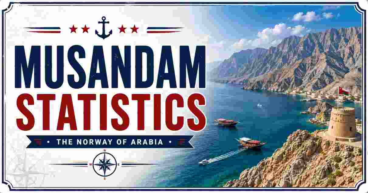
Musandam Statistics 2026
Musandam describe one of the most geographically unusual territories on earth — an Omani exclave cut off from the rest of the Sultanate by a strip of United Arab Emirates territory, jutting into the Strait of Hormuz at the very tip of the Arabian Peninsula. According to Oman’s National Centre for Statistics and Information (NCSI), the Musandam Governorate was home to 55,802 residents as of the end of May 2026, making it both the smallest governorate in Oman by area and the smallest by population, accounting for just 1% of the Sultanate’s total population of 5,388,513. Spanning just 1,800 square kilometers (690 sq mi), Musandam’s rugged, fjord-cut coastline has earned it the nickname the “Norway of the Middle East.”
Musandam’s significance, however, is wildly disproportionate to its small population. Its capital, Khasab, sits directly across the Strait of Hormuz from Iran, placing the territory at the epicenter of one of the planet’s most strategically vital — and most contested — waterways, through which roughly 20% of the world’s oil and LNG supply passes daily. This report breaks down the latest verified Musandam Statistics 2026 — covering population trends, area, location, wilayat-level breakdowns, and the governorate’s unique geopolitical position — using data from Oman’s NCSI, Wikipedia’s Musandam Governorate records, and Oman’s Ministry of Foreign Affairs.
Interesting Facts About Musandam Statistics 2026
| Fact Category | Details |
|---|---|
| 2026 Population (NCSI, end of May 2026) | 55,802 residents |
| 2020 Census Population | 49,062 |
| Share of Oman’s Total Population | 1% (smallest of Oman’s 11 governorates) |
| Total Area | 1,800 km² (690 sq mi) |
| Population Density (2020 census) | 27 people/km² (71/sq mi) |
| Capital | Khasab, population 21,651 (2020) |
| Governorate Status | Exclave — separated from mainland Oman by UAE territory |
| Wilayats (Provinces) | Khasab, Bukha, Dibba Al-Bay’ah, plus the exclave of Madha |
| Coordinates | 25°55′N, 56°17′E |
| Highest Peak | Jebel Al Harim (“Mountain of Women”), approximately 2,087 meters |
Data Source: Oman National Centre for Statistics and Information (NCSI), Wikipedia (Musandam Governorate), Oman Ministry of Foreign Affairs
The jump to 55,802 residents recorded in the NCSI’s May 2026 Monthly Statistical Bulletin confirms Musandam’s status as Oman’s smallest governorate by population, a title it has held consistently even as the territory posts some of the fastest percentage growth rates of any Omani region. Set against Oman’s national population of 5,388,513 — itself up 1.6% year-on-year — Musandam’s roughly 1% share underscores just how sparsely settled this mountainous, fjord-lined peninsula remains compared with the densely populated Muscat Governorate, which alone accounts for 28.6% of the Sultanate’s population.
What makes Musandam’s demographic profile genuinely unusual on a global scale is its status as a true exclave — a piece of national territory with no land connection whatsoever to the rest of its own country. Access historically required either a limited flight schedule or a grueling ten-hour drive through four separate immigration posts, a logistical reality that shaped both the region’s population growth and its economic development for decades before the 2008 launch of a direct sea ferry connection to Muscat.
Musandam Population Trend Statistics 2026
| Year/Period | Population | Notes |
|---|---|---|
| Historical Peak (Pre-20th Century Decline) | ~236,000 (estimated) | Reduced sharply over generations due to political and economic conditions |
| 1993 | 28,727 | Early modern census baseline |
| 2010–2020 | Annual growth ~4.56% | Most significant growth period on record |
| 2020 National Census | 49,062 | Density 27 people/km² |
| 2026 Estimate (NCSI, end of May) | 55,802 | +13.8% increase over the 2020 census figure |
| Growth, 1993–2026 | +94.2% | Population nearly doubled over 33 years |
Data Source: Wikipedia (Musandam Governorate), Musandam Association, Oman NCSI Monthly Statistical Bulletin (July 2026)
Musandam Governorate Population Growth
1993   |####################                    | 28,727
2020   |###################################     | 49,062
2026*  |########################################| 55,802
Musandam’s population trajectory tells a story of recovery rather than steady linear growth. Historical accounts, including those compiled by the Musandam Association, describe a population once estimated as high as 236,000 that dwindled dramatically over the course of the 20th century as political isolation, limited infrastructure, and the region’s punishing terrain drove out-migration among the resourceful Shihuh people who have inhabited the peninsula for centuries. The modern recovery began in earnest from the 1993 baseline of 28,727, with the decade from 2010 to 2020 standing out as the sharpest growth period on record, posting an average annual increase of 4.56% — a pace far exceeding Oman’s national growth rate.
That momentum has carried through into 2026: the NCSI’s most recent bulletin places Musandam’s population at 55,802, a 13.8% increase over the formal 2020 census count of 49,062. Taken together with the historical estimate of a once far larger population, Musandam’s 2026 figures represent genuine demographic recovery rather than a return to historical peak levels, driven by continued government investment in infrastructure, the 2008 launch of the Shinas fast ferry connecting Khasab to Muscat, and growing employment opportunities tied to tourism and fishing.
Musandam Area and Location Statistics 2026
| Geographic Parameter | Data |
|---|---|
| Total Area | 1,800 km² (690 sq mi) |
| Share of Oman’s Total National Area | ~0.85% |
| Coordinates (Governorate Center) | 25°55′N, 56°17′E |
| Coordinates (Khasab, Capital) | 26°11′N, 56°15′E |
| Position | Northernmost tip of the Musandam Peninsula, jutting into the Strait of Hormuz |
| Bordering Body of Water (North) | Strait of Hormuz |
| Bordering Body of Water (East) | Gulf of Oman / Arabian Sea |
| Land Border | Entirely surrounded by United Arab Emirates territory on the landward side |
| Distance from Muscat (mainland Oman capital) | ~6–7 hours by road |
| Distance from Dubai, UAE | ~3–4 hours by road |
Data Source: Wikipedia (Musandam Governorate, Musandam Peninsula), Oman Ministry of Foreign Affairs
Musandam Area Compared to Other Small Oman Governorates (km²)
Musandam    |########                                | 1,800 km²
Al Buraimi  |####################                    | ~4,400 km² (approx.)
Muscat      |###############                         | 3,500 km²
Musandam’s geography is defined above all by its extraordinary isolation from the rest of its own country. Occupying just 1,800 square kilometers, or roughly 0.85% of Oman’s total national territory, the governorate sits at the northernmost extremity of the Musandam Peninsula, a rugged extension of the Hajar Mountains that plunges directly into the sea rather than sloping gradually toward a coastal plain — the geological feature responsible for the deep, cliff-lined inlets known locally as khors that give the region its “Norway of the Middle East” reputation. The peninsula’s mountains rise to as much as 1,200 meters in places directly from the waterline, creating a coastline unlike anywhere else on the Arabian Peninsula.
Critically, Musandam has no land connection to mainland Oman whatsoever — the entire landward perimeter of the governorate is bordered by the United Arab Emirates, making it a genuine political exclave in the fullest sense. This forces overland travelers to cross international borders twice to reach Musandam from the rest of Oman, a journey of 6 to 7 hours by road, compared with a considerably shorter 3-to-4-hour drive from Dubai. This geographic reality places Musandam’s population, economy, and even its telecommunications infrastructure in closer day-to-day proximity to the UAE than to the Omani capital it formally answers to — a dynamic explored further in our Strait of Hormuz Statistics report, which examines how the peninsula’s location shapes the broader geopolitics of the strait it borders.
Musandam Wilayat and Settlement Statistics 2026
| Wilayat (Province) | Population Data | Notes |
|---|---|---|
| Khasab (capital) | 21,651 (2020 census) | Administrative and economic hub |
| Dibba Al-Bay’ah | 9,873 (2018 estimate), area 491 km² | Fishing industry hub near UAE border |
| Bukha | Smaller coastal population | Historical significance, home to Bukha Castle |
| Madha (exclave) | Small population | Exclave located midway between Musandam and mainland Oman, entirely surrounded by UAE |
| Nahwa (counter-exclave within Madha) | Very small population | UAE territory (Sharjah) enclosed entirely within Madha |
| Governorate Total | 55,802 (2026 estimate) | Across all wilayats |
Data Source: Wikipedia (Khasab, Dibba Al-Baya, Musandam Governorate), Musandam Association
Musandam Population Share by Wilayat (Approx., 2020 basis)
Khasab                 |########################        | ~44%
Dibba Al-Bay'ah        |####################            | ~20%
Bukha & Other Villages |################                | Remainder
Musandam’s population concentrates heavily in its capital: Khasab, home to 21,651 residents as of the 2020 census, accounts for close to 44% of the governorate’s total population, functioning as the administrative, commercial, and logistical center for the entire peninsula. Dibba Al-Bay’ah, positioned near the UAE border and spread across a comparatively large 491 km², recorded 9,873 residents in a 2018 estimate and remains an important fishing community, while Bukha, home to the historic 16th-17th century Bukha Castle, rounds out the governorate’s three mainland wilayats with a smaller coastal population.
The most geographically unusual settlement pattern belongs to Madha, an exclave of Musandam itself, located roughly midway between the peninsula and mainland Oman and entirely enclosed by UAE territory — a genuine double exclave situation made even more remarkable by the presence of Nahwa, a tiny UAE (Sharjah) counter-exclave sitting entirely within Madha’s borders. Madha formally joined Musandam Governorate in 1979, and while government policy has actively discouraged migration from small fishing villages into Khasab — offering free electricity and water to remaining Bedouin and fishing communities specifically to preserve the peninsula’s traditional settlement pattern — the pull of Khasab’s greater economic opportunity continues to shape internal migration across Musandam’s 2026 population distribution.
Musandam Ethnicity, Language and Governance Statistics 2026
| Demographic/Governance Metric | Data |
|---|---|
| Primary Ethnic Group | Shihuh people |
| Primary Languages | Arabic; Kumzari (in Kumzar, northern Musandam) |
| Kumzari Language Classification | Southwestern Iranian language, related to Larestani and Luri |
| Sultan of Oman | Haitham bin Tariq Al Said |
| Governor of Musandam | Sayyid Ibrahim bin Said al Busaidy |
| Primary Economic Activities | Fishing, dhow tourism, small-scale agriculture |
| Ferry Connection to Muscat | Shinas fast ferry, launched August 2008 |
| Ferry Connection to Dibba/UAE | 2.5-hour crossing, operates twice weekly |
Data Source: Wikipedia (Musandam Governorate, Kumzari language), Musandam Association
Musandam Access Routes Before and After 2008 Ferry Launch
Pre-2008: Flight or 10-hr drive through 4 immigration posts
2008+:    Shinas fast ferry direct to Muscat added as third option
Musandam’s cultural and linguistic identity reflects its centuries of relative isolation from both mainland Oman and the wider Arabian Peninsula. The dominant ethnic group, the Shihuh people, have developed a distinct way of life adapted to the peninsula’s harsh mountain and coastal terrain, while in the northern settlement of Kumzar, residents speak Kumzari, a genuinely unique southwestern Iranian language unrelated to Arabic and more closely tied linguistically to Larestani and Luri, spoken across the strait in Iran — a linguistic fingerprint of the deep historical trade and migration connections across the Strait of Hormuz that predate the modern Iran-Oman border entirely.
Administratively, Musandam falls under the direct governance structure of the Sultanate, led nationally by Sultan Haitham bin Tariq Al Said and locally by Governor Sayyid Ibrahim bin Said al Busaidy. The territory’s connectivity to the rest of Oman improved substantially with the August 2008 launch of the Shinas fast ferry service between Muscat and Musandam, easing what had previously been an extremely difficult overland or limited-flight-only journey. A separate, twice-weekly 2.5-hour ferry now also connects Khasab to Dibba on the UAE side, reinforcing how thoroughly Musandam’s daily transportation and economic life is intertwined with its Emirati neighbors despite its unambiguous status as sovereign Omani territory.
Musandam vs Other Oman Governorates Population Statistics 2026
| Governorate | Population (May 2026) | Share of National Total |
|---|---|---|
| Muscat | 1,538,312 | 28.6% |
| North Al Batinah | 945,647 | 17.6% |
| South Al Batinah | 589,152 | 10.9% |
| Al Dakhiliyah | 574,354 | 10.7% |
| Dhofar | 535,623 | 9.9% |
| South Al Sharqiyah | 377,701 | 7% |
| North Al Sharqiyah | 322,914 | 6% |
| Al Dhahirah | 248,813 | 4.6% |
| Al Buraimi | 135,629 | 2.5% |
| Al Wusta | 64,566 | 1.2% |
| Musandam | 55,802 | 1% (smallest governorate) |
| Oman National Total | 5,388,513 | 100% |
Data Source: Oman National Centre for Statistics and Information (NCSI), Monthly Statistical Bulletin, May 2026
Oman Governorate Population Ranking (Selected, May 2026)
Muscat         |########################################| 1,538,312
North Batinah  |#############################           |   945,647
Al Buraimi     |####                                    |   135,629
Al Wusta       |##                                      |    64,566
Musandam       |#                                       |    55,802
Set against Oman’s other ten governorates, Musandam’s 55,802 residents confirm its position as the smallest by population nationwide, trailing even the sparsely populated desert governorate of Al Wusta, home to 64,566 people, and standing at barely 3.6% the size of Muscat’s 1,538,312 residents. This ranking has remained essentially stable for years, a reflection of Musandam’s genuinely constrained land area combined with the logistical difficulty of its exclave status, both of which naturally limit population carrying capacity compared with the more accessible and economically diversified governorates along Oman’s Batinah coast.
Yet Musandam’s outsized geopolitical importance stands in stark contrast to its modest demographic footprint. As the Omani territory bordering the Strait of Hormuz directly opposite Iran, Musandam’s roughly 1% share of Oman’s population belies its role in one of the most consequential maritime security arrangements on earth — a dynamic examined in greater depth in our Countries Using Strait of Hormuz Statistics report, and in our companion coverage of Hormuz Island Statistics, which profiles the similarly small but strategically outsized Iranian island sitting just across the strait from Musandam’s own rugged coastline.
Disclaimer: This research report is compiled from publicly available sources. While reasonable efforts have been made to ensure accuracy, no representation or warranty, express or implied, is given as to the completeness or reliability of the information. We accept no liability for any errors, omissions, losses, or damages of any kind arising from the use of this report.