
Where Is Larak Island Located?
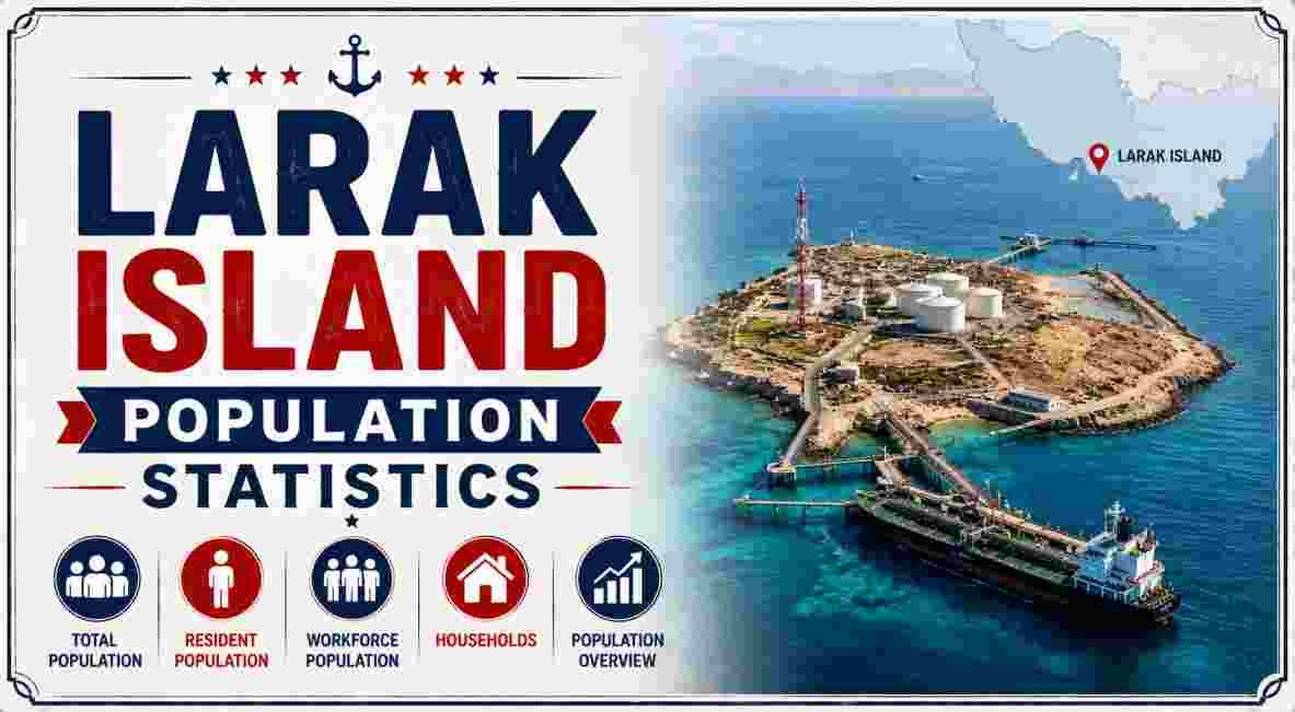
Larak Island is a small Iranian island situated in the Strait of Hormuz, part of Hormozgan Province in southern Iran. Lying roughly 45 kilometers southeast of Bandar Abbas, Iran’s largest southern port city, and about 18 kilometers southeast of the eastern end of Qeshm Island, Larak sits just south of the better-known Hormuz Island within the same small island chain that lines the Iranian side of the strait. Despite covering just 49 square kilometers (19 square miles), the island has remained a settled, if sparsely populated, corner of Hormozgan Province for centuries, with a single village housing its entire recorded population.
In 2026, Larak Island continues to be defined largely by its small, stable population, its arid, largely barren terrain, and a local economy built around subsistence fishing and diving rather than agriculture or tourism infrastructure. With official census figures placing the population at just 421 residents as of the most recent national count, Larak remains one of the smallest inhabited islands in Iran’s southern waters, administered as its own rural district within Qeshm County.
Key Larak Island Facts in 2026
| Fact | Figure |
|---|---|
| Total population (2016 census) | 421 residents |
| Total households (2016 census) | 115 |
| Total land area | 49 km² (19 sq mi) |
| Highest elevation | ~138 meters (453 ft) |
| Only permanent settlement | Larak Shahri |
| Governing province | Hormozgan Province, Iran |
| Governing county | Qeshm County |
| Administrative district | Larak Rural District, Central District |
Source: Statistical Center of Iran, 2016 National Census; Wikipedia, “Larak Rural District” and “Larak Island”
Larak Island’s population figures place it firmly among Iran’s smaller inhabited islands, with the entire recorded population of 421 people across 115 households concentrated in a single village, Larak Shahri, on the island’s northern shore. That population is spread across a modest 49 square kilometers of largely arid terrain, giving the island one of the lowest population densities of any inhabited landmass in the Strait of Hormuz region — a reflection of both its limited fresh water resources and its historically narrow economic base.
What stands out most about Larak’s demographic profile is its administrative structure relative to its size: despite housing only a few hundred residents, the island holds its own formal designation as Larak Rural District within Qeshm County, complete with defined boundaries, a capital settlement, and inclusion in Iran’s national census system. Two additional settlements once existed on the island — Larak Kuhi and Mowrona — but both are recorded in the most recent census as abandoned, with no remaining inhabitants, leaving Larak Shahri as the island’s sole populated place.
Larak Island Population and Growth Statistics 2026
| Census Year | Population | Households |
|---|---|---|
| 2006 | 466 | 98 |
| 2011 | 473 | Not separately reported |
| 2016 | 421 | 115 |
Source: Statistical Center of Iran, 2016 National Census, via Wikipedia “Larak Rural District”
Larak Island Population Trend, 2006-2016 (Official Census Data)
2006   ████████████████████████████████████████████ 466
2011   █████████████████████████████████████████████ 473
2016   ███████████████████████████████████████████   421
Larak Island’s population history across Iran’s three most recent national censuses shows a modest rise followed by a more pronounced decline: from 466 residents in 2006, the population edged up slightly to 473 in 2011, before falling to 421 by the 2016 census — a drop of roughly 11% over five years. That decline coincided with a rise in the number of recorded households, from 98 in 2006 to 115 in 2016, suggesting a shift toward smaller average household sizes even as the overall population contracted, a pattern common in small, isolated island communities where younger residents increasingly relocate to the mainland for education and employment.
Separately, some tourism-oriented sources describe Larak’s population more loosely as “about 1,000 people,” a figure notably higher than the official census count. That discrepancy likely reflects either outdated estimates, a broader informal count that includes seasonal or temporary residents tied to fishing activity, or simply less rigorous sourcing than Iran’s official statistical agency. For consistency and accuracy, the 421-resident figure from the 2016 national census — Iran’s most recent full census — remains the most reliable benchmark for Larak’s population, though it’s worth noting that no more recent official census has been published, meaning the island’s precise current population as of 2026 is technically an extrapolation from 2016 data rather than a freshly counted figure.
Larak Island Geography and Area Statistics 2026
| Geographic Metric | Figure |
|---|---|
| Total area | 49 km² (19 sq mi) |
| Highest point | ~138 meters (453 ft) above sea level |
| Island length | Approximately 11 km |
| Coordinates | ~26°51′N, 56°21′E |
| Distance from Bandar Abbas | ~45 km southeast |
| Distance from Qeshm Island (eastern end) | ~18 km southeast |
| Nearest major neighboring island | Hormuz Island (to the north) |
Source: Wikipedia, “Larak Island”; Sunday Guardian Live, August 2026
Larak Island stretches roughly 11 kilometers across its longest axis, rising to a highest point of approximately 138 meters at a sandstone peak that dominates the island’s otherwise low, arid profile. Positioned at approximately 26°51′N, 56°21′E, the island sits within a compact cluster of small islands — including Qeshm and Hormuz — that together line the Iranian side of the Strait of Hormuz, roughly 45 kilometers southeast of Bandar Abbas, the region’s principal port and administrative center.
The island’s terrain is predominantly barren and rocky, typical of the wider Hormozgan coastline, with limited natural fresh water and low, sparse vegetation. A notable engineering feature of the landscape is a system of recharge dams designed to capture and store floodwater during the region’s infrequent rainfall events, an adaptation that has historically been essential to sustaining the island’s small permanent population given the near-complete absence of natural freshwater sources. Larak’s compact size and elongated shape place it firmly among the smaller inhabited islands in the immediate Strait of Hormuz region, considerably smaller than nearby Qeshm Island but larger in land area than its northern neighbor, Hormuz Island, which covers approximately 42 square kilometers. Readers interested in a detailed comparison can consult the complete Hormuz Island statistics, which covers that neighboring island’s population, geology, and economy in similar depth.
Larak Island Economy and Livelihoods Statistics 2026
| Economic Metric | Detail |
|---|---|
| Primary economic activities | Diving and fishing |
| Secondary activity | Limited agriculture |
| Fresh water source | Recharge dams capturing seasonal floodwater |
| Historical trade role | Regional maritime trade route, 16th century onward |
Source: SURFIRAN Travel Guide, April 2024; Wikipedia, “Larak Island”
Larak’s economy remains modest and closely tied to the sea, with diving and fishing forming the two primary economic activities supporting the island’s small population. Limited agricultural activity supplements this maritime livelihood, though the island’s arid conditions and lack of natural fresh water place firm constraints on how much farming the land can realistically support, making the recharge dam system described earlier a genuinely essential piece of local economic infrastructure rather than a purely environmental feature.
Larak’s economic story is inseparable from its long maritime history. During the 16th century, the wider Hormozgan island chain — including Larak — fell successively under Portuguese, British, and Dutch influence, drawn by the region’s strategic position along historic Indian Ocean and Persian Gulf trade routes. Physical reminders of that era, including old military forts and cannons, remain scattered across several of the region’s islands. Sovereignty over Larak and its neighboring islands was restored to Iran during the reign of Shah Abbas, after which the island settled into the smaller-scale fishing and diving economy that continues to define it today, largely outside the tourism and shipping infrastructure that has grown around larger neighboring islands like Qeshm.
Larak Island Administrative and Governance Statistics 2026
| Administrative Metric | Detail |
|---|---|
| Country | Iran |
| Province | Hormozgan |
| County | Qeshm County |
| District | Central District |
| Rural district | Larak Rural District |
| Capital of rural district | Larak Shahri |
| Prior district assignment (until 2017) | Shahab District |
| Time zone | UTC+3:30 (Iran Standard Time) |
Source: Wikipedia, “Larak Rural District”
Larak Island’s administrative status has shifted at least once in recent years: the island was reassigned from Shahab District to the Central District of Qeshm County in 2017, a routine administrative restructuring that placed Larak Rural District under its current jurisdictional arrangement. That rural district consists entirely of the island itself, with Larak Shahri serving as its formal capital and sole populated settlement — a straightforward governance structure reflecting the island’s small scale relative to Iran’s more populous rural districts elsewhere in Hormozgan Province.
Operating on Iran Standard Time (UTC+3:30), the same time zone as the rest of the country, Larak’s governance and administrative life is fully integrated into Iran’s national and provincial systems despite its geographic remoteness. For broader context on the maritime geography surrounding Larak — including the strait’s role in regional and global shipping — the complete Strait of Hormuz statistics provide detailed figures on the wider waterway’s dimensions, shipping lanes, and the constellation of small islands, Larak included, that line its Iranian shore. For a sense of how a similarly small, remote island population compares on the opposite side of the world, the complete Norfolk Island statistics offer a useful parallel case study — a South Pacific territory of just over 2,000 residents navigating many of the same small-population, high-isolation governance challenges that shape daily life on Larak.
Larak Island Infrastructure and Navigation Statistics 2026
| Infrastructure Metric | Detail |
|---|---|
| Lighthouse constructed | 2008 |
| Lighthouse construction material | Concrete tower |
| Lighthouse height | 18 meters (59 ft) |
| Lighthouse power source | Solar power |
| Lighthouse focal height | 40 meters (130 ft) |
| Lighthouse range | 18 nautical miles (33 km / 21 mi) |
| Lighthouse light characteristic | Fl(2) W 10s |
Source: Wikipedia, “Larak Island”
Larak Island’s most notable piece of modern infrastructure is its solar-powered lighthouse, constructed in 2008 as a cylindrical concrete tower standing 18 meters tall, with a focal height of 40 meters above sea level once its elevated positioning on the island’s terrain is factored in. The lighthouse’s 18-nautical-mile range and distinctive Fl(2) W 10s flashing pattern — two white flashes every ten seconds — serve the substantial volume of maritime traffic passing through the surrounding waters, reflecting the island’s position within one of the world’s most heavily trafficked shipping corridors even as the island’s own population and economy remain modest in scale.
The lighthouse’s reliance on solar power rather than a mains electrical connection underscores the island’s broader infrastructure profile: a small, largely self-sufficient community where essential services are adapted to the practical realities of limited freshwater, limited electrical infrastructure, and a population too small to justify the kind of large-scale utility investment seen on Iran’s mainland or on larger regional islands like Qeshm.
Disclaimer: This research report is compiled from publicly available sources. While reasonable efforts have been made to ensure accuracy, no representation or warranty, express or implied, is given as to the completeness or reliability of the information. We accept no liability for any errors, omissions, losses, or damages of any kind arising from the use of this report.