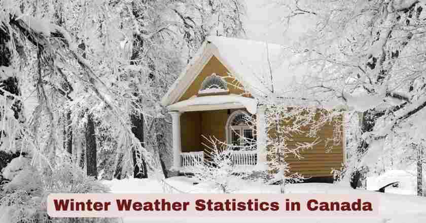
Winter Weather in Canada 2025
The winter season of 2024/2025 has marked a significant chapter in Canada’s climate history, with the nation experiencing its 5th warmest winter since nationwide recording began in 1947/1948. According to Environment and Climate Change Canada’s official Climate Trends and Variations Bulletin, the national average temperature for winter 2024/2025 stood at 3.7°C above the baseline average, calculated from the 1961-1990 reference period. This substantial temperature departure reflects the continuing trend of warming winters that has been particularly pronounced across the northern territories, with most regions experiencing temperatures at least 2°C above normal. The winter weather patterns across Canada have shown remarkable regional variation, with Arctic regions recording the most dramatic temperature departures while southern provinces experienced conditions closer to historical averages.
As Canadians look ahead to the remainder of 2025 and into the 2025-2026 winter season, forecasters predict a return to more traditional Canadian winter conditions. Environment and Climate Change Canada released its seasonal outlook in December 2025, indicating that La Niña conditions combined with an early disruption of the polar vortex will shape weather patterns across the country. The forecast suggests warmer-than-normal temperatures for the eastern Arctic and communities around Hudson Bay, including northern Manitoba, Ontario, and Quebec, while parts of the Yukon, Northwest Territories, and western Nova Scotia may experience colder conditions. This dynamic winter pattern is expected to bring increased precipitation near the Rockies and a more active storm season in eastern Canada, with multiple nor’easters and winter storms anticipated throughout late December 2025 and into early 2026.
Interesting Winter Weather Facts and Latest Statistics in Canada 2025
| Winter Weather Metric in Canada 2025 | Statistical Value | Comparison/Context |
|---|---|---|
| National Average Winter Temperature 2024/2025 | 3.7°C above baseline | 5th warmest winter since 1947/1948 |
| Warmest Winter on Record | 5.2°C above baseline | Occurred in 2023/2024 |
| Coldest Winter on Record | 3.6°C below baseline | Occurred in 1971/1972 |
| Arctic Tundra Temperature Departure | 5.2°C above baseline | 3rd warmest winter for this region |
| Arctic Mountains and Fiords Temperature | 4.6°C above baseline | 4th warmest winter recorded |
| Mackenzie District Temperature Departure | 4.7°C above baseline | 6th warmest winter since 1947 |
| Yukon/North B.C. Mountains Temperature | 4.9°C above baseline | 7th warmest winter on record |
| Northeastern Forest Temperature Departure | 3.7°C above baseline | 7th warmest winter recorded |
| Long-term Winter Warming Trend | 3.7°C increase | Over the past 78 years (1948-2025) |
| Strongest Regional Warming Trend | 5.9°C increase | Yukon/North B.C. Mountains region |
| Weakest Regional Warming Trend | 1.6°C increase | Atlantic Canada region |
| Recent Snowfall Event – Kapuskasing, ON | 36 cm | December 19, 2025 |
| Recent Snowfall – Thunder Bay, ON | 19 cm | December 19, 2025 |
| Record Low Temperature – Faro Area, BC | -49.2°C | Set December 19, 2025 (previous: -46.0°C in 1980) |
| Extreme Weather Events Analyzed | 42 events | Since June 2025 |
| Climate Change Attribution | 39 out of 42 events | Made more likely by human-caused climate change |
| 2025 Global Temperature Ranking | 3rd warmest year | Confirmed by UN’s World Meteorological Organization |
Data Source: Environment and Climate Change Canada – Climate Trends and Variations Bulletin Winter 2024/2025; Weather Summaries December 2025
The winter weather statistics for Canada in 2025 reveal a compelling narrative of climatic transformation across the nation’s diverse regions. The national average temperature for the winter of 2024/2025 reaching 3.7°C above the baseline average represents a significant warming trend that has persisted throughout the country, with only minor exceptions. This temperature departure makes it the 5th warmest winter in 78 years of comprehensive nationwide recording, underscoring the accelerating pace of winter warming across Canadian territories. The most pronounced warming occurred in the northern regions, particularly the Arctic Tundra, which experienced temperatures 5.2°C above baseline, ranking as its 3rd warmest winter on record. Similarly, the Arctic Mountains and Fiords recorded temperatures 4.6°C above baseline, representing the region’s 4th warmest winter since measurements began in 1947/1948.
The long-term trend analysis demonstrates that winter temperatures across Canada have increased by an average of 3.7°C over the past 78 years, with regional variations showing the most dramatic changes in western and northern territories. The Yukon and North B.C. Mountains region has experienced the strongest warming trend at 5.9°C, while Atlantic Canada shows the most moderate increase at 1.6°C. Remarkably, winter temperatures have remained consistently above the baseline average since 1995/1996, with only the 2012/2013 winter breaking this pattern. Recent extreme weather events in December 2025 illustrate the dynamic nature of Canadian winters, with Kapuskasing, Ontario receiving 36 centimeters of snow and the Faro area in British Columbia setting a new record low temperature of -49.2°C on December 19, 2025, breaking the previous record of -46.0°C set in 1980. Environment and Climate Change Canada’s analysis of 42 extreme precipitation events since June 2025 revealed that 39 were made more likely to occur due to human-caused climate change, highlighting the significant impact of global warming on Canada’s winter weather patterns.
Temperature Trends Across Canadian Regions 2025
| Climate Region | Winter 2024/2025 Temperature Departure | Regional Ranking | 78-Year Warming Trend |
|---|---|---|---|
| Arctic Tundra | +5.2°C | 3rd warmest | Significant positive trend |
| Arctic Mountains and Fiords | +4.6°C | 4th warmest | Strong positive trend |
| Mackenzie District | +4.7°C | 6th warmest | +2.9°C (strongest overall) |
| Yukon/North B.C. Mountains | +4.9°C | 7th warmest | +5.9°C (strongest winter) |
| Northeastern Forest | +3.7°C | 7th warmest | Strong positive trend |
| Maritime Provinces | Near baseline | Not in top 10 | Moderate positive trend |
| Southern Ontario | Near baseline | Not in top 10 | Positive trend |
| West Coast (BC) | Near baseline | Not in top 10 | Positive trend |
| Southern Saskatchewan | Slightly below baseline | Not in top 10 | Positive trend overall |
| Atlantic Canada | Near baseline | Not in top 10 | +1.6°C (weakest trend) |
| National Average | +3.7°C | 5th warmest | +3.7°C over 78 years |
Data Source: Environment and Climate Change Canada – Climate Trends and Variations Bulletin Winter 2024/2025
Temperature patterns across Canada’s diverse climate regions during the 2024/2025 winter demonstrate significant geographical variation in warming trends. The northern territories experienced the most dramatic temperature departures, with the Arctic Tundra recording temperatures 5.2°C above the baseline average, making it the region’s 3rd warmest winter since records began in 1947/1948. This exceptional warming extended across multiple Arctic zones, with the Arctic Mountains and Fiords experiencing temperatures 4.6°C above baseline (ranking as the 4th warmest) and the Mackenzie District showing departures of 4.7°C above baseline (6th warmest on record). The Yukon and North B.C. Mountains region recorded temperatures 4.9°C above the baseline, representing the 7th warmest winter for this mountainous territory. The Northeastern Forest region also experienced significant warming at 3.7°C above baseline, tying with the national average and ranking as the region’s 7th warmest winter.
In contrast, southern and coastal regions experienced more moderate temperature departures during winter 2024/2025. The Maritime provinces, southern Ontario, and west coast of British Columbia all recorded temperature departures near the baseline average, indicating conditions closer to historical norms for these populated regions. Notably, a small region in southern Saskatchewan recorded temperatures slightly below the baseline average, representing one of the few areas in the country that experienced cooler-than-normal conditions. When examining long-term trends over the past 78 years (1948-2025), all eleven climate regions exhibited positive warming trends for winter temperatures. The Yukon/North B.C. Mountains showed the strongest winter warming trend at +5.9°C, while the Mackenzie District demonstrated the strongest overall annual trend at +2.9°C. The Atlantic Canada region exhibited the weakest warming trend at +1.6°C, though still showing consistent long-term increases in winter temperatures.
Winter Storm Activity and Extreme Weather Events in Canada 2025
| Winter Storm Event | Date/Period in 2025 | Affected Regions | Impact Details |
|---|---|---|---|
| Trio of Back-to-Back February Storms | February 2025 | Central and Eastern Canada | Heavy snow, fierce winds, buried regions |
| Early November Snowstorm | November 2025 | Central and Eastern Canada | Early winter conditions, travel disruptions |
| Toronto Pearson Airport Snowfall | February 2025 storms | Southern Ontario | 25 cm of snow |
| Montreal Airport Accumulation | February 2025 storms | Quebec | 40 cm of snow |
| Mirabel, Quebec Snowfall | February 2025 storms | Quebec | 53 cm of snow (strongest storm) |
| Major Ice Storm | March 28-31, 2025 | Ontario and Quebec | Up to 25 mm freezing rain |
| Ice Storm Power Outages | March 30, 2025 | Ontario and Quebec | 380,000 households without power |
| Ice Storm Casualties | March 2025 | Ontario and Quebec | 1 fatality, multiple injuries |
| December Blizzard – Kapuskasing | December 19, 2025 | Northern Ontario | 36 cm snowfall |
| December Blizzard – Sioux Lookout | December 19, 2025 | Northern Ontario | 25 cm snowfall |
| December Blizzard – Thunder Bay | December 19, 2025 | Northern Ontario | 19 cm snowfall |
| Manitoba Blizzard | December 18-19, 2025 | Southern Manitoba, Winnipeg | Highway closures, school closures |
| Polar Vortex Disruption | December 2025 | Canada-wide | Arctic air outbreaks, extreme cold |
| Nor’Easter System | December 2025 | Atlantic Canada | Blizzard conditions, heavy snow |
| Extreme Weather Events Analyzed | June-December 2025 | Canada-wide | 42 events total |
Data Source: Environment and Climate Change Canada Top 10 Weather Stories 2025; Weather Summaries December 2025
The winter and fall of 2025 delivered an unprecedented series of disruptive snowstorms and extreme weather events across central and eastern Canada, beginning with a powerful trio of back-to-back storms in February 2025 that brought fierce winds and buried much of the region under heavy snow. According to Environment and Climate Change Canada’s Top 10 Weather Stories of 2025, these February storms represented some of the most significant winter weather events of the year, with the strongest system dropping 25 centimeters at Toronto’s Pearson International Airport, 40 centimeters at Montreal Airport, and an astonishing 53 centimeters at Mirabel, Quebec. The storms resulted in widespread road closures, abandoned vehicles, grounded flights, and in Montreal, garbage pickup was suspended for a full week. Months later, in November 2025, another intense system brought an early taste of winter to many of the same areas, demonstrating the persistent pattern of rapidly deepening low-pressure systems tracking along sharp temperature divides and tapping into abundant moisture.
The major ice storm that struck Ontario and Quebec from March 28-31, 2025 stands out as one of the year’s most devastating weather events, with Hydro One calling it the province’s worst ice storm since the historic event of 1998. The storm coated everything from tree blossoms to power lines with ice as up to 25 millimeters of freezing rain fell in certain regions, resulting in flooded basements and at least 380,000 households losing power on March 30. The ice storm caused nearly 100 vehicle collisions due to poor conditions and resulted in one fatality with several injuries. More recently, in December 2025, a powerful blizzard system affected northern Ontario, with Kapuskasing receiving 36 centimeters, Sioux Lookout 25 centimeters, and Thunder Bay 19 centimeters of snow by December 19. Southern Manitoba, including Winnipeg, experienced blizzard conditions with gusty winds and visibility frequently near zero, causing rare school cancellations across the city and closing major highways including the Trans-Canada Highway. Environment and Climate Change Canada analyzed 42 extreme precipitation events across Canada since June 2025, determining that 39 were made more likely to occur by human-caused climate change, with three additional events being made much more likely.
Regional Winter Weather Forecasts for Canada 2025-2026
| Region | Temperature Forecast 2025-2026 | Precipitation Forecast | Notable Conditions |
|---|---|---|---|
| Eastern Arctic & Hudson Bay | Warmer than normal | Above normal near Rockies | Includes northern Manitoba, Ontario, Quebec |
| Labrador | Warmer than normal | Dynamic season expected | Multiple nor’easters predicted |
| Newfoundland | Near normal | Heavy snowfall expected | Blizzards in late January and February |
| Eastern Nova Scotia | Near normal | Variable conditions | Rain-snow mixes, coastal flooding risks |
| Western Nova Scotia | Colder than normal | Variable conditions | More traditional winter conditions |
| Southern Ontario | Variable, occasional cold snaps | Above normal | Lake-effect snow, icy conditions |
| Southern Quebec | Variable conditions | Above normal | Much precipitation as rain/mixed events |
| Prairie Provinces | Below normal to normal | Near average amounts | Bitter cold, Arctic Clippers, blizzards |
| Alberta | Cold, deep freezes | Near average | Prolonged deep-freeze periods |
| Saskatchewan | Cold, deep freezes | Near average, slightly drier | Whiteout and blizzard conditions |
| Manitoba | Cold, deep freezes | Near average | Dangerous wind chills expected |
| Coastal British Columbia | Near normal | Above normal precipitation | Rain, wind, potential flooding |
| Interior British Columbia | Variable | Heavy snow at elevations | Pacific storm impacts |
| Yukon | Colder in parts | Above normal in south | Below normal snowfall in north |
| Northwest Territories | Colder than normal | More dynamic conditions | Arctic conditions |
Data Source: Environment and Climate Change Canada Winter Seasonal Outlook 2025-2026; released December 2025
Environment and Climate Change Canada’s official winter seasonal forecast for 2025-2026, released in December 2025, indicates a complex and regionally varied winter pattern across the country. The forecast predicts warmer-than-normal temperatures across the eastern Arctic and communities around Hudson Bay, including northern Manitoba, Ontario, and Quebec, with Labrador also expected to experience above-normal temperatures. However, Newfoundland should see temperatures near normal, while eastern Nova Scotia and the southwestern British Columbia coast are forecast to remain close to seasonal averages. In contrast, parts of the Yukon, the Northwest Territories, and western Nova Scotia may experience colder-than-normal conditions, creating a stark temperature gradient across the country. The forecast emphasizes increased precipitation near the Rockies and a more dynamic season in eastern Canada, with the potential for multiple weather systems to impact various regions throughout the winter months.
The Prairie provinces (Alberta, Saskatchewan, and Manitoba) along with northern Quebec and Labrador are forecast to experience some of the coldest air masses of the season, with prolonged deep-freezes and extreme wind-chill conditions expected, particularly in January and February 2026. Southern Ontario and southern Quebec will see variable conditions with occasional thaws and mixed precipitation, though sharp cold snaps remain likely throughout the season. Eastern Newfoundland, Labrador, and Quebec are expected to face heavy snowfall with multiple nor’easters and blizzards, especially in late January and February 2026. The Prairie provinces will experience Alberta Clippers bringing whiteout and blizzard conditions, while southern and eastern Ontario can anticipate frequent snowstorms, lake-effect snow, and icy conditions. Coastal British Columbia should prepare for torrential rain, high winds, and localized flooding from powerful Pacific storms, while interior British Columbia will see heavy snow in higher elevations. This forecast reflects the influence of La Niña conditions and an unusually early disruption of the polar vortex, which has already triggered several cold waves across the continent in December 2025.
Historical Winter Climate Context in Canada 2025
| Historical Winter Metric | Value/Trend | Time Period | Significance |
|---|---|---|---|
| Warmest Winter on Record | 5.2°C above baseline | 2023/2024 | Previous year’s record |
| Coldest Winter on Record | 3.6°C below baseline | 1971/1972 | Historical benchmark |
| Continuous Above-Average Winters | Since 1995/1996 | 30 years | Only exception: 2012/2013 |
| National Winter Warming | 3.7°C increase | 1948-2025 (78 years) | Linear trend analysis |
| Recording Period Start | 1947/1948 winter | 78 years of data | Comprehensive national records |
| Regions with Top 10 Rankings | 5 out of 11 climate regions | Winter 2024/2025 | Widespread warmth |
| Regions with Coolest Rankings | Zero regions | Winter 2024/2025 | No below-average regions |
| All Regions Warming Trend | 11 out of 11 regions | Past 78 years | Universal positive trends |
| Year 2024 Global Ranking | Tied warmest (with 2010) | 3.1°C above baseline | National annual temperature |
| Year 2025 Global Ranking | 3rd warmest on record | Through December 2025 | UN World Meteorological Org. |
Data Source: Environment and Climate Change Canada – Climate Trends and Variations Bulletins; Temperature Change in Canada Indicators
The historical context of winter weather in Canada in 2025 reveals a dramatic shift in climate patterns over the past eight decades. The winter of 2024/2025, ranking as the 5th warmest since nationwide recording began in 1947/1948, falls just behind the record-breaking winter of 2023/2024, which registered temperatures 5.2°C above the baseline average and stands as the warmest winter in Canadian history. This recent winter was 1.1°C higher than the previous warmest winter that occurred in 2009/2010, demonstrating the accelerating pace of winter warming. In stark contrast, the coldest winter on record occurred in 1971/1972 when the national average temperature was 3.6°C below the baseline average, representing a remarkable 8.8°C difference between the coldest and warmest winters recorded. The consistency of warming becomes even more apparent when examining recent decades—winter temperatures have remained above the baseline average continuously since 1995/1996, with only the 2012/2013 winter breaking this 30-year pattern.
The linear trend analysis demonstrates that average winter temperatures across the nation have warmed by 3.7°C over the past 78 years (1948-2025), with the rate of warming accelerating in recent decades. During the winter of 2024/2025, five of the eleven climate regions experienced warmer average winter temperatures ranking among the top 10 warmest since 1947/1948, while remarkably, none of the eleven climate regions recorded average winter temperatures that ranked among the 10 coolest, indicating widespread and consistent warming across the entire country. All eleven climate regions exhibited positive trends for winter temperatures over the past 78 years, with the strongest trend observed in the Yukon/North B.C. Mountains region at +5.9°C and the weakest trend found in the Atlantic Canada region at +1.6°C. On an annual basis, the year 2024 joined 2010 as the warmest year on record for Canada, both measuring 3.1°C above the 1961 to 1990 reference value, while 2025 is confirmed by the United Nations’ World Meteorological Organization to be the 3rd warmest year on record globally, underscoring the global nature of the warming trend affecting Canadian winters.
Snowfall and Precipitation Patterns in Canada 2025
| Snowfall Metric/Location | Amount/Measurement | Date/Period | Context |
|---|---|---|---|
| Kapuskasing, Ontario | 36 cm | December 19, 2025 | Highest recent accumulation |
| Sioux Lookout, Ontario | 25 cm | December 19, 2025 | Northern Ontario blizzard |
| Ear Falls, Ontario | 24 cm | December 19, 2025 | Northwestern Ontario |
| Armstrong, Ontario | 22 cm | December 19, 2025 | Northern region |
| Nagagami, Ontario | 22 cm | December 19, 2025 | Northern region |
| Thunder Bay, Ontario | 19 cm | December 19, 2025 | Lake Superior region |
| Terrace Bay, Ontario | 18 cm | December 19, 2025 | Lake Superior coast |
| Mirabel, Quebec | 53 cm | February 2025 storm | Strongest February storm |
| Montreal Airport | 40 cm | February 2025 storm | Major urban impact |
| Toronto Pearson Airport | 25 cm | February 2025 storm | Southern Ontario event |
| Winnipeg Typical Snow Days | 30-45 days per winter | Seasonal average | 90% probability around 30 days |
| Extreme Winnipeg Snow Days | 70 days | Once per 100 years | Statistical outlier |
| Single-Day Snowfall Probability | 5 cm or more | Winter season | Common across Prairies |
Data Source: Environment and Climate Change Canada Weather Summaries December 2025; Prairie Winter Snowfall Forecast 2025-2026; Historical Climate Data
Snowfall patterns across Canada during 2025 have shown significant variability, with intense localized events punctuating an otherwise complex winter season. The most recent major snowfall event in December 2025 demonstrated the capacity for winter storms to deliver substantial accumulations across northern regions of the country. Between December 18-19, 2025, a powerful low-pressure system brought heavy snow and blowing snow to parts of northern and far northeastern Ontario, with Kapuskasing leading accumulations at 36 centimeters, followed by Sioux Lookout with 25 centimeters, and multiple communities including Armstrong and Nagagami receiving 22 centimeters each. This system resulted in multiple highway closures northeast of Lake Superior, including large portions of Highway 11 and Highway 17, demonstrating the significant transportation impacts of major winter storms in the region.
Earlier in 2025, the trio of February storms that affected central and eastern Canada produced even more dramatic snowfall totals in certain locations. The strongest of the three February 2025 storms dropped 53 centimeters of snow at Mirabel, Quebec, making it one of the most significant single-storm accumulations of the winter season. Montreal Airport received 40 centimeters during the same system, while Toronto’s Pearson International Airport recorded 25 centimeters. These accumulations led to widespread disruptions including road closures, abandoned vehicles, and flight cancellations across the heavily populated Quebec-Ontario corridor. Analysis of snowfall behavior across the Prairie provinces reveals important climatological patterns—in Winnipeg, a representative station with a long period of record, there is a 90 percent probability of experiencing around 30 snowfall days per winter, with about half of winters seeing closer to 45 days, and only once in roughly 100 years will that number reach 70 days. Environment and Climate Change Canada’s Adjusted Daily Rainfall and Snowfall dataset indicates that unadjusted total precipitation data underestimates actual precipitation by more than 25 percent in northern Canada and about 10-15 percent in most of southern Canada, highlighting the importance of data adjustments for accurate snowfall measurements and climate analysis.
Polar Vortex and La Niña Impacts on Canada Winter 2025-2026
| Climate Driver | Status/Condition | Impact on Canada | Timing |
|---|---|---|---|
| Polar Vortex Disruption | Exceptionally early split | Arctic air outbreaks | December 2025 |
| Polar Vortex Southern Lobe | Shifted to North America | Frigid temperatures across Canada | Late December 2025 |
| Temperature Drop – Calgary | 30°C in 24 hours | From +5°C to -25°C | Mid-December 2025 |
| Wind Chill Temperatures | -50°F locally | Southern Canada to northern U.S. | December weekends 2025 |
| La Niña Pattern | Weak to moderate strength | Return for 2025-2026 winter | Confirmed December 2025 |
| La Niña Frequency | Every 3-5 years | Typically lasts 1-2 years | Historical pattern |
| La Niña Primary Impact | Colder ocean off BC coast | Affects winter and spring | Seasonal influence |
| Solar Cycle 25 | Peaking phase | Influences winter patterns | 2025-2026 season |
| ENSO Conditions | Near-neutral to weak La Niña | Multiple weather drivers | Winter 2025-2026 |
| North Pacific Ocean Temps | Warm anomalies present | Blocking pattern potential | Variable positioning |
Data Source: Environment and Climate Change Canada Winter Seasonal Outlook December 2025; Severe-Weather.eu Polar Vortex Analysis December 2025
The exceptionally early disruption of the polar vortex in December 2025 has emerged as a primary driver of extreme winter weather across Canada, triggering some of the most intense Arctic outbreaks of the season. The polar vortex, which is the broad winter circulation over the northern hemisphere, experienced a significant split at the start of the meteorological winter season of 2025/2026, with its southern lobe shifting over North America and spreading across Arctic Canada toward the United States. This disruption created what meteorologists call the “Polar Express” weather pattern, characterized by consecutive Arctic cold waves moving from northwest to southeast across North America along the corridor between an Omega blocking High on the west and over Greenland. The intensity of this pattern was dramatically illustrated in cities like Calgary, where temperatures dropped by more than 30°C in 24 hours, plummeting from +5°C on Thursday to -25°C on Friday in mid-December 2025. Wind chill temperatures reached locally close to -50°F on Saturday mornings across southern Canada, extending into North Dakota and Minnesota.
The return of La Niña conditions for the 2025-2026 winter season adds another layer of complexity to Canada’s winter weather patterns. Environment and Climate Change Canada confirmed in December 2025 that a weak to moderate La Niña pattern has emerged, marking an encore performance after last winter’s weak La Niña. La Niña is a large-scale weather pattern resulting from changes in wind patterns and ocean temperatures in the tropical Pacific, and it typically appears every 3 to 5 years, lasting 1 to 2 years. Historically, Canada is most affected by La Niña during winter and spring, with the pattern typically bringing colder than usual ocean temperatures off Canada’s West Coast. The combination of the disrupted polar vortex and La Niña conditions should deliver what forecasters call “a truly Canadian winter” for most of the country. Additional factors influencing the 2025-2026 winter include a peaking Solar Cycle 25, near-neutral El Niño-Southern Oscillation (ENSO) conditions, and potential polar vortex displacement events, which together elevate the risk of extreme cold, major storms, and possible disruptions to supply chains or power infrastructure across the nation.
Climate Change Attribution and Future Winter Trends in Canada 2025
| Climate Change Metric | Finding/Value | Analysis Period | Implication |
|---|---|---|---|
| Extreme Precipitation Events | 42 events analyzed | June-December 2025 | Comprehensive attribution study |
| Human-Caused Climate Change | 39 out of 42 events | 2025 season | Made more likely by warming |
| Much More Likely Events | 3 additional events | 2025 season | Significantly increased probability |
| Annual Average Temp Increase | 2.1°C | 1948-2024 | 77-year national trend |
| Winter Specific Warming | 3.7°C | 1948-2025 | 78-year winter trend |
| Strongest Regional Trend | +2.9°C annually | Mackenzie District | Arctic acceleration |
| Temperature Departures | Above normal since 1995/1996 | 30-year period | Consistent warming pattern |
| 2025 Global Ranking | 3rd warmest year | Through December 2025 | UN confirmation |
| 2024 Canada Ranking | Tied warmest year | With 2010 record | 3.1°C above baseline |
| All Climate Regions Trend | 100% positive warming | 11 out of 11 regions | No exceptions nationwide |
Data Source: Environment and Climate Change Canada – Climate Change Attribution System; Temperature Change in Canada Indicators; Climate Trends and Variations Bulletins
Environment and Climate Change Canada’s expanded Rapid Extreme Weather Event Attribution system, launched in December 2025, has provided groundbreaking insights into the role of human-caused climate change in shaping Canada’s winter weather patterns. Researchers have analyzed 42 of the most extreme precipitation events across Canada since June 2025, determining that 39 were made more likely to occur by human-caused climate change, while 3 additional events were made much more likely. This represents an 85 percent attribution rate for extreme weather events to anthropogenic climate change, providing concrete evidence of how global warming is intensifying precipitation extremes across the country. The attribution system specifically examines how human-caused climate change affects extreme precipitation events, helping Canadians better understand the changing nature of winter storms, heavy snowfall, and ice storms that have become increasingly common features of the Canadian winter landscape.
The long-term temperature trends underscore the profound transformation of Canada’s winter climate over recent decades. The national average temperature has increased by 2.1°C annually over the 77-year period from 1948 to 2024, while winter-specific temperatures have shown an even more dramatic increase of 3.7°C over the 78 years from 1948 to 2025. This accelerated winter warming is particularly pronounced in northern regions, with the Mackenzie District showing the strongest annual trend at +2.9°C, while the Yukon/North B.C. Mountains exhibit the most dramatic winter warming at +5.9°C.
Disclaimer: This research report is compiled from publicly available sources. While reasonable efforts have been made to ensure accuracy, no representation or warranty, express or implied, is given as to the completeness or reliability of the information. We accept no liability for any errors, omissions, losses, or damages of any kind arising from the use of this report.