
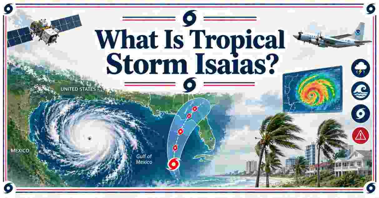
Tropical Storm Isaias is the 9th named storm of the 2026 Atlantic hurricane season, formed on October 7, 2026 in the southwestern Gulf with 40 mph winds, and forecasters expect it to reach Category 2 strength near 110 mph before it strikes the northern Gulf Coast between late Friday, October 9 and early Saturday, October 10. The forecast cone covers about 30 million people from Louisiana to the Florida Panhandle, with 6 to 10 inches of rain possible and a Florida state of emergency already active in 25 counties.
Tropical Storm Isaias 2026 – Introduction
What Is Tropical Storm Isaias, and why are Gulf Coast forecasters watching it so closely? Isaias organized out of Tropical Depression Nine in the Bay of Campeche on October 7, 2026. It is the ninth named storm of a season that has run quiet by recent standards. It arrives over very warm water, under a sharp dip in the jet stream, with a compact core. Those three ingredients can turn a 40 mph tropical storm into a hurricane within two days.
The name is pronounced ees-ah-EE-ahs. Hurricane Hunter aircraft are flying the system, and the National Hurricane Center expects a US landfall somewhere between Louisiana and the Florida Panhandle. Heavy rain, storm surge, tornadoes and long power outages are all on the table. The exact track and the exact strength at landfall are still moving targets. This report lays out the path, wind speed, forecast and key facts, one data table at a time.
Interesting Facts About Tropical Storm Isaias in the US 2026
ISAIAS FORECAST WIND SPEED BY DATE (each █ = 5 mph)
━━━━━━━━━━━━━━━━━━━━━━━━━━━━━━━━━━━━━━━━━━━━━━━━━━━
Wed Oct 7 (formation)    ████████                  40 mph
Thu Oct 8 (2 a.m.)       ███████████████           75 mph
Fri Oct 9 (2 a.m.)       ██████████████████████   110 mph
━━━━━━━━━━━━━━━━━━━━━━━━━━━━━━━━━━━━━━━━━━━━━━━━━━━
| Interesting Fact | 2026 Data |
|---|---|
| Pronunciation | ees-ah-EE-ahs |
| Formation date and place | October 7, 2026, Bay of Campeche (southwestern Gulf), from Tropical Depression Nine |
| Season rank | 9th named storm of 2026 |
| Winds at formation | 40 mph, moving east-northeast at 8 mph |
| Forecast peak winds | About 110 mph (Category 2) on Friday morning |
| Landfall window | Late Friday October 9 to early Saturday October 10 |
| People in the forecast cone | About 30 million across Louisiana, Alabama, Mississippi and the Florida Panhandle |
| Florida emergency order | Executive Order 26-202, covering 25 counties |
Source: National Hurricane Center public advisories and Forecast Discussion No. 3 (NOAA); FOX Weather; The Weather Channel; WBRC First Alert Weather; Florida Governor’s Office, October 7, 2026.
The first four rows describe where Isaias stands today. It carries the name pronounced ees-ah-EE-ahs, it formed on October 7, 2026, and it ranks 9th among named storms this season. Its winds sit at 40 mph, just above the 39 mph line that separates a depression from a tropical storm. It moves east-northeast at only 8 mph, which gives the storm time to organize before the turn north.
The last four rows describe where it is going. The forecast peak is near 110 mph, the top of the Category 2 range. Landfall is expected from late Friday October 9 into early Saturday October 10. About 30 million people live inside the cone. Florida Governor Ron DeSantis signed Executive Order 26-202 for 25 counties, so crews can stage fuel, water and food before the storm arrives.
Tropical Storm Isaias Path and Landfall Forecast 2026 | Where Will It Hit the Gulf Coast?
FORECAST LANDFALL ZONES (WEST → EAST, each █ = one coastal zone)
━━━━━━━━━━━━━━━━━━━━━━━━━━━━━━━━━━━━━━━━━━━━━━━━━━━━━━━━━━━━━━━━
                        LA      BILOXI  MOBILE  PENSACLA PANAMA  BIGBEND
FOX Weather estimate            ████████████████████████████████
Weather Channel spread  ████████████████████████████████████████
CNN monitor zone        ████████████████████████████████████████████████
WBRC Alabama/Panhandle                  ████████████████████████
━━━━━━━━━━━━━━━━━━━━━━━━━━━━━━━━━━━━━━━━━━━━━━━━━━━━━━━━━━━━━━━━
| Path Metric | 2026 Forecast Data |
|---|---|
| Time to northern Gulf Coast | 60 to 72 hours (NHC Forecast Discussion No. 3) |
| Landfall timing | Late Friday to early Saturday |
| FOX Weather landfall estimate | Between Biloxi, Mississippi and Panama City, Florida |
| Weather Channel model spread | Louisiana to the Florida Panhandle |
| Storm motion | East-northeast at 8 mph, then northeast, then north Thursday into Friday |
| Turn trigger | A strong dip in the jet stream after a day in the southern Gulf |
Source: National Hurricane Center Forecast Discussion No. 3 (NOAA); FOX Weather; The Weather Channel; CNN Weather, October 6-7, 2026.
The path starts with a slow crawl. Isaias drifts east-northeast at 8 mph and stays in the southern Gulf for much of Thursday, which brings heavy rain to Mexico’s Yucatan Peninsula. Then a strong jet stream dip grabs it and pulls it north. The National Hurricane Center puts the storm at the northern Gulf Coast in 60 to 72 hours, which matches the late Friday to early Saturday window.
The landfall zone is wide because the models disagree. FOX Weather draws the zone from Biloxi to Panama City. The Weather Channel sees tracks from Louisiana to the Florida Panhandle. CNN tells everyone from Louisiana to Florida’s Big Bend to watch. The NHC says plainly that across-track and along-track spread is large. Check each update, because a 50-mile shift moves the worst surge to a different town.
Tropical Storm Isaias Wind Speed and Hurricane Category Forecast 2026
SAFFIR-SIMPSON WIND THRESHOLDS VS ISAIAS (each █ = 5 mph)
━━━━━━━━━━━━━━━━━━━━━━━━━━━━━━━━━━━━━━━━━━━━━━━━━━━━━━━━
Tropical storm starts    ████████                  39 mph
Category 1 starts        ███████████████           74 mph
Category 2 starts        ███████████████████       96 mph
Category 3 (major)       ██████████████████████   111 mph
Isaias at formation      ████████                  40 mph
Isaias forecast peak     ██████████████████████   110 mph
━━━━━━━━━━━━━━━━━━━━━━━━━━━━━━━━━━━━━━━━━━━━━━━━━━━━━━━━
| Wind Metric | 2026 Data |
|---|---|
| Winds at formation | 40 mph |
| Hurricane timing | By Thursday October 8, with 75 mph forecast by 2 a.m. |
| Forecast peak | Near 110 mph Friday morning (NHC peak of 95 knots in 48 hours) |
| Category 2 range | 96 to 110 mph |
| Likely landfall strength | Category 1 or 2 (Weather Channel); a significant hurricane is increasingly likely (NHC) |
| Wind shear | Stronger shear farther north may trim winds near landfall |
Source: National Hurricane Center Forecast Discussion No. 3 and Saffir-Simpson Hurricane Wind Scale (NOAA); FOX Forecast Center; The Weather Channel; WBRC First Alert Weather, October 7, 2026.
Isaias starts at 40 mph and has a short runway to hurricane strength. FOX Forecast Center expects 75 mph by 2 a.m. Thursday, which clears the 74 mph hurricane line. The NHC then raised its peak to 95 knots, which equals about 110 mph, on Friday morning over the central Gulf. That sits at the very top of Category 2, one mph below the 111 mph major hurricane threshold.
Landfall strength carries more doubt than the peak. The Weather Channel calls Category 1 or 2 most likely, because the jet stream that pulls Isaias north also brings stronger wind shear. FOX Weather notes that some models weaken the storm at the coast while others strengthen it as upper-level winds from the north interact with it. The NHC says a significant hurricane at landfall looks more likely. Gulf water sits well into the 80s and ranks warmest on record since 1982, so the fuel is there.
Tropical Storm Isaias Rainfall and Flash Flood Forecast 2026 | How Much Rain Will Isaias Bring?
FORECAST RAINFALL FROM ISAIAS (inches; █ = high end, ▒ = low-to-high range)
━━━━━━━━━━━━━━━━━━━━━━━━━━━━━━━━━━━━━━━━━━━━━━━━━━━━━━━━━━━━━━━━━━━━━━━━━━
Most areas (Weather Channel)   ▒▒▒██████               3 to 6 in
FOX Forecast Center range      ▒▒▒▒▒▒████████████      6 to 10 in
Local maximum (Weather Ch.)    ███████████████████     up to 10 in
━━━━━━━━━━━━━━━━━━━━━━━━━━━━━━━━━━━━━━━━━━━━━━━━━━━━━━━━━━━━━━━━━━━━━━━━━━
| Flood Metric | 2026 Data |
|---|---|
| Rain arrival | Friday along the Gulf Coast, then inland through the weekend |
| FOX Forecast Center rainfall | 6 to 10 inches, with higher local amounts |
| Weather Channel rainfall | Up to 10 inches locally, most places 3 to 6 inches |
| WPC Friday flash flood risk | Level 3 of 4 for Mobile, Alabama and the Florida Panhandle west of Panama City |
| WPC secondary risk | Level 2 of 4 for Atlanta and Montgomery, moving inland Saturday |
| States in the Friday outlook | 8 states, from Louisiana to western South Carolina |
| Inland flood reach | Appalachians, Ohio Valley and mid-Atlantic |
Source: NOAA Weather Prediction Center excessive rainfall outlooks; FOX Forecast Center; The Weather Channel, October 6-7, 2026.
Two forecasts give two ranges. FOX Forecast Center calls for 6 to 10 inches with localized higher totals. The Weather Channel expects most places to see 3 to 6 inches, with a local maximum near 10 inches. The gap comes from track uncertainty: rain falls heaviest to the east of the center, so a western landfall shifts the totals. Rain starts Friday on the coast and keeps moving inland through the weekend.
NOAA’s Weather Prediction Center rates the Friday flash flood threat at Level 3 of 4 around Mobile and the western Panhandle. It rates Atlanta and Montgomery at Level 2 of 4, and the risk shifts to the Carolinas and Tennessee Valley on Saturday. The Friday outlook spans 8 states. Flood damage is the loss that surprises households most. A standard National Flood Insurance Program policy carries a 30-day waiting period, so a policy bought now will not cover Isaias, and the flood insurance statistics in the US show how few homeowners carry coverage at all.
Tropical Storm Isaias Storm Surge, Tornado and Power Outage Risk 2026
HIGHEST OFFICIAL RISK LEVEL ISSUED FOR ISAIAS (each █ = 5% of scale)
━━━━━━━━━━━━━━━━━━━━━━━━━━━━━━━━━━━━━━━━━━━━━━━━━━━━━━━━━━━━━━━━━━━
WPC flash flood, Friday      ███████████████      Level 3 of 4
SPC severe weather, Saturday ████████             Level 2 of 5
━━━━━━━━━━━━━━━━━━━━━━━━━━━━━━━━━━━━━━━━━━━━━━━━━━━━━━━━━━━━━━━━━━━
| Hazard | 2026 Forecast Detail |
|---|---|
| Storm surge | NHC sees an increasing risk of dangerous wind and surge; watches likely for part of the northern Gulf Coast |
| Watch definition | Hurricane and surge watches signal 74 mph winds and life-threatening flooding within 48 hours |
| Tornadoes | SPC Level 2 of 5 on Saturday for southern Alabama and the Florida Panhandle |
| Worst side of the storm | The right side of the center, east of the track |
| Power outages | Several hours to multiple days |
| State response | Florida stages fuel, water and food in 25 counties |
Source: National Hurricane Center Forecast Discussion No. 3 (NOAA); NOAA Storm Prediction Center; CNN Weather; The Weather Channel; FOX Weather, October 6-7, 2026.
Surge is the hazard the NHC stresses most. Its discussion warns of an increasing risk of dangerous wind and storm surge along parts of the northern Gulf Coast, and it expects hurricane and storm surge watches soon. A watch means hurricane-force winds of 74 mph or more and life-threatening coastal flooding are possible within 48 hours. FOX Hurricane Specialist Bryan Norcross says the worst weather will sit on the right side of the center, so towns east of the landfall point carry the most risk.
Tornadoes ride the outer bands. NOAA’s Storm Prediction Center issued a Level 2 of 5 severe weather risk for Saturday across southern Alabama and the Florida Panhandle. Rain-wrapped tornadoes are hard to see, a pattern covered in the Mississippi tornado statistics report. Power loss is the hazard most people will feel. The Weather Channel says outages could last several hours or multiple days, and Florida is already staging fuel, water and food across 25 counties.
Tropical Storm Isaias and the 2026 Atlantic Hurricane Season | Record Facts
NAMED STORMS: 2026 SEASON VS DECADE AVERAGE (each █ = 1 storm)
━━━━━━━━━━━━━━━━━━━━━━━━━━━━━━━━━━━━━━━━━━━━━━━━━━━━━━━━━━━━━━
2026 total as of Aug 17          ███                    3
2026 total with Isaias (Oct 7)   █████████              9
2016-2025 full-season average    ██████████████████    18
━━━━━━━━━━━━━━━━━━━━━━━━━━━━━━━━━━━━━━━━━━━━━━━━━━━━━━━━━━━━━━
| Season Metric | 2026 Data |
|---|---|
| Isaias season rank | 9th named storm |
| Hurricanes before Isaias | 0; Isaias would be the first |
| Record watch | A hurricane by October 8 ties the latest first hurricane, set October 8, 1905 |
| Satellite-era record | Already the latest first hurricane since 1966 |
| September streak breaker | Ended with no hurricane for the first time in 32 years |
| Gulf water temperature | Warmest on record since 1982 |
| Earlier Gulf storms | Arthur (June), Bertha (July 22), Edouard (September 1, about 60 mph) |
Source: National Hurricane Center and NOAA Climate Prediction Center records; USAFacts using NOAA data; WKMG ClickOrlando; FOX Weather; The Weather Channel, October 2026.
The season has been slow, and the numbers show it. Three named storms existed by August 17, and Isaias is the 9th now, still half the 18 storms per year that the 2016-2025 decade averaged, a record high for any ten-year span. No hurricane had formed before Isaias. If it reaches hurricane strength by October 8, it ties the 1905 record for the latest first hurricane. The 2026 season already owns that record for the satellite era, which began in 1966. September also ended without a hurricane for the first time in 32 years.
Gulf water is the reason this late storm can grow. Surface temperatures sit at their warmest since records began in 1982. Ocean heat is the fuel, and NOAA logged record upper-ocean heat content for a fifth straight year in 2025, a trend covered in the climate change statistics report. Three earlier storms hit the Gulf this year without reaching hurricane strength. Arthur came in June, Bertha struck St. Bernard Parish, Louisiana on July 22, and Edouard made landfall on September 1 with winds near 60 mph.
Tropical Storm Isaias 2020 vs 2026 | Name History and Past Landfall Facts
ISAIAS WIND SPEED COMPARISON (each █ = 5 mph)
━━━━━━━━━━━━━━━━━━━━━━━━━━━━━━━━━━━━━━━━━━━━━━━━━━━━━
2020 landfall, North Carolina   █████████████████    85 mph
2026 at formation               ████████               40 mph
2026 forecast peak              ██████████████████████ 110 mph
━━━━━━━━━━━━━━━━━━━━━━━━━━━━━━━━━━━━━━━━━━━━━━━━━━━━━
| Comparison Metric | Isaias 2020 | Isaias 2026 |
|---|---|---|
| Formation area | Eastern Caribbean | Bay of Campeche, southwestern Gulf |
| Landfall | Ocean Isle Beach, North Carolina, 11:10 p.m. EDT on August 3 | Forecast for the northern Gulf Coast, October 9-10 |
| Landfall winds | 85 mph (Category 1) | About 110 mph forecast peak |
| Deaths reported | At least 7 on the US East Coast, plus 2 in the Caribbean | None; no landfall yet |
| Notable fact | Earliest 9th Atlantic named storm; 4 feet of surge at North Myrtle Beach | 9th named storm after a quiet season |
Source: Associated Press; NASA Earth Observatory; Colorado State University hurricane research; National Hurricane Center, 2020 and October 2026.
The same name has now tracked two very different storms. In 2020 Isaias formed in the eastern Caribbean on July 29, raked the Bahamas and came ashore near Ocean Isle Beach, North Carolina at 11:10 p.m. EDT with 85 mph winds. The Associated Press counted at least 7 deaths on the East Coast and 2 more in the Caribbean. Colorado State University researcher Phil Klotzbach called it the earliest 9th Atlantic named storm on record. New York’s power utility reported more outages than any storm except Superstorm Sandy.
The 2026 Isaias started later and farther west, and it has not made landfall. The name returned because Atlantic name lists rotate every six years and the 2020 list came back around in 2026. Its 110 mph forecast peak would beat the 85 mph landfall strength of the 2020 storm. Final 2026 damage and death counts do not exist yet. The 2020 figures above are early Associated Press tallies, so treat them as the floor and not the final number.
Tropical Storm Isaias FAQs 2026
What Is Tropical Storm Isaias?
What Is Tropical Storm Isaias: it is the 9th named storm of the 2026 Atlantic hurricane season. It formed on October 7, 2026 in the Bay of Campeche with 40 mph winds and is forecast to strengthen into a hurricane before reaching the northern Gulf Coast.
Is Tropical Storm Isaias a hurricane?
Not yet. As of October 7, 2026, Isaias is a tropical storm with 40 mph winds. Forecasters expect it to become a hurricane by Thursday, October 8, and it would be the first hurricane of the 2026 season.
Where will Tropical Storm Isaias make landfall?
The latest estimate runs from Biloxi, Mississippi to Panama City, Florida. The Weather Channel’s model spread stretches from Louisiana to the Florida Panhandle, so the exact spot stays uncertain.
When will Tropical Storm Isaias hit the Gulf Coast?
Landfall is expected between late Friday, October 9 and early Saturday, October 10. The NHC puts the storm at the northern Gulf Coast in 60 to 72 hours from its Wednesday forecast.
How strong will Tropical Storm Isaias get?
The forecast peak is near 110 mph, a high-end Category 2, on Friday morning. A significant hurricane at landfall looks increasingly likely, though wind shear could trim the storm before it reaches shore.
What is the Tropical Storm Isaias wind speed right now?
The wind speed at formation was 40 mph, with the storm moving east-northeast at 8 mph. FOX Forecast Center expects 75 mph by 2 a.m. Thursday and 110 mph by 2 a.m. Friday.
Will Tropical Storm Isaias hit Florida?
The Florida Panhandle sits inside the forecast zone. Governor DeSantis declared a state of emergency for 25 counties under Executive Order 26-202. Central Florida should not see a direct hit, only extra moisture.
Will Tropical Storm Isaias affect Atlanta?
Yes, through rain. Atlanta sits in a Level 2 of 4 flash flood risk from NOAA’s Weather Prediction Center. Rain moves inland through the weekend toward the Appalachians, Ohio Valley and mid-Atlantic.
How much rain will Tropical Storm Isaias bring?
FOX Forecast Center expects 6 to 10 inches with higher local amounts. The Weather Channel says most places get 3 to 6 inches, with up to 10 inches in spots. Rain starts Friday on the coast.
How do you pronounce Isaias?
Say it ees-ah-EE-ahs. The name sits on the 2026 Atlantic list, which reused the 2020 name set after the six-year rotation.
Is Tropical Storm Isaias 2026 the same storm as Hurricane Isaias in 2020?
No. They share a name only. The 2020 storm hit North Carolina at 85 mph on August 3, 2020. The 2026 storm formed on October 7, 2026 in the Gulf and has not made landfall.
How should I prepare for Tropical Storm Isaias?
The NHC tells residents from Louisiana to the Florida Panhandle to have a hurricane plan in place and watch forecast updates. Plan for outages lasting several hours to multiple days, and avoid flooded roads.
Will the Tropical Storm Isaias forecast change?
Yes. Track and strength forecasts shift with each advisory, and the NHC has flagged large spread in the guidance. Check the National Hurricane Center for the newest watches, warnings and forecast cone.
Disclaimer: This research report is compiled from publicly available sources. While reasonable efforts have been made to ensure accuracy, no representation or warranty, express or implied, is given as to the completeness or reliability of the information. We accept no liability for any errors, omissions, losses, or damages of any kind arising from the use of this report.