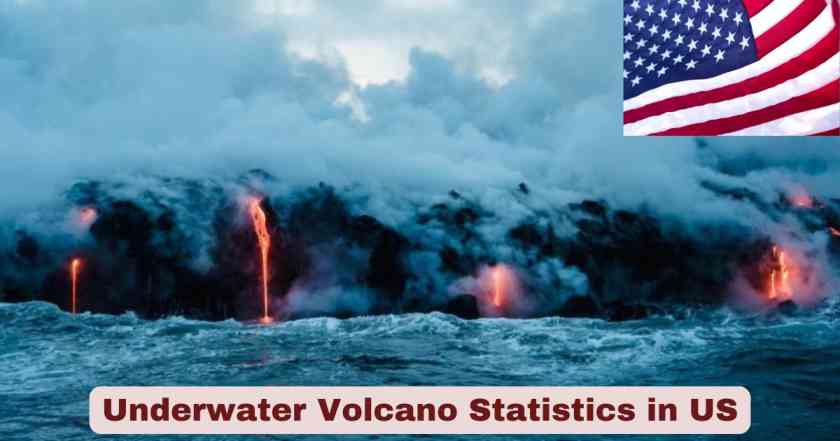
Underwater Volcano in America 2025
The United States maintains one of the world’s most extensive networks of underwater volcanoes, with monitoring systems tracking volcanic activity across the Pacific Ocean territories. As of December 2025, the nation hosts dozens of active submarine volcanoes beneath its territorial waters, primarily concentrated in the Northern Mariana Islands, Hawaii, and off the Pacific Northwest coast. These hidden geological features represent a significant portion of America’s volcanic landscape, with approximately 60 submarine volcanoes in the Commonwealth of the Northern Mariana Islands alone, making this region a global hotspot for underwater volcanic activity. The USGS Volcano Hazards Program continuously monitors these formations through sophisticated seismic networks, satellite imagery, and hydroacoustic detection systems to ensure public safety and advance scientific understanding.
The year 2025 has proven particularly eventful for underwater volcano monitoring in the US, with heightened activity observed at multiple sites. The most notable development involves Axial Seamount, located 300 miles off Oregon’s coast, which scientists predict will erupt before the end of 2025 based on unprecedented inflation rates and seismic activity patterns. In the Northern Mariana Islands, Ahyi Seamount has displayed continuous unrest since August 2024, maintaining an Advisory alert level throughout 2025. Meanwhile, Kamaʻehuakanaloa (formerly Lōʻihi) Seamount off Hawaii’s Big Island has experienced periodic earthquake swarms, demonstrating the dynamic nature of these underwater volcanic systems. These developments underscore the critical importance of real-time monitoring infrastructure, as the United States leads global efforts to understand and predict submarine volcanic behavior through cutting-edge technology and scientific research.
Interesting Facts About Underwater Volcanoes in the US 2025
| Fact Category | Key Information | Specific Data |
|---|---|---|
| Total US Submarine Volcanoes | Commonwealth of Northern Mariana Islands | 60 underwater volcanoes |
| Most Active Submarine Volcano | Axial Seamount, Pacific Northwest | 3 eruptions in 30 years (1998, 2011, 2015) |
| Deepest Monitored Volcano | Axial Seamount depth | 4,600 feet (1,400 meters) below sea surface |
| Distance from US Coast | Axial Seamount location | 300 miles (480 kilometers) offshore Oregon |
| Hydrothermally Active Sites | Northern Mariana Islands | 20 submarine volcanoes with hydrothermal activity |
| Confirmed Historical Eruptions | Since 1950s in CNMI | 10 submarine volcanoes with confirmed eruptions |
| Earthquake Detection Record | Kamaʻehuakanaloa 1996 swarm | 4,070 earthquakes recorded |
| Real-Time Monitoring Cable | Ocean Observatories Initiative | 660 miles of undersea cables with 140+ instruments |
| Current Alert Status 2025 | Ahyi Seamount | Advisory/Yellow since November 2025 |
| Future Island Formation | Kamaʻehuakanaloa emergence | 10,000-100,000 years until surface breach |
| Summit Elevation | Kamaʻehuakanaloa highest point | 3,200 feet (975 meters) below sea level |
| Monitoring Challenges | Northern Mariana Islands | No local stations on most volcanoes |
| Daily Seismic Activity | Axial Seamount peak 2025 | Over 1,000 earthquakes per day recorded |
| Seafloor Inflation Rate | Axial Seamount 2015-2025 | Up to 10 feet elevation change between eruptions |
| Temperature Record | Kamaʻehuakanaloa vents 1996 | 390°F hottest waters measured |
Data source: U.S. Geological Survey Volcano Hazards Program, Ocean Observatories Initiative, USGS Scientific Investigations Report 2024-5062-I (October 2024), USGS Weekly Volcanic Activity Reports (2025)
The fascinating world of underwater volcanoes in the US reveals extraordinary geological phenomena that challenge our understanding of volcanic behavior. The 60 submarine volcanoes concentrated in the Northern Mariana Islands represent the largest collection of underwater volcanic features under US jurisdiction, with 20 of these volcanoes exhibiting active hydrothermal systems that support unique deep-sea ecosystems. Axial Seamount stands out as the most intensively studied submarine volcano globally, with the 660-mile Ocean Observatories Initiative cable network providing continuous real-time data transmission from 140+ monitoring instruments deployed across the seafloor. This technological marvel enables scientists to observe volcanic processes with unprecedented detail, including the remarkable detection of over 1,000 earthquakes per day during peak activity periods in 2025.
The predictive capabilities developed through submarine volcano monitoring represent a breakthrough in volcanic science. Researchers tracking Axial Seamount have documented seafloor elevation changes of up to 10 feet between eruption cycles, creating a measurable pattern that enabled scientists to forecast the upcoming 2025 eruption window. The 4,070 earthquake swarm recorded at Kamaʻehuakanaloa in 1996 remains the most energetic seismic event in Hawaii’s recorded history, demonstrating the immense power contained within these underwater giants. Perhaps most intriguing is the long-term geological timeline, as Kamaʻehuakanaloa slowly builds toward the ocean surface from its current depth of 3,200 feet below sea level, destined to become Hawaii’s newest island in 10,000 to 100,000 years. These statistics paint a picture of dynamic geological processes operating on both human and geological timescales.
Total Number of Underwater Volcanoes in the US 2025
| Region | Number of Submarine Volcanoes | Active Status | Monitoring Level |
|---|---|---|---|
| Commonwealth of Northern Mariana Islands | 60 | 20 hydrothermally active | Limited local monitoring |
| Hawaii Territory | 3 major seamounts | 1 historically active (Kamaʻehuakanaloa) | Land-based seismic monitoring |
| Pacific Northwest (Oregon/Washington) | 1 major (Axial Seamount) | Active – eruptions expected 2025 | Extensive real-time cable monitoring |
| American Samoa | 1 (Vailuluʻu Seamount) | Historically active | Limited monitoring |
| Total Documented US Submarine Volcanoes | 65+ | Multiple active systems | Variable by region |
Data source: USGS Scientific Investigations Report 2024-5062-I “Monitoring Marine Eruptions” (October 2024), USGS Volcano Hazards Program 2025
The United States and its territories host an impressive network of underwater volcanic systems, with the Commonwealth of the Northern Mariana Islands containing the vast majority at approximately 60 submarine volcanoes. According to the USGS Scientific Investigations Report published in October 2024, this concentration represents one of the most volcanically active submarine regions under American jurisdiction. Of these Northern Mariana volcanoes, 20 are classified as hydrothermally active, meaning they exhibit ongoing geothermal activity through underwater hot springs and vents. The National Volcanic Threat Assessment identified 10 Northern Mariana submarine volcanoes with confirmed eruptions since the 1950s, with 9 volcanoes possessing combinations of eruptive type and summit depth that pose higher risks of hazardous eruptions, though only one received a moderate threat classification.
Beyond the Northern Mariana Islands, the US monitors several other significant submarine volcanic systems across the Pacific. Hawaii’s underwater volcanic landscape includes Kamaʻehuakanaloa Seamount (previously known as Lōʻihi), the youngest volcano in the Hawaiian chain, along with other seamounts in the region. The Pacific Northwest features the exceptionally well-monitored Axial Seamount, located on the Juan de Fuca Ridge off Oregon and Washington coasts. American Samoa contributes the Vailuluʻu Seamount to the nation’s submarine volcanic inventory. While monitoring capabilities vary significantly by location, these 65+ documented submarine volcanoes represent critical components of America’s volcanic monitoring network, providing invaluable data for understanding volcanic processes and improving eruption forecasting capabilities worldwide.
Axial Seamount Activity and Eruption Forecast in the US 2025
| Monitoring Parameter | Current Status (2025) | Significance |
|---|---|---|
| Location | 300 miles (480 km) off Oregon coast | Most active NE Pacific submarine volcano |
| Summit Depth | 4,600 feet (1,400 meters) below sea level | Too deep to threaten coastal populations |
| Previous Eruptions | 1998, 2011, 2015 | Three documented eruptions in 30 years |
| Inflation Status | Approaching 2015 eruption threshold | Magma accumulation beneath caldera |
| Seismic Activity Peak | Over 1,000 earthquakes per day (April 2025) | Indicates magma movement |
| Current Daily Earthquakes | Several hundred events per day | Elevated but moderated from peak |
| Eruption Forecast Window | Before end of 2025 | Based on inflation and seismic patterns |
| Monitoring System | 660+ miles of fiber optic cable | Ocean Observatories Initiative Regional Cabled Array |
| Instrument Count | 140+ monitoring instruments | Real-time data transmission to shore |
| Caldera Dimensions | Approximately 3 by 4 km caldera | Contains multiple volcanic features |
| Volcano Type | Shield volcano with effusive eruptions | Non-explosive, poses no tsunami risk |
| Scientific Prediction | First successful submarine eruption forecast | Predicted 5 years before 2011 eruption |
Data source: USGS Cascades Volcano Observatory (May 2025), Oregon State University Axial Seamount Research Team, Ocean Observatories Initiative Regional Cabled Array Reports (2025), University of Washington College of the Environment (April 2025)
Axial Seamount, situated 300 miles off the Oregon coast at a depth of 4,600 feet beneath the Pacific Ocean surface, has captured international scientific attention in 2025 as it approaches what researchers predict will be its fourth eruption in three decades. Scientists from Oregon State University and the University of North Carolina reported at the December 2024 American Geophysical Union conference that the volcano had reached critical inflation levels, with the seafloor rising by several feet as magma accumulates in the shallow chamber beneath the caldera. By April 2025, seismic monitoring detected over 1,000 earthquakes per day, the highest rate observed since the volcano’s last eruption in 2015. While earthquake activity has since moderated to several hundred events daily, the sustained seismicity combined with continued inflation led researchers to forecast an eruption before the end of 2025, making this one of the most anticipated volcanic events in modern submarine volcanology.
The sophistication of Axial Seamount’s monitoring infrastructure represents a quantum leap in volcanic surveillance capabilities. The Ocean Observatories Initiative’s Regional Cabled Array extends more than 660 miles of high-power electrical and fiber-optic cables from shore stations in Pacific City and Newport, Oregon, directly to the volcano’s summit. This network powers and connects over 140 scientific instruments that continuously transmit real-time data including bottom pressure measurements, seismicity, temperature, and water chemistry. Previous eruptions at Axial occurred in 1998, 2011, and 2015, each preceded by measurable seafloor inflation patterns. Scientists successfully predicted the 2011 eruption approximately five years in advance based on inflation data, and again correctly forecast the 2015 event. The volcano’s consistent behavior makes it an ideal natural laboratory for testing eruption forecasting techniques. As a shield volcano producing effusive lava flows rather than explosive eruptions, Axial poses no threat to coastal populations or ocean travel, allowing scientists to refine prediction methods without public safety concerns.
Kamaʻehuakanaloa Seamount Activity in the US 2025
| Parameter | Measurement | Details |
|---|---|---|
| Location | 22 miles (35 km) SE of Big Island Hawaii | Youngest volcano in Hawaiian chain |
| Summit Depth | 3,200 feet (975 meters) below sea level | Submarine preshield development stage |
| Previous Name | Lōʻihi Seamount until 2021 | Renamed Kamaʻehuakanaloa for cultural appropriateness |
| Last Confirmed Eruption | 1996 | Associated with major earthquake swarm |
| 1996 Earthquake Swarm | 4,070 earthquakes recorded | Most energetic in Hawaii’s recorded history |
| November 2024 Activity | 70+ earthquakes in swarm | 32 events exceeded magnitude 2.0 |
| Largest 2024 Earthquake | Magnitude 4.3 on November 2 | Depth of 5.8 km below sea level |
| January 2025 Activity | 16 earthquakes detected | Very low magnitude events |
| Caldera Size | 3 by 4 km approximately | Contains multiple pit craters |
| Hot Spring Temperature | 390°F maximum recorded 1996 | Hottest waters measured at volcano |
| Hydrothermal Vents | Multiple active vent sites | Support unique deep-sea ecosystems |
| Future Island Emergence | 10,000-100,000 years estimate | Will become Hawaii’s newest island |
| Current Alert Level | Unassigned | No working instruments on volcano |
| Monitoring Method | Land-based seismometers only | Limited detection capabilities |
Data source: USGS Hawaiian Volcano Observatory Monthly Updates (2025), Smithsonian Institution Global Volcanism Program, USGS Scientific Reports on Kamaʻehuakanaloa/Lōʻihi Seamount
Kamaʻehuakanaloa Seamount, formerly known as Lōʻihi until its culturally appropriate renaming in 2021, represents Hawaii’s volcanic future as the youngest member of the Hawaiian-Emperor seamount chain. Located 22 miles southeast of the Big Island’s coast, this active submarine volcano rises from the ocean floor to within 3,200 feet of the sea surface. The volcano experienced significant unrest in November 2024 when a seismic swarm produced over 70 earthquakes, with 32 events exceeding magnitude 2.0 and the largest registering magnitude 4.3 at a depth of 5.8 kilometers below sea level. This November activity marked the most vigorous seismic episode since the volcano’s historic 1996 eruption and earthquake swarm, which recorded an extraordinary 4,070 earthquakes and remains the most energetic volcanic earthquake sequence in Hawaii’s documented history. Additional seismic unrest occurred in January 2025 with another swarm of approximately 16 earthquakes, though these were of considerably lower magnitude.
The 1996 eruption event transformed Kamaʻehuakanaloa’s summit region, creating a new pit crater and altering approximately 4-5 square miles of the seamount’s upper structure. During submersible investigations following the eruption, scientists discovered newly formed hydrothermal vents emitting water at temperatures reaching 390°F, the hottest measurements ever recorded at this volcano. Despite its active nature, monitoring Kamaʻehuakanaloa presents significant challenges as there are no working instruments deployed on the volcano itself. All observations must be made using land-based seismometers located on the Big Island, which can only detect events from one direction and cannot provide the triangulation necessary for precise location and characterization. The volcano maintains an Unassigned alert level due to this monitoring limitation. Eventually, continued volcanic growth will bring Kamaʻehuakanaloa above sea level in an estimated 10,000 to 100,000 years, creating Hawaii’s newest island through the same processes that formed the existing Hawaiian archipelago.
Northern Mariana Islands Submarine Volcano Activity in the US 2025
| Volcano Name | Status 2025 | Location | Key Activity |
|---|---|---|---|
| Ahyi Seamount | Advisory/Yellow Alert | 11 miles SE of Farallon de Pajaros | Continuous unrest since August 2024 |
| Summit Depth (Ahyi) | 164 feet (50 m) below surface | Very shallow submarine volcano | Poses potential aviation hazard |
| Discolored Water Plumes | Observed multiple dates in 2025 | Extending up to 1 mile from vent | Indicates active degassing |
| Recent Ahyi Eruptions | October 2022-May 2023, December 2023-April 2024 | Detected by hydroacoustic arrays | Multiple eruption episodes |
| 2014 Ahyi Eruption | April 24-May 17, 2014 | Formed new summit crater | Created large landslide chute |
| Total CNMI Volcanoes | 11 named volcanoes monitored | Includes Ahyi, Anatahan, Sarigan, others | Most have Unassigned alert levels |
| Hydrothermally Active | 20 submarine volcanoes | Northern Mariana Islands region | Active geothermal systems |
| Confirmed Eruptions Since 1950s | 10 volcanoes | CNMI territory | Documented eruptive activity |
| South Sarigan 2010 Eruption | Ash plume reached 11.9 km altitude | 160 km north of Saipan | Affected international air traffic |
| Monitoring Stations | Zero local instruments | Most volcanoes unmonitored | Relies on distant sensors |
| Detection Methods | Satellite imagery, hydroacoustic arrays | Wake Island sensors 1,410 miles away | Limited early warning capability |
| Alert Level Status | Unassigned for most volcanoes | Except Ahyi at Advisory/Yellow | No advance eruption warnings possible |
Data source: USGS Northern Mariana Islands Weekly Updates (November-December 2025), USGS Volcano Hazards Program, USGS Scientific Investigations Report 2024-5062-I
The Commonwealth of the Northern Mariana Islands contains the highest concentration of submarine volcanoes under US jurisdiction, with approximately 60 underwater volcanic features and 20 demonstrating active hydrothermal systems. Among these, Ahyi Seamount has dominated volcanic activity monitoring throughout 2025, maintaining an elevated Advisory alert level with Yellow aviation color code since the volcano began showing signs of renewed unrest in August 2024. The seamount rises to within just 164 feet of the ocean surface, making it one of the shallowest submarine volcanoes in US territory and posing potential risks to aviation if explosive eruptions occur. Throughout 2025, satellite imagery has repeatedly detected plumes of discolored water extending up to 1 mile from the volcano, observed on multiple dates including October 20, 21, 26, 28, November 5, 14, and 30. These discoloration events indicate active degassing from the volcanic vent, while underwater pressure sensors positioned near Wake Island, 1,410 miles distant, have detected acoustic signals potentially associated with submarine activity.
Ahyi Seamount’s recent eruptive history demonstrates the dynamic nature of Northern Mariana submarine volcanism. The volcano produced documented eruptions from October 2022 through May 2023 and again from December 2023 through April 2024, characterized by submarine plumes and hydroacoustic detections. The 2014 eruption, lasting from April 24 to May 17, proved particularly significant as it formed a new crater near the summit and created a large landslide chute on the volcano’s southeast flank. Historical records document 10 Northern Mariana submarine volcanoes with confirmed eruptions since the 1950s, with South Sarigan’s 2010 eruption being particularly noteworthy for producing an ash plume that reached 11.9 kilometers into the atmosphere, high enough to disrupt international air traffic. The critical challenge facing volcanic monitoring in this region is the complete absence of local monitoring stations on the volcanoes themselves. All 11 named volcanoes maintained by USGS monitoring (including Ahyi, Anatahan, Sarigan, Farallon de Pajaros, Supply Reef, Maug, Asuncion, Agrigan, Pagan, Alamagan, and Guguan) rely on distant seismo-acoustic sensors on Saipan, satellite imagery, and the Wake Island hydroacoustic array, providing detection capability but no advance warning of eruptions.
Hydrothermal Vent Ecosystems at US Underwater Volcanoes in 2025
| Ecosystem Feature | Location | Characteristics |
|---|---|---|
| Primary Vent Sites | Axial Seamount summit caldera | Multiple active black smoker chimneys |
| Water Temperature | Over 700°F at vent exits | Superheated mineral-rich fluids |
| Unique Species | Kamaʻehuakanaloa vents | Bresiliid shrimp (Opaepele loihi) endemic |
| Tube Worms | Axial Seamount vents | Large colonies near hydrothermal vents |
| Energy Source | Chemosynthesis in darkness | Microbes use volcanic gases and sulfur |
| Vent Collapse Impact | 1996 Kamaʻehuakanaloa event | Pele’s Vents collapsed into Pele’s Pit |
| Species Recovery Unknown | Post-1996 at Kamaʻehuakanaloa | Endemic shrimp and worms not relocated |
| Research Value | Origin of life studies | Vents may mirror early Earth conditions |
| Microbial Communities | Heat-loving extremophiles | Survive at extreme temperatures and pressure |
| Mineral Deposits | Black smoker formations | Metal-rich chimneys from precipitated minerals |
| Ecosystem Disturbance | Volcanic eruption impacts | Provides data for deep-sea mining concerns |
| Monitoring Difficulty | 4,600+ feet depth | Requires submersibles and ROV technology |
Data source: University of Washington College of the Environment (2025), USGS Hawaiian Volcano Observatory, Hawaii Undersea Research Laboratory, Ocean Observatories Initiative research publications
The hydrothermal vent ecosystems thriving on US underwater volcanoes represent some of Earth’s most extreme environments, supporting unique life forms in total darkness under crushing pressure. At Axial Seamount, volcanic heat drives seawater deep into the ocean crust where it superheats to temperatures exceeding 700°F before jetting back through chimney-like structures called black smokers. These spectacular vents discharge mineral-rich fluids that precipitate upon contact with near-freezing seawater, creating the characteristic dark plumes and gradually building towering mineral deposits. In this environment devoid of sunlight, life operates on chemosynthesis rather than photosynthesis, with specialized bacteria and archaea converting chemical energy from compounds like hydrogen sulfide into organic matter. These extremophile microbes form the foundation of a unique food web supporting dense colonies of tube worms, palm worms, deep-sea spider crabs, and other organisms found nowhere else on Earth.
Kamaʻehuakanaloa Seamount hosts particularly significant hydrothermal communities, including two species endemic to its vents: the bresiliid shrimp Opaepele loihi discovered and described in 1995, and a pogonophoran tube worm. The volcano’s dramatic 1996 eruption and earthquake swarm provided scientists with a natural experiment in ecosystem resilience when an entire hydrothermal vent field called Pele’s Vents collapsed upon itself, forming the crater now known as Pele’s Pit and altering 4-5 square miles of seafloor. Subsequent submersible dives were unable to relocate the endemic shrimp and worm species, leaving their long-term survival uncertain and highlighting the vulnerability of these isolated communities. Research at these vent systems holds profound implications for understanding the origin of life, as many scientists theorize that similar hydrothermal environments on early Earth may have been the birthplace of the planet’s first organisms. The upcoming eruption at Axial Seamount offers researchers an unprecedented opportunity to observe how these microbial communities respond to volcanic disturbances, providing critical baseline data as the deep-sea mining industry threatens similar ecosystems worldwide.
Submarine Volcano Monitoring Technology in the US 2025
| Technology Type | Application | Specifications |
|---|---|---|
| Fiber Optic Cable Network | Ocean Observatories Initiative | 660+ miles of undersea cables |
| Real-Time Instruments | Axial Seamount monitoring | 140+ scientific instruments deployed |
| Bottom Pressure Recorders | Seafloor deformation measurement | Detects inflation/deflation to centimeter accuracy |
| Seismometers | Earthquake detection | Records events below magnitude 1.8 |
| Hydroacoustic Arrays | Underwater sound detection | Wake Island sensors 1,410 miles from CNMI |
| SOSUS System | Navy Cold War technology | Adapted for volcanic monitoring since 1991 |
| Satellite Imagery | Visual surveillance | High-resolution detection of water discoloration |
| ROV Technology | Deep-sea exploration | Jason ROV operates at 4,600+ feet depth |
| AUV Mapping | Bathymetric surveys | Sentry AUV conducts repeat seafloor mapping |
| Temperature Sensors | Hydrothermal monitoring | Records vent temperatures to 700°F+ |
| Water Chemistry Analyzers | Plume composition | Measures dissolved volcanic gases |
| Tiltmeters | Ground deformation | Tracks magma movement beneath volcano |
| Power Supply | Continuous monitoring | Cable provides constant electricity to instruments |
| Data Transmission | Shore station connectivity | Real-time data to Pacific City, Oregon |
Data source: Ocean Observatories Initiative Regional Cabled Array, NOAA Pacific Marine Environmental Laboratory, USGS Volcano Hazards Program, Woods Hole Oceanographic Institution National Deep Submergence Facility
The technological infrastructure enabling submarine volcano monitoring in the United States represents one of the most sophisticated scientific surveillance systems ever deployed in the marine environment. The crown jewel is the Ocean Observatories Initiative’s Regional Cabled Array, an extraordinary network extending more than 660 miles of high-power electrical and fiber-optic cables from shore stations in Oregon directly to the Juan de Fuca tectonic plate and Axial Seamount’s summit. This system provides continuous power and two-way communication to over 140 scientific instruments permanently installed on the seafloor, transmitting real-time data on seismicity, bottom pressure, temperature, water chemistry, and biological activity. Bottom pressure recorders deployed around the caldera measure seafloor inflation and deflation with centimeter-level precision, detecting the subtle rise and fall of the volcano as magma accumulates and drains. The system enables scientists to monitor Axial 24 hours per day, 365 days per year, a capability previously unimaginable for submarine volcanoes.
Complementing the cabled observatory, additional technologies provide comprehensive monitoring coverage across US submarine volcanic regions. The SOSUS (Sound Surveillance System), originally developed by the US Navy during the Cold War to detect Russian submarines, was adapted for scientific use by NOAA in 1991 and now detects submarine earthquakes as small as magnitude 1.8 by listening for acoustic waves traveling through ocean sound channels. Hydroacoustic arrays positioned near Wake Island, located 1,410 miles from the Northern Mariana Islands volcanoes, detect pressure waves from submarine eruptions and earthquakes, though they cannot determine event depth or precise location. High-resolution satellite imagery from multiple space agencies enables scientists to identify water discoloration plumes extending up to a mile from active vents. When detailed investigation is required, scientists deploy Remotely Operated Vehicles like ROV Jason and Autonomous Underwater Vehicles like AUV Sentry, which can operate at depths exceeding 4,600 feet to collect samples, capture imagery, and conduct repeat bathymetric surveys. Together, these technologies create a comprehensive monitoring network that has transformed submarine volcano science from periodic ship-based expeditions to continuous real-time observation.
Volcanic Hazard Assessment for US Submarine Volcanoes in 2025
| Hazard Type | Risk Level | Affected Regions |
|---|---|---|
| Coastal Tsunami | Low from deep volcanoes | Axial at 4,600 feet depth poses minimal risk |
| Aviation Disruption | Moderate from shallow volcanoes | Ahyi at 164 feet depth can produce ash plumes |
| Marine Navigation | Low to moderate | Pumice rafts and discolored water |
| International Air Traffic | Documented impact | South Sarigan 2010: plume reached 11.9 km altitude |
| Explosive Eruption Potential | Nine volcanoes identified | CNMI volcanoes with hazardous depth/type combinations |
| Moderate Threat Classification | One volcano | Single CNMI volcano rated level 3 threat |
| Submarine Lava Flows | Minimal surface impact | Effusive eruptions reshape seafloor without waves |
| Earthquake Generation | Minimal land impact | 4,600+ feet water depth attenuates seismic energy |
| Hydrothermal Vent Destruction | Ecosystem impact | 4-5 square miles altered in 1996 Kamaʻehuakanaloa event |
| False Alarm Risk | Low at Axial | Predictable behavior pattern established |
| Monitoring Gap Hazards | High in CNMI | Zero local instruments prevents early warnings |
| Historical Comparison | Hunga Tonga reference | 2022 eruption caused $90 billion in damages globally |
Data source: USGS National Volcanic Threat Assessment (Ewert et al., 2018), USGS Scientific Investigations Report 2024-5062-I, USGS Cascades Volcano Observatory (2025)
The hazard assessment for US submarine volcanoes reveals a complex risk landscape varying dramatically based on depth, location, and eruptive style. According to the National Volcanic Threat Assessment published by the USGS, nine Northern Mariana Islands submarine volcanoes possess combinations of eruptive type and summit depth that create higher risks of hazardous eruptions, though only one volcano received a moderate level 3 threat classification. The critical factor determining hazard potential is depth below sea level: volcanoes like Axial Seamount at 4,600 feet depth produce relatively calm effusive eruptions that reshape the seafloor without generating tsunamis or significant surface disturbances, while shallower features like Ahyi Seamount at just 164 feet depth can produce explosive eruptions that breach the surface and threaten aviation. The 2010 eruption of South Sarigan seamount demonstrated this aviation hazard when an ash plume reached 11.9 kilometers into the atmosphere from a depth of only 150 meters, rising high enough to disrupt international air traffic routes.
Despite these documented hazards, US submarine volcanic activity poses minimal direct threat to coastal populations. The USGS Cascades Volcano Observatory explicitly states that Axial Seamount poses no threat to people or ocean travel due to its depth and distance 300 miles offshore. Even the powerful 4,070-earthquake swarm at Kamaʻehuakanaloa in 1996 caused no damage to the Big Island despite occurring only 22 miles offshore, as the immense depth of 3,200+ feet attenuates seismic energy before it reaches land. However, the 2022 Hunga Tonga-Hunga Ha’apai eruption in the South Pacific serves as a sobering reminder of submarine volcanic power, generating a tsunami and shock waves that caused an estimated $90 billion in global damages. The most significant hazard facing US submarine volcano monitoring is the complete absence of local monitoring instruments in the Northern Mariana Islands, where 11 named volcanoes rely entirely on distant sensors that can detect eruptions but cannot provide advance warning. This monitoring gap means CNMI residents and aviators receive no early notification before submarine eruptions occur, representing the primary public safety vulnerability in America’s submarine volcanic surveillance network.
Scientific Research and Eruption Forecasting at US Underwater Volcanoes in 2025
| Research Achievement | Details | Impact |
|---|---|---|
| First Successful Prediction | 2011 Axial Seamount eruption | Forecast 5 years in advance based on inflation |
| Second Successful Forecast | 2015 Axial Seamount eruption | Confirmed predictive methodology accuracy |
| Current 2025 Prediction | Before end of 2025 eruption | Third consecutive forecast opportunity |
| Inflation Measurement Precision | Bottom pressure recorders | Centimeter-level accuracy in seafloor rise |
| Predictable Inflation Pattern | 10 feet elevation change between eruptions | Magma accumulation creates measurable bulge |
| Eruption Cycle Period | Every 13-17 years historically | Last eruption 2015, next expected 2025 |
| Research Collaborators | Multiple institutions | Oregon State, UNC, UW, Woods Hole |
| AGU Conference Presentation | December 2024 conference | Public forecast announcement |
| Cable Observatory Data | 100% uptime goal | Continuous monitoring without gaps |
| Historical Baseline | Three documented eruptions | 1998, 2011, 2015 establish pattern |
| False Alarm History | Zero false predictions | All forecasts accurate to date |
| Publication Record | Multiple peer-reviewed papers | Established methodology in scientific literature |
| International Collaboration | Global submarine volcano network | Data shared with international researchers |
| Educational Impact | Public outreach programs | Raises awareness of submarine volcanism |
Data source: Oregon State University research team publications, University of Washington College of the Environment, American Geophysical Union conference proceedings (2024-2025), USGS Cascades Volcano Observatory
The scientific achievements in submarine volcano eruption forecasting at Axial Seamount represent a paradigm shift in predictive volcanology. Researchers led by Oregon State University’s team successfully forecast the volcano’s 2011 eruption approximately 5 years in advance based on inflation patterns measured by bottom pressure recorders deployed on the seafloor. This unprecedented prediction was validated when the eruption occurred exactly as anticipated, marking the first time scientists had successfully predicted a deep-sea volcanic eruption with such precision. The research team repeated this success with the 2015 eruption, again accurately forecasting the event based on the volcano’s measurable inflation cycle. Analysis revealed a consistent pattern: following each eruption, magma begins accumulating in the shallow reservoir beneath the caldera, causing the seafloor to inflate by approximately 10 feet over several years until reaching a critical threshold that triggers the next eruption, creating a predictable cycle recurring roughly every 13 to 17 years.
Building on this established methodology, scientists announced at the December 2024 American Geophysical Union conference their third consecutive eruption forecast, predicting Axial Seamount will erupt before the end of 2025. The confidence in this prediction stems from the comprehensive dataset collected by the Ocean Observatories Initiative’s Regional Cabled Array, which provides continuous monitoring with near-100% uptime, eliminating the data gaps that plagued previous ship-based observation campaigns. The research collaboration involves multiple prestigious institutions including Oregon State University, University of North Carolina, University of Washington, and Woods Hole Oceanographic Institution, creating an interdisciplinary team that analyzes seismic, geodetic, and geochemical data in real-time. To date, the team maintains a perfect prediction record with zero false alarms, establishing Axial Seamount as the world’s most predictable submarine volcano. This success provides critical validation for eruption forecasting methodologies that may eventually be applied to subaerial volcanoes threatening populated areas, potentially saving lives through improved early warning systems. The research findings are regularly published in peer-reviewed journals and shared with the international volcanological community, advancing global understanding of magmatic processes and eruption dynamics.
Disclaimer: This research report is compiled from publicly available sources. While reasonable efforts have been made to ensure accuracy, no representation or warranty, express or implied, is given as to the completeness or reliability of the information. We accept no liability for any errors, omissions, losses, or damages of any kind arising from the use of this report.