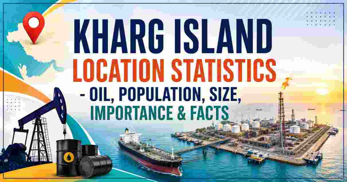
Kharg Island in 2026
Ask most people to name the single most economically important island on the planet and you will get answers like Manhattan, Singapore, or perhaps one of the Gulf’s banking hubs. The correct answer — at least from the perspective of global energy markets — is almost certainly Kharg Island, a 20-square-kilometre coral outcrop sitting quietly in the northern Persian Gulf, roughly 25 kilometres off Iran’s southwestern coastline. Known among Iranians as the “Forbidden Island” because of the iron-grip security maintained by the Islamic Revolutionary Guard Corps (IRGC), Kharg is the artery through which the overwhelming majority of Iran’s crude oil reaches international buyers. Without it, Iran’s ability to earn hard currency, fund its state budget, and sustain its military apparatus collapses almost entirely.
By 2026, Kharg Island has become more than just an energy statistic — it sits at the intersection of geopolitics, military conflict, and global oil price dynamics in a way that no other single geographic location can match. In March 2026, the island was directly struck by US forces as part of the wider 2026 Iran conflict, with military infrastructure targeted while oil facilities were deliberately spared. President Trump publicly referred to Kharg as Iran’s “crown jewel” — a rare moment of strategic candour that explains exactly why global energy markets track every satellite image of this tiny island with the same intensity that financial markets track Federal Reserve announcements. What follows is every verified, sourced statistic and key fact about Kharg Island in 2026.
Kharg Island Interesting Facts 2026 | Key Data at a Glance
KHARG ISLAND — KEY FACTS SNAPSHOT 2026
══════════════════════════════════════════════════════
  Land Area             20 km²  (7.7 sq mi)
  ██  (1/3 size of Manhattan)

  Distance from Iran    ~25 km  (16 miles)
  ████

  Iran's oil exports via Kharg   90–96%
  ████████████████████████████████████████████████  ~93%

  Terminal loading capacity      7 million bpd
  ████████████████████████████████████████████████████████

  Storage capacity (end-2025)    ~34 million barrels
  ████████████████████████████████████████

  Supertankers loading simultaneously   10
  ██████████

  Population (2026)              ~15,000–20,000
  ██████
══════════════════════════════════════════════════════
| Fact | Detail |
|---|---|
| Official name | Kharg Island (Persian: جزیره خارگ) — also spelled Khark Island |
| Nickname | “Forbidden Island” (due to IRGC military control) |
| Location | Northern Persian Gulf, Bushehr Province, Iran |
| Coordinates | 29°14′42″N, 50°18′36″E |
| Distance from Iranian mainland | ~25 km (16 miles) off Iran’s coast |
| Distance from Strait of Hormuz | ~483 km (300 miles) northwest |
| Total land area | 20 km² (7.7 sq mi) — roughly one-third the size of Manhattan |
| Island dimensions | ~8 km long, ~4–5 km wide |
| Highest elevation | 70 m (230 ft) — Kūh-e Dīdeh Bānī |
| Population (2026 estimate) | ~15,000–20,000 people, predominantly oil workers |
| Administrative jurisdiction | Kharg District, Bushehr County, Bushehr Province |
| Share of Iran’s crude exports handled | 90–96% of all Iranian crude exports |
| Terminal loading capacity | ~7 million barrels per day (bpd) (Britannica) |
| Simultaneous supertanker loading | 10 supertankers at once |
| Crude oil storage capacity (end-2025) | ~32–34 million barrels of crude + 5–7 million barrels of products |
| Crude held in storage (early March 2026) | ~18 million barrels (JP Morgan/Kpler data) |
| Iran crude exports via Kharg (2025 average) | ~1.577–1.68 million bpd |
| Iran’s pre-war export peak via Kharg | ~3.79 million bpd (week of February 16, 2026 — Kpler) |
| US military strike on Kharg | March 14, 2026 — military targets hit; oil terminal unscathed |
| Iran’s net oil export revenues (2025) | $53 billion (~11% of annual GDP) |
Source: Encyclopaedia Britannica (May 2026), Reuters (March 14, 2026), Kpler/Iran Open Data (March 2026), Argus Media (April 2026), Columbia University CGEP (May 2026), CNN (March 14, 2026), Wikidata
These top-line numbers make the scale of Kharg Island’s importance immediately legible in a way that prose alone cannot fully convey. A 20 km² island — smaller than many city parks by global standards — processes 90–96% of the crude oil exports of the world’s third-largest OPEC producer. The $53 billion in net oil export revenues Iran earned in 2025 flowed overwhelmingly through this single terminal, representing approximately 11% of Iran’s entire annual GDP. When Trump called it the “crown jewel,” he was not engaging in hyperbole — Kharg Island is literally the economic foundation upon which Iran’s state finances rest, and its vulnerability is as total as its strategic importance.
The population figure of 15,000–20,000 people (per Argus Media, April 2026) is itself a revealing data point — virtually everyone living on this tightly controlled island is there because of the oil industry. Unlike comparable strategic oil terminals scattered across the Gulf, Kharg has a resident civilian-worker population, its own city (Kharg city, registered population 8,193 in the 2016 census), its own freshwater supply (one of the few Persian Gulf islands with natural fresh water), and permanent IRGC military garrison infrastructure. It functions less like a terminal and more like a self-contained industrial city-state focused almost entirely on one purpose.
Kharg Island Location & Geography Statistics 2026
KHARG ISLAND — GEOGRAPHIC PROFILE 2026
═══════════════════════════════════════════════════════════
  Persian Gulf Position     Northern Gulf, Iran's western shelf
  ███████████████████████████████████████████████████████

  Coordinates               29.25° N  |  50.33° E
  Mainland distance         25 km  ████████
  Hormuz distance           483 km ████████████████████████
  Island length             8 km   ███
  Island width              4.5 km ██
  Land area                 20 km² ██
  Elevation (max)           70 m   █
═══════════════════════════════════════════════════════════
| Geographic Metric | Data |
|---|---|
| Body of water | Persian Gulf (northern section) |
| Latitude | 29.25° N (29°14′42″N) |
| Longitude | 50.33° E (50°18′36″E) |
| Distance from Bushehr port (nearest major city) | ~55 km (34 miles) northwest |
| Distance from Iranian coast | ~25 km (16 miles) |
| Distance from Strait of Hormuz | ~483 km (300 miles) northwest |
| Island length (N–S) | ~8 kilometres |
| Island width (E–W) | ~4–4.5 kilometres |
| Total land area | ~20 km² (7.7 sq mi) |
| Size comparison | ~1/3 size of Manhattan; ~1.5× size of Los Angeles International Airport |
| Highest point | Kūh-e Dīdeh Bānī, 70 m (230 ft) above sea level |
| Island type | Continental coral outcrop (not volcanic) |
| Coastal water depth | Naturally deep-water shoreline — unique for Iran’s western Gulf coast |
| Companion island | Khārgu (Khārku), a narrow uninhabited island ~2 miles to the north |
| Climate | Hot, humid summers; mild winters. Average annual temperature ~75°F (24°C); average annual precipitation 10.9 inches (277 mm) |
| Time zone | IRST — UTC+3:30 |
| Seismicity | Moderately high — located near Persian Gulf continental shelf seismic zone |
Source: Encyclopaedia Iranica (iranicaonline.org), Wikipedia/Wikidata, Latitude.to, Al Jazeera Interactive (April 2026)
Kharg Island’s geography is the foundational reason for its economic indispensability, and the statistics above explain why no other location along Iran’s coastline has ever been able to replicate its function. The deep-water coastal access — rare along Iran’s otherwise shallow western Gulf shoreline — is the single physical characteristic that made Kharg the only viable site for building the supertanker loading infrastructure that modern crude oil export requires. Very Large Crude Carriers (VLCCs), the workhorses of global oil shipping, require deep berths that most of Iran’s coastal geography simply cannot provide. Kharg can. That geological accident, combined with its proximity to Iran’s giant southwestern oilfields and its position along major Gulf shipping lanes, locked Kharg into its role decades before the present infrastructure was built.
The 483 km distance from the Strait of Hormuz is also strategically significant. When Iran blockaded the Strait in the 2026 conflict — shutting off the chokepoint through which 20% of global oil and LNG normally flows — Kharg’s exports were still accessible to tankers that could navigate alternative routes, at least temporarily. This geographic separation means Kharg and Hormuz are distinct vulnerabilities in Iran’s export architecture, not the same one. Equally worth noting is the island’s companion landmass, Khārgu, sitting just 2 miles to the north — essentially uninhabited but administratively part of the same Kharg District, adding marginal territorial presence to Iran’s offshore position in this section of the Gulf.
Kharg Island Oil Terminal Statistics 2026 | Infrastructure & Capacity Data
KHARG ISLAND OIL TERMINAL — CAPACITY PROFILE 2026
═══════════════════════════════════════════════════════════
  Loading capacity (terminal)    7 million bpd (Britannica)
  ████████████████████████████████████████████████████████

  Simultaneous supertankers      10
  ██████████

  Storage tanks                  55 tanks
  ████████████████████████████████████████████████████████

  Total crude storage            ~34 million barrels (end-2025)
  ████████████████████████████████████████

  Iran avg exports via Kharg     ~1.68 million bpd (2025)
  ████████████████

  Peak weekly export (Feb 2026)  3.79 million bpd
  ████████████████████████████████████

  Share of Iran's exports        90–96%
  ████████████████████████████████████████████████
═══════════════════════════════════════════════════════════
| Infrastructure Metric | Statistic |
|---|---|
| Terminal maximum loading capacity | ~7 million barrels per day (bpd) |
| Supertankers loading simultaneously | 10 supertankers at once (Britannica, mid-2020s data) |
| Number of storage tanks | 55 tanks (Iran Open Data, March 2026) |
| Total crude oil storage capacity (end-2025) | ~32–34 million barrels of crude (Argus Media, April 2026) |
| Oil products storage capacity | ~5–7 million barrels of products (Argus Media) |
| Storage added May 2025 | +2 million barrels — tanks 25 & 26 rehabilitated (S&P Global) |
| Storage utilisation (April 20, 2026) | ~74% of design capacity (Columbia University CGEP, May 2026) |
| Crude held on island (early March 2026) | ~18 million barrels (JP Morgan/Kpler report) |
| Storage build since US blockade (to April 20) | +3 million barrels above pre-conflict level |
| All-time storage high | ~27 million barrels (late April 2020, COVID-19 lockdowns) |
| Key terminal complexes | Kharg Terminal; Sea Island Terminal; Darius Terminal; KHEMCO gas terminal |
| Falat Iran Oil Company production (on-island) | 500,000 barrels per day of crude oil |
| Kharg Petrochemical Company (KHEMCO) | Operates on-island; produces LPG and petrochemical products |
| Connected oilfields (subsea pipeline) | Ahvaz, Marun, Gachsaran (mainland); Abouzar, Forouzan, Doroud (offshore) |
| Operational since | 1960s — developed under the Shah in partnership with Amoco (US) |
Source: Encyclopaedia Britannica (May 2026), Argus Media (April 2026), Iran Open Data/Kpler (March 2026), S&P Global Commodity Insights (May 2025), Columbia University CGEP (May 2026), Wikipedia (2026 Kharg Island attack)
The terminal infrastructure statistics for Kharg Island in 2026 represent the accumulated result of over six decades of continuous investment — and, more revealingly, they represent what is theoretically possible versus what Iran is currently exporting. The gap between terminal loading capacity of ~7 million bpd and actual 2025 average exports of ~1.68 million bpd is entirely a product of sanctions, not infrastructure limitations. Iran has the physical hardware to move far more oil than international sanctions allow it to sell. The record weekly export figure of 3.79 million bpd recorded in the week of February 16, 2026 — just before the outbreak of the 2026 Iran conflict — confirms this: when Iran had incentive to accelerate exports ahead of anticipated disruptions, the terminal handled it without difficulty.
The 55 storage tanks holding up to 34 million barrels of crude represent another layer of strategic depth. When the US naval blockade in April 2026 prevented normal export tanker operations, Kharg functioned as a giant strategic petroleum reserve — absorbing the crude that could not be shipped and filling to 74% of design capacity by April 20. The Columbia University energy policy analysis notes that standard operating maximum is considered 80%, meaning by late April 2026 Iran had less than ~3 million barrels of effective spare storage remaining — equivalent to under two days of pre-war export flows. The Falat Iran Oil Company’s 500,000 bpd production directly on the island, separate from the mainland pipeline flows, adds a dimension most analysts miss: Kharg is not just a transit terminal but also an active production hub processing oil from three major offshore fields simultaneously.
Kharg Island Oil Export Statistics 2026 | Iran’s Crude Output & Global Share
IRAN OIL PRODUCTION & KHARG EXPORT SHARE — 2026
═══════════════════════════════════════════════════════════════
  Iran total crude output         3.3 million bpd
  ████████████████████████████████

  Iran total liquids output       ~4.6 million bpd
  ████████████████████████████████████████████████

  Iran's share of global supply   4.5%
  ████

  2025 avg exports via Kharg      ~1.577–1.68 million bpd
  ████████████████

  Iran 2025 oil export revenue    $53 billion
  ████████████████████████████████████████████

  Oil revenue as % of Iran GDP    ~11%
  ██████████

  Iran OPEC rank                  #3 (after Saudi Arabia, Iraq)
  ███
═══════════════════════════════════════════════════════════════
| Export / Production Metric | Statistic |
|---|---|
| Iran crude oil output (2026) | ~3.3 million barrels per day (bpd) (Reuters, March 2026) |
| Iran total liquids output (crude + condensate) | ~4.6 million bpd total (The Global Statistics, 2026) |
| Iran’s share of global oil supply | ~4.5% (Reuters, March 2026) |
| Iran’s OPEC rank | 3rd — after Saudi Arabia and Iraq (Al Jazeera, April 2026) |
| Iran crude exports in 2025 (annual average) | ~1.68 million bpd (Kpler data) |
| Iran seaborne crude outflow growth, 2023–2025 | +9% increase (Kpler data, March 2026) |
| Iran exports in March 2026 (pre-blockade) | ~1.84 million bpd (Kpler, cited by Al Jazeera) |
| Iran exports in April 2026 (US naval blockade) | ~1.71 million bpd shipped (down from March) |
| Pre-war February 2026 peak exports | ~2.17 million bpd (Kpler) |
| Record weekly exports (Feb 16, 2026) | 3.79 million bpd — all-time weekly high |
| Iran net oil export revenue (2025) | $53 billion (~11% of GDP) |
| Iran GDP (nominal, 2026) | $300.3 billion (Wikipedia Economy of Iran) |
| Iran’s GDP growth (2025) | 0.3% (near-zero; IMF) |
| Primary buyer of Iranian crude via Kharg | China — sole main destination for discounted sanctioned crude |
| Kharg share of Iran’s exports (pre-war 2026) | ~90–96% (Reuters, Iran Open Data, Al Jazeera) |
| Jask terminal alternative (only bypass) | Pipeline capacity 1 million bpd; actual volumes minimal in 2026 |
Source: Reuters (March 14, 2026), Al Jazeera (April 29, 2026), Kpler via Iran Open Data (March 2026), Time Magazine (March 14, 2026), Wikipedia Economy of Iran, Argus Media (April 2026)
The export statistics for Kharg Island in 2026 tell the story of a terminal that is simultaneously Iran’s greatest strategic asset and its most exposed vulnerability. Iran’s ~3.3 million bpd crude output makes it a genuinely significant OPEC producer — its 4.5% share of global supply is large enough that any sustained disruption moves international oil prices. Yet virtually all of that production funnels through a single 20 km² island. Iran’s only meaningful export alternative, the Jask terminal located outside the Strait of Hormuz and connected via a 1 million bpd capacity pipeline from Bushehr province, was specifically designed to provide a bypass route. By 2026, its actual throughput remains far below that rated capacity — the Iran Open Data analysis notes just one cargo of roughly 2 million barrels departed Jask in the most recent two-week tracking period, compared to the continuous multi-tanker flows at Kharg.
China’s position as the sole primary buyer of Iranian crude is a structural feature of the post-sanctions oil market that cannot be overstated. The entire revenue stream — the $53 billion in net oil export earnings that funded ~11% of Iran’s GDP in 2025 — flows overwhelmingly from Chinese buyers paying discounted prices for crude delivered through Kharg. Iran’s IRGC is reported to allocate a large share of this export revenue directly to military operations, with the armed forces physically taking possession of barrels and selling independently. This means Kharg Island is not merely Iran’s economic backbone — it is the primary funding mechanism for Iran’s military and regional proxy networks, a fact that makes every barrel loaded at its jetties a geopolitical event as much as a commercial transaction.
Kharg Island Importance & Strategic Significance 2026 | Global Energy Context
STRAIT OF HORMUZ & KHARG — GLOBAL ENERGY LEVERAGE (2026)
═══════════════════════════════════════════════════════════════
  Global oil through Hormuz (normal)   20% of world supply
  ████████████████████████████████████████

  Global LNG through Hormuz            significant share
  ████████████████████████████

  Crude + products daily flow          14.7 + 4.8 = 19.5 million bpd
  ████████████████████████████████████████████████████████

  Oil price rise (March 2026 conflict) +~30% to above $100/bbl
  ████████████████████████████████████████

  Iran crude removed in Hormuz block   ~10.1 million bpd disrupted
  ████████████████████████████████████████████████████████
═══════════════════════════════════════════════════════════════
| Strategic Metric | Data |
|---|---|
| % of global oil trade through Strait of Hormuz | ~20% of world’s oil and LNG (Britannica, CNN) |
| Daily crude + products flow through Hormuz (pre-conflict) | 14.7 million bpd crude + 4.8 million bpd petroleum products |
| Supply disrupted by Iran’s Hormuz blockade (2026) | ~10.1 million bpd removed from global supply (OPEC data, Iran Open Data) |
| Oil price impact (March 2026) | Rose ~30% — above $100 per barrel globally |
| Iranian heavy crude price (March 2026, blockade) | $124 per barrel (OPEC data, Iran Open Data) |
| Iran oil revenue change (March 2026 vs prior) | More than doubled due to blockade-driven price spike |
| Analyst projection if Kharg oil targeted | Prices could reach ~$150/barrel (JP Morgan, independent analysts) |
| US March 14, 2026 strike outcome | Military targets on Kharg destroyed; oil terminal unscathed |
| Targets struck (per Britannica) | Storage facilities for submarine mines and missiles used in Hormuz blockade |
| Trump’s stated threat post-strike | Oil infrastructure could be targeted if Iran continued Hormuz interference |
| Iran’s counter-threat | Oil/energy infrastructure of firms working with US would be “immediately destroyed” |
| Kharg’s role in IRGC funding | IRGC reportedly controls large share of oil revenues — estimated 51% of oil/gas export revenue allocated to IRGC in Iran’s 2025 budget |
| Estimated IRGC oil revenue (2025 budget allocation) | ~12 billion euros |
Source: Encyclopaedia Britannica (May 2026), Iran Open Data (March 2026), CNN (March 14, 2026), Wikipedia 2026 Kharg Island attack, The Global Statistics (March 2026), Euronews (March 16, 2026)
The strategic importance of Kharg Island in 2026 goes far beyond the metrics of any individual oil terminal. By March 2026, it had become the physical embodiment of Iran’s leverage over global energy markets — and simultaneously the most visible symbol of that leverage’s limits. When Iran’s IRGC blockaded the Strait of Hormuz following the start of the US-Israel-Iran conflict, the immediate response in global energy markets was brutal: oil prices rose ~30% to above $100 per barrel, and Iranian heavy crude spiked to $124 per barrel as the disruption removed ~10.1 million bpd from effective global supply. Kharg sat at the centre of all of this — its continued operational status meant Iran was still able to accumulate storage even while exports were blocked, maintaining optionality for when flows could resume.
The US decision to strike only military targets on Kharg on March 14 — destroying weapons storage including submarine mines and missiles — while deliberately leaving the oil terminal unscathed was a carefully calculated signal. It demonstrated that the US could reach the island at will, while making explicit that the oil infrastructure’s fate depended entirely on Iranian behaviour. Trump’s follow-up statement that oil facilities could be targeted if Hormuz interference continued was the most direct threat to Kharg’s terminal in four decades — the last time it was subjected to sustained bombing raids was during the 1980s Iran-Iraq War, when Iraqi forces repeatedly struck the island’s infrastructure, forcing Iran to temporarily shift exports to the smaller Lavan Island and Sirri Island terminals. The fact that Kharg kept exporting through even that sustained campaign underlines the extraordinary resilience of its infrastructure — and why analysts believe only a truly comprehensive strike could meaningfully disrupt output for more than a matter of days.
Kharg Island Population, History & Administration 2026
KHARG ISLAND — POPULATION & HISTORY TIMELINE
═══════════════════════════════════════════════════════════════
  Ancient history    Trading post — Achaemenid period artefacts
  ░░░░░░░░░░░░░░░░░░░░

  1960s              Developed as oil terminal (Amoco/Shah)
  ████████

  1970s              Supertankers replace Abadan; world's largest offshore terminal
  ████████████████

  1979               Iranian Revolution; NIOC takes over from Amoco
  ████████████████████

  1980s              Iraq-Iran War; repeated bombing raids; partial closure
  ████████████████████████

  2026 (est. pop.)   15,000–20,000 (oil workers + military)
  ████████████████████████████████████████████████████████
═══════════════════════════════════════════════════════════════
| Metric | Detail |
|---|---|
| Population (2026 estimate) | ~15,000–20,000 people (Argus Media, April 2026) |
| Population (2016 official census) | 8,193 (registered city of Kharg) |
| Primary residents | Oil workers, IRGC military personnel, support staff |
| Administrative unit | Kharg District, Bushehr County, Bushehr Province |
| Language | Persian (majority); Khargi (local minority dialect) |
| Natural freshwater | Yes — one of very few Persian Gulf islands with its own freshwater supply |
| Historical significance | Archaeological features from the Achaemenid period; rock-cut tombs; ancient trading post |
| Oil terminal development began | 1960s — under Mohammad Reza Shah Pahlavi, partnership with US company Amoco |
| World’s largest offshore crude terminal | Achieved this status by the early 1970s |
| 1970s milestone | Supertankers began docking at Kharg instead of Abadan for bulk loading |
| 1979 | Iranian Revolution; National Iranian Oil Company (NIOC) takes over from Amoco |
| 1980–1988 | Iran-Iraq War — Iraqi forces repeatedly targeted Kharg; terminal partially damaged; Iran shifted to Lavan and Sirri Islands temporarily |
| Post-war reconstruction | Years of repair and expansion post-1988; current capacity reflects this investment |
| 2025 infrastructure event | +2 million barrels storage added (tanks 25 & 26 rehabilitated, May 2025) |
| March 14, 2026 | US air strikes hit military targets on island; oil facilities unharmed |
| Security | Controlled exclusively by IRGC; civilian access requires official clearance |
Source: Argus Media (April 2026), Wikipedia (Kharg Island; 2026 Kharg Island attack), Encyclopaedia Iranica (Geography), Britannica (May 2026), Geographical magazine (April 2026)
Kharg Island’s population and history are inseparable from its oil infrastructure, and the numbers above reflect that reality directly. The gap between the official 2016 census figure of 8,193 residents and the 2026 operational estimate of 15,000–20,000 people reflects both population growth and the steady expansion of the workforce required to operate an increasingly sophisticated export terminal system. Virtually everyone on the island is connected to the oil industry either directly — as engineers, technicians, and terminal operators — or indirectly as service workers and IRGC security personnel. There are no significant tourist facilities, no major commercial district, and no reason to be on Kharg unless the oil brings you there.
The historical arc from Achaemenid trading post to 21st-century oil supernode is a compressed version of Iran’s entire modern economic history. The island’s natural deep water, which made it a viable trading stop for ancient merchant vessels, is the same physical characteristic that made it the only viable supertanker terminal along Iran’s western Gulf coastline sixty years later. The transition from Amoco partnership under the Shah to full NIOC control after the 1979 Revolution — and the terminal’s survival of years of Iraqi bombing during the 1980s — demonstrates the degree to which the infrastructure has been treated as a national irreplaceable asset by every Iranian government regardless of ideology. The March 2026 US strike targeting only military installations while explicitly sparing the terminal was, in a sense, a continuation of that same strategic logic: even Washington acknowledged that destroying Kharg’s oil facilities would be a step with consequences that nobody — not Iran, not the United States, not global energy markets — was fully prepared to absorb.
Disclaimer: This research report is compiled from publicly available sources. While reasonable efforts have been made to ensure accuracy, no representation or warranty, express or implied, is given as to the completeness or reliability of the information. We accept no liability for any errors, omissions, losses, or damages of any kind arising from the use of this report.