Where is Hormuz Island?
Hormuz Island — nicknamed the “Rainbow Island of Iran” — is a small yet geologically extraordinary Iranian island situated in the Strait of Hormuz, the narrow waterway connecting the Persian Gulf to the Gulf of Oman and ultimately the Arabian Sea. The island lies just 8 kilometres (5 miles) off the coast of Bandar Abbas, the main port city of southern Iran, within Hormozgan Province. Its coordinates place it at approximately 27°03′N, 56°28′E, right at the mouth of one of the most strategically vital maritime passages on earth — the Strait of Hormuz — through which over 20 percent of the world’s oil and liquefied natural gas exports transit every single day. Despite covering only 42 square kilometres (16 square miles), making it just over twice the size of Monaco, Hormuz Island commands global attention for reasons both geological and geopolitical — its dazzling multicoloured landscape of 70+ mineral types, its ancient trading history spanning over 700 years, and its position at the very chokepoint of global energy flows.
What truly separates Hormuz Island from every other island in the Persian Gulf is the sheer improbability of its existence and appearance. The island is a salt diapir — an ancient geological formation in which layers of salt, laid down approximately 600 million years ago, have slowly squeezed upward through overlying rock under immense geological pressure, eventually breaching the surface and emerging above sea level roughly 50,000 years ago. The process has produced a landscape unlike anywhere on earth: soil and cliff faces painted in vivid reds, golds, yellows, purples, and silvers driven by a high concentration of iron oxide and other minerals. Wherever red sand meets the sea, the waves themselves turn pink. Historically, Hormuz was one of the most powerful trading emporia of the medieval world — Marco Polo visited it twice, and by around 1200 CE, the city of Hormuz on the mainland near the modern island site effectively monopolised trade between India, China, and the Persian Gulf. As of 2026, the island sits at the epicentre of a geopolitical crisis that is reshaping global energy markets, with ongoing US-Iran tensions keeping the Strait — and by extension, the world’s oil supply — in a state of heightened alert.
Interesting Facts About Hormuz Island 2026
| Fact | Detail |
|---|---|
| Official Name | Hormuz Island (Persian: جزیره هرمز / Jazireh-ye Hormoz; also spelt Hormoz, Ormuz, Ormus) |
| Ancient Greek Name | Organa (Όργανα) |
| Medieval Islamic Name | Jarun |
| Nickname | The “Rainbow Island of Iran”; also “The Bloody Island” and “Geologic Pearl of the Persian Gulf” |
| Location | Strait of Hormuz, Hormozgan Province, Iran |
| Distance from Iranian Coast (Bandar Abbas) | 8 km (5 miles) |
| Total Land Area | 42 km² (16 sq mi) — more than twice the size of Monaco |
| Shape | Roughly oval/circular (salt diapir structure ~7 km east-west axis) |
| Highest Point | ~186 metres (610 ft) above sea level |
| Geological Age | ~600 million years old (Precambrian salt formation) |
| Time Above Sea Level | ~50,000 years |
| Geological Classification | Salt diapir (ancient salt deposits squeezed upward by geological pressure) |
| Number of Distinct Soil/Mineral Colours | 70+ (including iron oxide red, silver, gold, white, purple, yellow) |
| Primary Mineral Resource | Red ochre (iron oxide / haematite) — mined and exported; also used in local cuisine as “Golak” |
| Haematite Mining Location | Southernmost part of the island |
| Other Key Minerals | Quartz, calcite, feldspar, clay, pyroxene, Fe-bearing minerals, salt, anhydrite, sylvite, zunyite |
| Vegetation | Mangrove forest (Sea Forest); halophyte plants; some native wildlife including gazelles |
| Freshwater | No fresh groundwater; soil and water are salty due to lack of precipitation |
| Climate | Hot arid; best visited October to April; summer temperatures extremely high |
| Population (est. 2026) | 6,000–10,000 (most sources cite ~6,000–8,000; Tripadvisor native account: ~8,000) |
| Population Seasonal Fluctuation | May decline by half in summer as residents move to cooler mainland |
| Only Permanent Settlement | Hormuz village (at the harbour) |
| Ethnic Groups | Persians, Arabs, indigenous Hormuzis (Bandari people — “people of the port”) |
| Language | Farsi; Bandari dialect; Minabi dialect; historical loanwords from Portuguese, Dutch, English, Hindi, Arabic |
| Religion | Predominantly Sunni Muslim (unlike most of Iran’s Shia majority) |
| Traditional Women’s Dress | Flowing colourful robes + borqe (traditional face mask) |
| Primary Economy | Fishing (shrimp, fish, shark); tourism; handicrafts; small-scale trade |
| Governing Province | Hormozgan Province, Iran |
| Ferry Access from Bandar Abbas | ~40–50 minute crossing; multiple daily departures; ticket ~$2–3 USD one-way |
| ATMs / Banks | None on the island — cash only |
| Mobile Data | Sporadic 3G signal; works best in Hormuz village |
| Currency Exchange Rate (Jan 2026) | ~1,600,000 Iranian Rial (IRR) to $1 USD |
Source: Wikipedia, Britannica, Encyclopaedia Iranica, Geology Page, iransafar.co, Adventures of Nicole (Feb 2026), Tripadvisor, World Atlas, Mindat.org, Immersive Iran (Jan 2026)
Hormuz Island’s statistics reveal a place of extraordinary contrasts — geologically ancient, historically powerful, and economically fragile all at once. The 600-million-year geological age of its salt formation makes Hormuz one of the oldest exposed geological features in the Persian Gulf, and its 70+ distinct soil colours — caused by the complex mineralogy of its salt diapir structure including iron oxides, sulphates, and volcanic ash — create a landscape so surreal that geologists have dubbed it the “Paradise of Geologists” and the “Geologic Pearl of the Persian Gulf.” The red ochre known locally as Golak is so unusual that local islanders have historically eaten it — one of only a handful of places in the world where a naturally occurring soil mineral is incorporated directly into cuisine. The fact that the island has no fresh groundwater at all — all soil and water carrying a salt burden due to the underlying diapir and near-zero precipitation — makes the existence of a permanent human settlement there a feat of adaptation and resilience that has persisted for millennia.
The population figure of 6,000 to 10,000 captures an island in transition. Historically a fishing community of the Bandari people, shaped by centuries of contact with Portuguese, Dutch, English, Hindi, and Arabic-speaking traders — a linguistic legacy still preserved in the Bandari dialect — the island has slowly been drawn into Iran’s tourism economy since the late 2000s. The community’s unusual religious identity as predominantly Sunni Muslim within a predominantly Shia Iranian state reflects the distinct cultural inheritance of the southern Gulf coast, where Arab and Hormuzi ethnic traditions run deep. The complete absence of ATMs, banks, or card payment infrastructure as of January 2026 tells you exactly what stage of development the island occupies — a place where the modern cash-free economy has barely arrived, and where $2–3 ferry tickets still bring visitors face-to-face with one of the most otherworldly landscapes on the planet.
Hormuz Island Geology & Natural Wonders Statistics 2026
| Metric | Data |
|---|---|
| Geological Type | Mature salt diapir (salt plug/dome) |
| Salt Plug East-West Axis Length | ~7 km |
| Rock Types | Sedimentary, volcanic ash, rhyolites, basalts, tuffs |
| Unique Wave Phenomenon | Waves turn pink/red where iron oxide sand meets the sea |
| Red Beach | Famous landmark; vivid crimson sand; located on the island’s coastline |
| Rainbow Valley | Multi-coloured mineral formations; yellows, reds, purples, silvers |
| Silence Valley / Salt Goddess | Wind-sculpted salt mountain; usually completely quiet — visitors rendered speechless |
| Salt Cave | Located near Salt Mountain; petrified salt and coloured mineral formations inside |
| Valley of Statues | Jagged rock formations resembling mysterious figures |
| Silver Beach | Shiny silver sand; popular camping site; creates a “magical scene” in moonlight |
| Soil Carpet of Hormuz (event) | Annual land art event using natural ochre; held 2009–2014; area ~1,300 m² |
| Coral Reefs | Surrounding waters contain coral reef systems |
| Mangrove Forest (Sea Forest) | Trees live and survive partially submerged in saltwater tidal zone |
| Geological Heritage Status | Described as globally important; candidate for geopark designation |
| Iron Oxide Concentration | Gives landscape a characteristic reddish hue; turns sea water pink near red sand beaches |
| Protection Status | Part of Iran’s network of protected areas; Dept of Environment has intervened to protect ochre from overuse |
| Haematite Ore Mining | Active in the southernmost part of the island |
| Wildlife | Native gazelles, wild birds; waterways attract significant birdlife |
Source: Wikipedia, Geology Page, Mindat.org, Geotourism paper (GTG Journal 2020), iransafar.co, Adventures of Nicole (Feb 2026)
The geological statistics for Hormuz Island in 2026 confirm that this is one of the rarest geological sites on earth. The island’s structure as a mature salt diapir — with a salt plug stretching approximately 7 kilometres along its east-west axis — is extraordinary even within the salt-dome-rich geology of the southern Iranian and Gulf coastline, which hosts multiple such formations in the Zagros Mountain fold system. What makes Hormuz unique among these is the combination of the diapir’s age (600 million years old), its complete surface exposure, and the extraordinary diversity of minerals carried up with the rising salt: not just halite, but anhydrite, sylvite, zunyite crystals, rhyolites, basalts, iron oxides, and volcanic ash layers that create the island’s famous palette of over 70 colour shades. Geoscientists from European and Iranian universities have conducted detailed zircon geochronology and whole-rock geochemistry studies here specifically because the Hormuz Formation’s age and composition remain scientifically contested and fascinating.
For visitors, these geological facts translate into a series of attractions that have no real parallel anywhere else: the Red Beach, where iron oxide pigments in the sand stain the incoming surf pink; the Silence Valley, where a massive wind-sculpted salt mound rises in eerie silence; the Salt Cave, whose crystalline interior glows with mineral colours; and the Silver Beach, where the sand’s mineralogy creates a silvery shimmer under moonlight. The Iranian Department of Environment has been forced to intervene to regulate extraction of the famous red ochre, locally called Golak, because tourist overuse was degrading the formations. This tension between preservation and accessibility is central to Hormuz Island’s 2026 reality — a geological wonder that attracts growing numbers of visitors to a fragile ecosystem with minimal formal infrastructure, guarded by an active environmental protection framework but under constant pressure.
Hormuz Island Historical Statistics 2026
| Metric | Data |
|---|---|
| Earliest Evidence of Human Occupation | Pleistocene era (first confirmed evidence published 2021; Bulletin of Miho Museum) |
| Medieval Name | Jarun (in the Islamic period) |
| Medieval Trade Peak | By ~1200 CE — monopolised India-China-Persian Gulf trade |
| Notable Visitors (Medieval) | Marco Polo (visited twice, including 1290 CE); Ibn Battuta; Babur (Mughal emperor, mentioned Hormuz in memoirs) |
| Chinese Fleet Visit | 15th century — Chinese fleet visited as part of Indian Ocean voyages |
| Mainland Ruler Relocation to Island | ~1300 CE — Arab ruler of Hormuz moved to island to evade Mongol/Turkish raiders |
| Peak of New Hormuz (Island City) | After 1300 CE — superseded Qeys Island as most important Persian Gulf trading emporium |
| Portuguese Capture | 1507 CE — Portuguese Duke Afonso de Albuquerque seized the island |
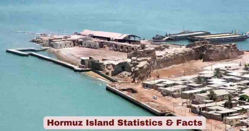
| Fort Built by Portuguese | Fort of Our Lady of the Conception (“Portuguese Castle”) — built in red stone; church and cannon remnants survive |
| Portuguese Island Use | Emergency stopover for ships sailing to Goa and Gujarat (India) |
| Ottoman Siege | 1552 CE — Admiral and cartographer Piri Reis besieged the island |
| Augustinian Hermits | Settled on island 1575 CE; established Isfahan mission 1602 CE |
| Portuguese Control Duration | ~115 years (1507–1622) |
| End of Portuguese Rule | 1622 CE — captured by joint Anglo-Persian forces (East India Company + Shah Abbas I) |
| Decline of Hormuz | Shah Abbas I developed Bandar Abbas on mainland as replacement trading centre — Hormuz went into decline |
| Muscat & Oman Lease | Hormuz, Jeshun island, and mainland Bandar Abbas leased to rulers of Muscat and Oman (1798–1868) |
| Colonial Powers Present | Portuguese, British (East India Company), Dutch East India Company (nearby), Omani |
| Export in Decline Period | Small quantities of rock salt and iron oxide lumps (used as ship ballast); only permanent residents were fishermen |
Source: Wikipedia, Britannica, Encyclopaedia Iranica, World Atlas, Immersive Iran (Jan 2026)
The historical statistics for Hormuz Island map an arc from medieval greatness to colonial fragmentation and eventual obscurity — a trajectory that makes the island’s current tourist rediscovery all the more remarkable. By approximately 1200 CE, the city of Hormuz (then on the mainland, 60 kilometres away) effectively monopolised the trade routes between India, China, and the Persian Gulf — a commercial dominance so complete that the first Mughal Emperor Babur specifically mentioned Hormuz in his memoirs as the endpoint of Central Asian trade goods. When the Arab ruler relocated the entire city to the island around 1300 CE to escape Mongol raids, New Hormuz became one of the most important ports in the medieval world, visited by Marco Polo (twice), Ibn Battuta, and later Chinese imperial fleets. At its peak, the island-city dominated “other Gulf islands and occasionally mainland Oman,” according to Britannica — an extraordinary geopolitical reach for a barren salt dome of barely 42 square kilometres.
The 115 years of Portuguese rule (1507–1622) left the most visible physical legacy — the Fort of Our Lady of the Conception, a red-stone fortress whose ruins, including cannon remnants, still stand on the island’s north side and remain one of its primary heritage attractions. The 1622 Anglo-Persian joint seizure by the East India Company ended Portuguese control but also marked the beginning of Hormuz Island’s long decline, as Shah Abbas I deliberately redirected Persian Gulf trade to Bandar Abbas on the mainland. What followed was centuries of depopulation and diminishment — the once-great emporium reduced to a small fishing settlement exporting only rock salt and iron oxide lumps used as ship ballast. The island’s modern rediscovery as a tourism destination since the late 2000s, driven by its extraordinary geology rather than any commercial infrastructure, represents in many ways a third act for a location that has already lived two complete historical lives.
Hormuz Island Tourism & Infrastructure Statistics 2026
| Metric | Data |
|---|---|
| Tourism Status (2026) | One of the most visited Iranian islands in the Persian Gulf |
| Primary Tourism Draws | Red Beach, Rainbow Valley, Salt Goddess / Silence Valley, Valley of Statues, Silver Beach, Portuguese Castle, Salt Cave |
| Best Travel Season | October to April (mild and breezy; summer is extreme and prohibitively hot) |
| Ferry Access (Bandar Abbas → Hormuz) | ~6 daily departures from Bandar Abbas; ~5 return departures from Hormuz |
| Ferry Journey Time | ~40–50 minutes |
| Ferry Ticket Price (one-way) | ~$2–3 USD (Bandar Abbas ↔ Hormuz) |
| Ferry Access from Qeshm Island | 2 ferries/day each direction; ~$3 USD one-way |
| Accommodation Type | Eco-lodges, guesthouses, homestays; almost no conventional hotels |
| Majara Residence | Iconic eco-lodge; 200 coloured domes; 17 suites; capacity up to 84–85 guests |
| Majara Completion Year | 2020 |
| Majara Location | Northern coast, 5 km from Hormuz village; on former “Soil Carpet” campsite |
| Majara Architect | ZAV Architects (Tehran-based) |
| Majara Construction Technique | Superadobe (layered sandbags of local earth/sand + cement; no expensive imported materials) |
| Majara Total Budget | ~$900,000 USD (18 billion Iranian Tomans in 2020) |
| Majara Project Lot Area | ~10,000 m² (~1/4,000th of the island’s total area) |
| Majara Built Area | ~4,000 m² |
| Majara Building Density | 41% (59% open space; 22% green space — far below Iran’s typical 120% density) |
| Majara Minimum Distance from Sea | 71 metres (legal minimum: 60 metres) |
| Majara Water Use per Room/Day | ~300 litres (of which 100 litres from recycled wastewater; standard hotels use 200–800 litres) |
| Majara Awards | Aga Khan Award for Architecture (2025); ArchDaily Building of the Year 2021; Golden Award, Taipei International Design Award; 2nd Prize, Memar Award |
| Rong Cultural Centre | First phase of “Presence in Hormuz” (2017); two domes — café + visitor centre at the harbour |
| Badban Centre | Phase 3; human-resource training and tourism management hub (completed 2021) |
| Nadalian Museum | Museum of environmental art by Ahmad Nadalian (b. 1963); opened March 2009 as “Paradise Art Centre”; renamed 2012; near the harbour |
| Soil Carpet of Hormuz | Annual land-art event using natural ochre; 2009–2014 (6 events); ~1,300 m² per event |
| Siesta (La Pausa) | Village shuts down 2 pm–5 pm daily |
| Local Cuisine | Fresh fish, shrimp, shark; southern Iranian spiced dishes; unique red ochre (Golak) used in local food |
Source: Wikipedia (Majara Residence), ZAV Architects fact sheet, Adventures of Nicole (Feb 2026), iransafar.co, Immersive Iran (Jan 2026), Metalocus, Field Mag, Surfiran (Jun 2025)
The tourism and infrastructure statistics for Hormuz Island in 2026 paint a picture of a destination that is genuinely unique in the global eco-tourism landscape — not because of grand hotel resorts or theme-park attractions, but because of the raw, unmediated power of its geology combined with deliberate, community-centred development. The Majara Residence, completed in 2020 for a total budget of just $900,000 USD and built almost entirely using local soil, local labour, and the Superadobe construction technique pioneered by Iranian-American architect Nader Khalili, represents one of the most internationally acclaimed small-scale eco-tourism projects of the 2020s. Its Aga Khan Award for Architecture in 2025 — among the most prestigious awards in the architectural world — brought global attention to both the project and to Hormuz Island itself. The fact that the 200 domes covering an area of just 4,000 square metres won that award while operating on a budget that major hotel chains would consider pocket change is a testament to the strength of its community-impact model.
The ferry statistics tell a critical story about access and economics: with 6 daily departures from Bandar Abbas and tickets costing just $2–3, Hormuz Island is both remarkably accessible and deeply infrastructure-poor. There are no ATMs, no banks, no card readers, and no conventional hotels — a profile consistent with an island where the local economy historically ran on fishing, informal trade, and barter. The daily 2–5 pm siesta shutdown of the entire village is not quaint local custom but practical necessity in a climate where summer temperatures are extreme. The “Presence in Hormuz” project — spanning Rong Cultural Centre (2017), Majara Residence (2020), and Badban training hub (2021) — explicitly acknowledges in its own documentation that unmanaged mass tourism could harm the island, and its stated goal is not to maximise visitor numbers but to manage and monitor the quality and environmental impact of tourism. In 2026, that philosophy is being tested as geopolitical tensions around the Strait of Hormuz simultaneously threaten to disrupt tourism while also, paradoxically, raising global awareness of the island’s existence.
Hormuz Island & Strait of Hormuz Strategic Statistics 2026
| Metric | Data |
|---|---|
| Strait of Hormuz Width (narrowest) | ~30 miles (48 km) at narrowest point |
| Strait of Hormuz Total Length | ~104 miles (167 km) |
| Depth of Strait | 200–330 feet (60–100 metres) — deep enough for large tankers |
| Daily Oil & LNG Exports Through Strait | Over 20% of global oil and LNG exports |
| Daily Ship Traffic | 80–130+ ships per day; over 30,000 tankers per year |
| Typical Tanker Cargo | Each tanker carries over 1 million barrels of oil |
| Shipping Lane Jurisdiction | Primarily Omani territorial waters; governed by international maritime law (UNCLOS) |
| Key Naval Force in Region | US Navy Fifth Fleet — based in Bahrain |
| Iran’s Naval Control | IRGC Navy controls northern side of shipping lanes |
| Strait Closure History | Has never been fully closed in modern history |
| Iran Parliament Authorization (June 22, 2025) | Iran’s parliament voted to authorize closing the Strait following US strikes on nuclear facilities — required Supreme National Security Council approval to enact |
| 2026 US-Iran Conflict Impact | Ongoing disruptions; some tankers rerouting; oil price impact above $100/barrel |
| Hormuz Island’s Strategic Role | Located at the mouth of the Strait — historically the gateway guardian of Persian Gulf access |
| Strait Comparable Chokepoints | Strait of Malacca (the only other comparable global oil chokepoint) |
| 1959 Iran Territorial Sea Expansion | Iran expanded territorial sea to 12 nautical miles — “closing” the strait legally in combination with Oman’s 1972 expansion |
| Oman 1972 Expansion | Oman also expanded to 12 nmi — completing the jurisdictional closure of the strait between the two nations |
| Iran-Iraq War Disruption (1980s) | Tanker War — both sides attacked oil tankers; US and European navies intervened to keep shipping open |
| IRIS Kharg Sinking (June 2, 2021) | Iran’s largest naval vessel — a modified replenishment oiler — caught fire and sank in the Strait of Hormuz |
| MSC Aries Seizure (April 2024) | Iranian Navy seized a Portuguese-flagged container ship with 25 crew in Gulf of Oman; steered through strait claiming maritime law violations |
Source: Britannica (updated March 13, 2026), Wikipedia (Strait of Hormuz), Strauss Center, US EIA
The Strait of Hormuz strategic statistics for 2026 are as alarming as they are familiar — a body of water that has been a geopolitical flashpoint for centuries, and which shows no sign of losing that status. The strait’s dimensions — 30 miles wide at its narrowest, 200–330 feet deep throughout — make it physically difficult for any single nation to permanently close to shipping, as the depth and width give tankers enough room to navigate even under contested conditions. Yet the June 22, 2025 vote by Iran’s parliament to authorise closure of the Strait following US strikes on Iranian nuclear facilities marked the closest any Iranian government has formally come to threatening that action in the modern era. The fact that the vote required Supreme National Security Council approval to take effect — and that closure was not enacted — shows the internal tension between political signalling and the economic catastrophe that any actual closure would inflict on Iran itself, which depends on the Strait for all its own oil exports.
Hormuz Island’s physical location at the mouth of this strait gives it a symbolic and strategic significance that extends far beyond its 42 km² of colorful soil. Historically, controlling Hormuz meant controlling access to the entire Persian Gulf — a logic that drove the Portuguese, the Ottomans, the British East India Company, and eventually the Iranian state to fight over it repeatedly across six centuries. In 2026, as US naval assets including the Fifth Fleet in Bahrain maintain a constant presence in the Gulf and IRGC naval forces control the northern shipping lanes, the island sits between two of the most powerful naval forces on earth. The IRIS Kharg sinking in 2021 — Iran’s largest naval vessel lost in the very strait it was meant to help guard — and the MSC Aries seizure in April 2024 are reminders that even in nominally peaceful periods, the Strait of Hormuz remains one of the most operationally tense maritime environments anywhere on the planet.
Disclaimer: This research report is compiled from publicly available sources. While reasonable efforts have been made to ensure accuracy, no representation or warranty, express or implied, is given as to the completeness or reliability of the information. We accept no liability for any errors, omissions, losses, or damages of any kind arising from the use of this report.