Geomagnetic Storms in America 2025
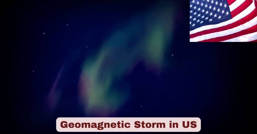
The geomagnetic storm activity in the US in 2025 has reached levels unprecedented in modern times, with multiple severe G4-level disturbances and ongoing watches issued by NOAA’s Space Weather Prediction Center throughout the year as Solar Cycle 25 approaches its anticipated peak. Following the historic G5 “extreme” geomagnetic storm of May 10-12, 2024 that marked the first such event in over 20 years, the United States experienced three additional G4 “severe” storms on January 1, 2025, June 1, 2025, and November 11, 2025, with each event triggering spectacular aurora displays visible as far south as Utah, Pennsylvania, Florida, and even Mexico, while simultaneously disrupting GPS navigation systems, satellite operations, power grid management, and high-frequency radio communications across the nation.
The geomagnetic storm statistics for the US in 2025 reflect both the magnificent natural phenomena and serious infrastructure challenges these space weather events create, with the November 11, 2025 G4 storm causing geomagnetic declination variations of 1.8 degrees at Fairbanks, Alaska—enough to visibly affect compass readings—while USGS magnetometer observatories across 14 locations in U.S. states and territories recorded real-time magnetic disturbances that NOAA and Air Force meteorologists used to estimate storm intensity and warn critical infrastructure operators. Scientists project high probability of several additional G4 storms or even a G5 storm occurring through 2026-2027 as the sun continues through the declining phase of Solar Cycle 25, which peaked earlier than initially forecast around late 2024 to early 2025, maintaining elevated solar activity that produces the coronal mass ejections responsible for geomagnetic storms when they strike Earth’s magnetosphere with speeds exceeding 1.5 million miles per hour.
Interesting Facts About Geomagnetic Storms in the US 2025
| Geomagnetic Storm Fact Category | Statistic/Data Point | Year |
|---|---|---|
| G5 Extreme Storm (Historic) | May 10-12, 2024 (first in 20+ years) | 2024 |
| G4 Severe Storms in 2025 | 3 storms (January 1, June 1, November 11) | 2025 |
| November 11, 2025 Storm Level | G4 (Severe) – X5.1 solar flare | 2025 |
| Compass Deflection (Alaska) | 1.8 degrees visible variation | Nov 2025 |
| Aurora Visibility South Extent | Utah, Pennsylvania, Florida, Mexico | 2025 |
| Strongest Solar Flare of 2025 | X5.1 classification | Nov 11, 2025 |
| CME Impact Speed | 1.5 million+ mph (4.4 million mph in Nov) | 2025 |
| Solar Cycle Peak | Late 2024 / Early 2025 | 2024-2025 |
| USGS Magnetometer Observatories | 14 active stations + 36 variometers | 2025 |
| G3 Strong Storm Watch | December 9, 2025 | Dec 2025 |
| May 2024 GPS Farmer Losses | $500-565 million | 2024 |
| Storm Return Period (May 2024 Magnitude) | 1-in-12.5-year event | 2024 |
| Storm Return Period (Duration) | 1-in-41-year event | 2024 |
| Quebec Blackout Historic Storm | 1989 (9-hour outage) | 1989 |
| Carrington Event | 1859 (most extreme on record) | 1859 |
| G4 Storm Probability | Once every 70 years globally | Historical |
| Potential Carrington-Level Cost | Trillions of dollars | Projection |
Data Source: NOAA Space Weather Prediction Center (SWPC), U.S. Geological Survey Geomagnetism Program, National Oceanic and Atmospheric Administration, Department of Defense 557th Weather Wing 2024-2025
The geomagnetic storm frequency in the US during 2025 demonstrates the exceptional solar activity characterizing Solar Cycle 25’s peak phase, with three G4 severe-level storms striking within the calendar year following the historic May 2024 G5 extreme event. The November 11, 2025 storm commenced suddenly at 19:10 Eastern Time with a coronal mass ejection (CME) arrival, reaching G4 severity and association with the strongest solar flare of 2025—an X5.1-class eruption that peaked at 5:04 AM EST, approximately five times the intensity of preceding flares that month and triggering R3 “Strong” radio blackouts over Europe and Africa immediately upon eruption. The storm produced geomagnetic declination variations of 1.8 degrees at College Observatory near Fairbanks, Alaska, a magnitude sufficient for ordinary compass users to detect deviation from true magnetic north.
Aurora borealis sightings extended to remarkably low latitudes throughout 2025, with the January, June, and November G4 storms each generating visible Northern Lights displays across northern United States from Oregon, Montana, North Dakota, Minnesota eastward to New York, Vermont, New Hampshire, and Maine, while particularly intense periods pushed visibility southward to Utah, Pennsylvania and during the most active phases, reports emerged from Florida, Texas, Arizona, and northern Mexico. The May 10-12, 2024 G5 storm that preceded 2025’s activity represented a 1-in-12.5-year event by magnitude but a 1-in-41-year event by duration according to extreme value theory analysis, highlighting the storm’s unusual persistence rather than just peak intensity, with this combination of factors producing the widespread infrastructure impacts and spectacular aurora displays that attracted global media attention.
G4 Geomagnetic Storm Events in the US 2025
| Storm Date | Storm Level | Associated Solar Activity | Peak Impacts | Year |
|---|---|---|---|---|
| January 1, 2025 | G4 (Severe) | Multiple CMEs | Aurora visible to mid-latitudes | 2025 |
| June 1, 2025 | G4 (Severe) | Solar flare and CME | GPS disruptions, power grid stress | 2025 |
| November 11-13, 2025 | G4 (Severe) | X5.1 flare, fastest CME | Aurora to Florida, 1.8° compass deflection | 2025 |
| December 9, 2025 (Watch) | G3 (Strong) expected | M8.1 flare, CME | Northern US aurora forecast | Dec 2025 |
| May 10-12, 2024 | G5 (Extreme) | Multiple X-class flares | First G5 since 2003, $500M+ losses | 2024 |
| October 10-11, 2024 | G4 (Severe) | X-class solar flare | Aurora to Chicago, NYC | 2024 |
Data Source: NOAA Space Weather Prediction Center, USGS Severe Magnetic Storm Reports, Department of State Space Weather Data 2024-2025
The timeline of major geomagnetic storm events affecting the US in 2025 reveals an extraordinary concentration of severe space weather activity coinciding with Solar Cycle 25’s maximum phase. January 1, 2025 began the year dramatically with a G4 severe geomagnetic storm that caught many Americans celebrating New Year’s Day, producing unexpected aurora displays across northern states and prompting NOAA to issue alerts warning satellite operators, power grid managers, and GPS-dependent industries including aviation, maritime navigation, and precision agriculture. June 1, 2025 witnessed the second G4 event of the year, associated with a powerful coronal mass ejection that traveled from sun to Earth in approximately 48 hours, faster than the typical 3-5 day transit time, compressing Earth’s magnetosphere and triggering geomagnetic disturbances measured by USGS observatories from Alaska to Puerto Rico.
The November 11-13, 2025 storm series represented the most intense and scientifically significant geomagnetic event of the calendar year, initiated by an X5.1 solar flare—the single strongest solar eruption of 2025—from active region AR4274 that launched the year’s “most energetic and fastest” coronal mass ejection traveling at an extraordinary 4.4 million miles per hour. NOAA issued escalating watches beginning November 11 for G2 (Moderate) conditions, upgrading to G4 (Severe) for November 12, and G3 (Strong) for November 13, with actual observations confirming G4 levels reached and aurora borealis visible as far south as Florida and Mexico, surpassing most forecaster expectations for auroral extent. The storm maintained G3 strong levels for multiple periods even as it declined from peak intensity, demonstrating the sustained nature of modern solar maximum disturbances.
Geomagnetic Storm Scale and Impacts in the US 2025
| Storm Level | Kp Index | Frequency | Primary US Impacts | Year |
|---|---|---|---|---|
| G1 (Minor) | Kp 5 | ~1,700 per cycle | Weak power grid fluctuations, minor satellite effects | 2025 |
| G2 (Moderate) | Kp 6 | ~600 per cycle | High-latitude power systems affected, satellite drag | 2025 |
| G3 (Strong) | Kp 7 | ~200 per cycle | Voltage corrections needed, GPS intermittent | 2025 |
| G4 (Severe) | Kp 8 | ~100 per cycle | Widespread voltage issues, GPS degraded hours | 2025 |
| G5 (Extreme) | Kp 9 | ~4 per cycle | Power grid collapse risk, GPS inoperable | 2024-2025 |
| November 2025 Peak | G4 attained | Three G4s in 2025 | Compass deflection, aurora to Florida | 2025 |
| Most Vulnerable US Regions | Above 45° latitude | Always | OR, ID, MT, ND, SD, MN, WI, MI, NY, VT, NH, ME | 2025 |
Data Source: NOAA Space Weather Scales, Space Weather Prediction Center Classifications, Historical Storm Frequency Data 2024-2025
The NOAA geomagnetic storm classification system used in the US in 2025 provides a standardized framework for communicating space weather severity, ranging from G1 (Minor) through G5 (Extreme) levels that correspond to the planetary K-index (Kp) scale measuring global geomagnetic activity. G1 minor storms (Kp 5) occur approximately 1,700 times per 11-year solar cycle and produce weak power grid fluctuations typically requiring no operational changes, minor impacts to satellite operations, and aurora visible at high latitudes including northern Canada and Alaska. G2 moderate storms (Kp 6) happen roughly 600 times per cycle and begin affecting high-latitude power systems requiring voltage corrections, increasing satellite drag that forces orbital adjustments, and extending aurora visibility into northern United States including Minnesota, Montana, and Maine.
G3 strong storms (Kp 7) with approximately 200 occurrences per cycle necessitate voltage corrections to prevent damage to power transformers, cause intermittent GPS navigation problems including positional errors, trigger false alarms on some protection devices, and display aurora as far south as Illinois and Oregon. G4 severe storms (Kp 8) striking around 100 times per solar cycle create widespread voltage control problems requiring continuous monitoring and intervention, degrade or render GPS inoperable for hours at a time, dramatically increase satellite drag forcing emergency maneuvers, and push aurora visibility to regions like Pennsylvania, Iowa, and northern California. G5 extreme storms (Kp 9) remain rare at just 4 events per typical solar cycle, carrying catastrophic potential including complete power grid collapse affecting millions, total GPS system failure, satellite damage or loss, and aurora visible to the Gulf Coast states including Florida, Texas, and Louisiana—exactly the impacts observed during the May 10-12, 2024 historic event.
Economic Impacts of Geomagnetic Storms in the US 2025
| Impact Category | Economic Cost/Loss | Affected Sectors | Year |
|---|---|---|---|
| May 2024 Farmer GPS Losses | $500-565 million | Midwest crop producers | 2024 |
| Potential Major Storm Cost | Exceeds $55-90 billion | Greater than Hurricane Katrina | 2024 estimate |
| Carrington-Level Event Cost | Trillions of dollars globally | Complete infrastructure collapse | Projection |
| 1989 Quebec Blackout | Millions in damages | 9-hour regional power outage | 1989 |
| Satellite Repositioning Costs | Thousands of satellites | LEO constellation operators | 2024-2025 |
| GPS-Dependent Agriculture | $565 million (one event) | Precision planting delays | May 2024 |
| Aviation Route Diversions | Unknown millions | Polar route radiation exposure | 2024-2025 |
| Power Grid Protective Actions | Millions in prevention | Utility companies nationwide | 2025 |
Data Source: NOAA Economic Impact Reports, Bloomberg Intelligence Analysis, Kansas State University Agricultural Economics, Insurance Industry Estimates 2024-2025
The economic toll of geomagnetic storms on the US in 2025 extends into hundreds of millions of dollars for individual events and could reach catastrophic levels in the trillions if an extreme Carrington-class storm struck modern infrastructure. The May 10-12, 2024 G5 storm caused between $500 million and $565 million in losses to Midwestern crop producers according to Kansas State University agricultural economists, as GPS disruptions during critical spring planting season rendered precision agriculture equipment inoperable, with tractors veering off-course, automated planting patterns failing, and farmers unable to achieve the centimeter-level accuracy required for modern high-density seeding operations, resulting in delayed planting, reduced yields, and wasted inputs including seeds, fertilizer, and fuel.
Bloomberg Intelligence warned in May 2024 that a major space weather event could cost insurers more than Hurricane Katrina’s $55 billion (2005 dollars, approximately $90 billion in current value), given potential for simultaneous disruption of radio communications, power grids, spacecraft operations, and satellite navigation across continental or even global scales. The 1989 Quebec geomagnetic storm produced a 9-hour blackout affecting millions of Canadian residents and caused millions in transformer damage, demonstrating vulnerabilities that have only grown as modern society’s dependence on electrical systems intensified. Satellite operators faced extraordinary costs during May 2024 when thousands of low-Earth orbit spacecraft required emergency repositioning as atmospheric expansion from solar heating increased drag, with NORAD temporarily losing tracking of many satellites for several days—a scenario with even more serious implications in 2025 given the proliferation of commercial satellite constellations including SpaceX Starlink, Amazon Project Kuiper, and others that collectively number tens of thousands of spacecraft.
GPS and Navigation Disruptions from Geomagnetic Storms in the US 2025
| GPS Impact Category | Disruption Details | Duration | Year |
|---|---|---|---|
| Complete Signal Loss | GPS receiver loses lock | Hours | 2024-2025 |
| Positioning Errors | Meters to kilometers inaccuracy | Variable | 2024-2025 |
| Precision Agriculture Impact | Centimeter-level accuracy lost | Hours to days | 2024-2025 |
| May 2024 Tractor Incidents | Veered off-course during planting | Multi-day event | May 2024 |
| Aviation Navigation | Approach procedure failures | Hours | 2024-2025 |
| Maritime Shipping | Port approach difficulties | Hours | 2024-2025 |
| Military Operations | Classified precision-guided impacts | Classified | 2024-2025 |
| Autonomous Vehicles | Self-driving system failures | Storm duration | 2024-2025 |
| Smartphone Navigation | Consumer app errors | Hours | 2024-2025 |
Data Source: NOAA Space Weather Impact Reports, Federal Aviation Administration Data, Agricultural Industry Reports, GPS Industry Analysis 2024-2025
The GPS and navigation system disruptions from geomagnetic storms in the US during 2025 represent one of the most economically significant impacts of space weather on modern society, as virtually every sector from agriculture to aviation relies on satellite positioning for operations. Complete loss of signal lock occurs when extreme noise from the disturbed upper atmosphere (particularly at night during geomagnetic storms) overwhelms GPS receiver electronics, leaving navigation systems unable to determine position for intervals ranging from minutes to hours, with subsequent positioning errors when receivers do maintain lock ranging from several meters under moderate conditions to potentially kilometers during severe G4 or extreme G5 events as ionospheric disturbances refract and scatter satellite signals.
Precision agriculture suffered particularly dramatic losses during the May 2024 G5 storm when GPS-guided tractors across the Midwest veered off their programmed paths, unable to maintain the centimeter-level accuracy (typically 2-5 cm) required for modern high-density corn and soybean planting, with farmers reporting equipment driving in circles, overlapping previous passes, leaving unplanted gaps, and in some cases damaging crops as confused machinery drove through already-planted areas. The timing during peak spring planting season magnified impacts, as weather windows for optimal soil conditions are limited and delays compound through the growing season. Aviation faced approach procedure failures during G4 storms in 2025, particularly affecting Required Navigation Performance (RNP) approaches at airports that depend on GPS for curved flight paths and precision vertical guidance, forcing controllers to revert to traditional ground-based navigation aids and reducing airport capacity as aircraft spacing increased.
Power Grid Impacts from Geomagnetic Storms in the US 2025
| Power Grid Impact | Description | Affected Regions | Year |
|---|---|---|---|
| Geomagnetically Induced Currents (GIC) | Unwanted DC current in power lines | High latitudes primarily | 2025 |
| Transformer Heating | Temperature rise from GIC | Long transmission lines | 2025 |
| Voltage Instability | Reactive power regulation problems | States above 45° latitude | 2025 |
| Protective Relay False Trips | Safety systems disconnect equipment | Multiple substations | 2025 |
| Transformer Damage Risk | Permanent insulation breakdown | Critical infrastructure | 2025 |
| November 2025 G4 Event | Voltage control problems reported | Northern states | Nov 2025 |
| Grid Monitoring Actions | Continuous surveillance, adjustments | All utilities | 2025 |
| States Most Vulnerable | OR, ID, MT, SD, ND, MN, WI, MI, NY, VT, NH, ME | Above 45° north | 2025 |
Data Source: NOAA Power Grid Impact Reports, Federal Energy Regulatory Commission, North American Electric Reliability Corporation, Utility Company Data 2025
The power grid vulnerabilities to geomagnetic storms in the US in 2025 stem from geomagnetically induced currents (GIC) that flow through high-voltage transmission lines when rapid changes in Earth’s magnetic field during storms induce electrical potentials across long distances. These unwanted quasi-DC currents flow into transformers designed for alternating current, causing transformer core saturation that reduces efficiency, generates excessive heat, increases reactive power demand, and in extreme cases can cause permanent damage to transformer insulation—failures that take months or years to repair given the specialized nature and limited global manufacturing capacity for high-voltage power transformers weighing hundreds of tons.
States north of the 45th parallel including Oregon, Idaho, Montana, South Dakota, North Dakota, Minnesota, Wisconsin, Michigan, New York, Vermont, New Hampshire, and Maine face greatest risk as geomagnetic disturbances concentrate at higher latitudes where Earth’s magnetic field lines dive toward the surface, though severe storms can affect grids as far south as Virginia, Kentucky, and northern California. During the November 2025 G4 storms, NOAA specifically warned of “possible widespread voltage control problems” with some protective systems potentially mistakenly tripping out key assets from the grid, requiring utility operators to continuously monitor voltage levels, adjust reactive power compensation, and in some cases temporarily take vulnerable transformers offline to prevent damage. The 1989 Quebec blackout that left 6 million people without power for 9 hours demonstrated catastrophic potential when a G5 storm induced currents exceeding transformer ratings, though modern monitoring systems and operational procedures have improved resilience since that event.
Satellite and Space Infrastructure Impacts in the US 2025
| Satellite Impact Category | Effects | Mitigation Actions | Year |
|---|---|---|---|
| Atmospheric Drag Increase | Orbital altitude decay | Emergency thruster burns | 2024-2025 |
| May 2024 LEO Disruptions | Thousands of satellites repositioned | Operators raised orbits | May 2024 |
| NORAD Tracking Losses | Temporary loss of satellite positions | Enhanced surveillance | 2024-2025 |
| Electronic Component Damage | Radiation-induced failures | Safe mode operations | 2024-2025 |
| Solar Panel Degradation | Increased charged particle exposure | Reduced operational lifespan | 2024-2025 |
| Communication Satellite Anomalies | Signal interruptions | Redundant systems activated | 2024-2025 |
| GPS Satellite Impacts | Constellation integrity maintained | Military-grade hardening | 2024-2025 |
| Commercial Constellation Risk | Starlink, OneWeb, Kuiper vulnerable | ~25,000+ satellites affected | 2025 |
Data Source: NOAA Satellite Operations Reports, North American Aerospace Defense Command (NORAD), Satellite Industry Analysis, NASA Space Weather Data 2024-2025
The impacts on satellite and space infrastructure in the US during 2025 represent an escalating concern as the number of operational spacecraft in low-Earth orbit has surged from a few thousand in 2003 during the last G5 storm to over 25,000 active satellites in 2024-2025, with commercial mega-constellations accounting for the dramatic increase. Atmospheric drag effects dominate operational concerns during geomagnetic storms, as solar extreme ultraviolet radiation and energetic particle precipitation heat the upper atmosphere causing it to expand to higher altitudes, increasing drag on satellites by factors of 2-10 times normal levels depending on storm severity and altitude, accelerating orbital decay that if uncorrected leads to premature reentry.
During the May 10-12, 2024 G5 storm, satellite operators repositioned thousands of spacecraft as atmospheric density at typical LEO altitudes (400-600 km) increased dramatically, with some operators reporting complete loss of tracking data for hours as NORAD’s Space Surveillance Network struggled to maintain cataloging of objects whose orbits changed faster than prediction models anticipated. The storm marked the first major geomagnetic event to occur during the new paradigm of proliferated LEO constellations dominated by commercial smallsats, providing sobering lessons about vulnerabilities as SpaceX’s Starlink constellation alone exceeded 6,000 satellites by 2025, Amazon’s Project Kuiper began deployments, and numerous other operators launched thousands of additional spacecraft, each requiring fuel for drag compensation that depletes limited onboard propellant reserves and shortens operational lifespans when storms force frequent orbital maintenance maneuvers.
Solar Cycle 25 Peak Activity in the US 2025
| Solar Cycle Metric | Current Value | Original 2019 Prediction | Observed Reality | Year |
|---|---|---|---|---|
| Solar Maximum Timing | Late 2024 – Early 2025 | July 2025 | Peak occurred earlier | 2024-2025 |
| Peak Sunspot Number | 299+ (Aug 8, 2024) | 115 | 2.6x prediction | 2024 |
| Smoothed SSN Maximum | ~180-190 estimated | 115 | 57-65% higher | 2024-2025 |
| X-Class Flares 2024 | 82 flares (May alone) | Moderate activity | Highly active | 2024 |
| Strongest Flare Solar Cycle 25 | X9.0 (October 3, 2024) | Not predicted | Most intense | 2024 |
| G5 Storms This Cycle | 1 event (May 2024) | Rare | First since 2003 | 2024 |
| G4 Storms 2024-2025 | 5+ events | 100 per 11-year cycle avg | Elevated frequency | 2024-2025 |
| Cycle Duration Projection | ~11 years (2019-2030) | 11 years | On schedule | 2019-2030 |
Data Source: NOAA Space Weather Prediction Center, NASA Solar Dynamics Observatory, SILSO Sunspot Data Center, Royal Observatory Belgium 2019-2025
The Solar Cycle 25 progression in the US through 2025 has dramatically exceeded initial predictions, with the sun proving far more active than the expert panel forecast in December 2019 when they anticipated a relatively weak cycle similar to the preceding Solar Cycle 24. The original prediction called for a peak sunspot number of 115 occurring in July 2025 (± 8 months), expecting Solar Cycle 25 to be “fairly weak” and comparable to Solar Cycle 24, which was the weakest cycle in 100 years. However, observed reality has shattered these conservative projections, with the unofficial daily sunspot number reaching 337 on August 8, 2024 according to NOAA Space Weather Prediction Center estimates, though the official count from the World Data Center in Belgium recorded 299 sunspots that day—either figure represents the highest sunspot count since March 2001, over 23 years prior.
The smoothed monthly sunspot number (which averages out day-to-day variations to reveal underlying trends) likely peaked between 180 and 190 during mid-to-late 2024, approximately 57% to 65% higher than the predicted maximum of 115, fundamentally altering space weather forecasts and risk assessments for 2024-2026. May 2024 alone witnessed 82 notable solar flares classified at M5 strength or higher, including nine X-class eruptions representing the sun’s most powerful category, with this extraordinary burst of activity coming from two particularly active sunspot regions designated AR 13663 and AR 13664. The strongest solar flare of Solar Cycle 25 occurred on October 3, 2024, measuring X9.0 on the classification scale—nearly nine times the threshold for the most intense flare category—followed closely by an X7.1 flare on October 1, demonstrating the sun’s exceptional productivity during its actual maximum phase.
Aurora Visibility Statistics in the US 2025
| Aurora Viewing Location | Visibility Probability | Best Months | Geomagnetic Latitude | Year |
|---|---|---|---|---|
| Alaska (Fairbanks) | >80% clear nights | Sept-April (all season) | 65-68° north | 2024-2025 |
| Montana | 50-80% | October, April | ~50-55° north | 2024-2025 |
| North Dakota | 50-80% | October, April | ~52° north | 2024-2025 |
| Minnesota | 50-80% | October, April | ~52° north | 2024-2025 |
| Wisconsin | 40-60% | October, April | ~50° north | 2024-2025 |
| Michigan | 40-60% | October, April | ~50° north | 2024-2025 |
| Washington | 40-60% | October, April | ~53° north | 2024-2025 |
| Idaho | 30-50% | October, April | ~48° north | 2024-2025 |
| New York (Northern) | 20-40% | G4+ storms only | ~47° north | 2024-2025 |
| Pennsylvania | 10-30% | Severe storms only | ~45° north | 2024-2025 |
| Florida (May 2024, Nov 2025) | Exceptional events | G5/G4 storms | ~30° north | 2024-2025 |
| Mexico (Nov 2025) | Extreme rarity | G4+ storms | ~25° north | 2025 |
Data Source: NOAA Aurora Forecast, Geophysical Institute Aurora Monitoring, Eco Lodges Analysis of SWPC Data, Historical Observations 2024-2025
The aurora visibility statistics across the US in 2025 reveal unprecedented opportunities for Americans to witness the Northern Lights during the Solar Cycle 25 maximum period, with displays reaching latitudes that typically see aurora only once per decade or less frequently. Alaska remains the undisputed aurora capital with Fairbanks and surrounding areas experiencing visible Northern Lights on more than 80% of clear nights throughout the traditional viewing season from September through April, benefiting from its position within the typical auroral oval that centers on geomagnetic latitude 67-68° north where aurora naturally occurs even during geomagnetically quiet periods. The 2024-2025 season proved exceptional for northern tier states including Montana, North Dakota, and Minnesota, which achieved 50% to 80% visibility probability during peak months of October and April when equinoctial effects enhance geomagnetic storm frequency.
October 2024 stands out as particularly extraordinary with a series of severe geomagnetic storms that pushed aurora visibility across all northern states and deep into mid-latitude regions, with confirmed sightings reported from Wisconsin, Michigan, Iowa, Pennsylvania, New York, and New England states during multiple G4 storm events. The May 10-12, 2024 G5 extreme storm produced the most spectacular aurora displays in over two decades, with the Northern Lights visible as far south as Alabama, northern Florida, Texas, New Mexico, and Arizona, representing a remarkable reach to approximately 30° north latitude—roughly 2,000 miles from the normal auroral oval position. The November 11-13, 2025 G4 storm series replicated this extreme southern visibility, with confirmed aurora sightings from Florida, Texas, and northern Mexico, demonstrating that Solar Cycle 25’s peak phase continues producing storms capable of compressing Earth’s magnetosphere sufficiently to display aurora at near-tropical latitudes.
USGS Magnetometer Observatory Network in the US 2025
| Observatory Location | State | Magnetic Latitude | Primary Instruments | Year |
|---|---|---|---|---|
| Barrow (BRW) | Alaska | ~70° north | Variometer, magnetometer | 2025 |
| College (CMO) | Alaska (Fairbanks) | ~65° north | Variometer, magnetometer | 2025 |
| Sitka (SIT) | Alaska | ~60° north | Variometer, magnetometer | 2025 |
| Fresno (FRN) | California | ~41° north | Variometer, magnetometer | 2025 |
| Boulder (BOU) | Colorado | ~49° north | Variometer, magnetometer | 2025 |
| Fredericksburg (FRD) | Virginia | ~48° north | Variometer, magnetometer | 2025 |
| Honolulu (HON) | Hawaii | ~21° north | Variometer, magnetometer | 2025 |
| San Juan (SJG) | Puerto Rico | ~29° north | Variometer, magnetometer | 2025 |
| Guam (GUA) | Territory | ~5° north | Variometer, magnetometer | 2025 |
| Tucson (TUC) | Arizona | ~40° north | Variometer, magnetometer | 2025 |
| Total Active Observatories | 14 stations | Alaska to Puerto Rico | Continuous monitoring | 2025 |
| Total Variometers | 36 instruments | Multiple sites | Real-time data | 2025 |
Data Source: U.S. Geological Survey Geomagnetism Program, USGS Magnetic Observatory Network, National Geomagnetism Program 2025
The USGS magnetometer observatory network monitoring geomagnetic storms in the US in 2025 comprises 14 active magnetic observatories distributed across states and territories from Alaska to Puerto Rico, with each station equipped with sensitive variometers and magnetometers that continuously measure Earth’s magnetic field strength and direction in three dimensions (north-south, east-west, and vertical components). The network operates a total of 36 variometer instruments providing real-time data streams that feed into NOAA’s space weather forecasting models, enable retrospective analysis of storm intensity, and support scientific research into magnetospheric dynamics. College Observatory near Fairbanks, Alaska holds particular significance as one of the highest-latitude U.S. magnetic stations, positioned at approximately 65° geomagnetic north where it routinely records the strongest geomagnetic disturbances during storms, including the 1.8-degree compass declination variation observed during the November 11, 2025 G4 event.
Observatory locations span diverse geomagnetic latitudes from Barrow, Alaska at ~70° north (experiencing the most extreme geomagnetic variations) to Guam at ~5° north (serving as an equatorial reference point largely unaffected by auroral zone disturbances), with this strategic distribution enabling USGS scientists to map the geographic extent and intensity patterns of geomagnetic storms as they evolve. Mid-latitude observatories including Boulder, Colorado, Fredericksburg, Virginia, and Fresno, California provide critical data on storm impacts affecting the most economically developed regions of the United States where power grids, GPS systems, and communication networks serve the largest populations. The network’s continuous 24/7 operations maintained through the November 2025 storms allowed NOAA forecasters to monitor real-time magnetic field perturbations, calculate Kp index values, issue timely warnings to infrastructure operators, and validate storm intensity classifications (G1 through G5) based on observed measurements rather than solely model predictions.
Radio Communication Disruptions from Geomagnetic Storms in the US 2025
| Radio Impact Category | Affected Frequencies | Primary Users | Disruption Duration | Year |
|---|---|---|---|---|
| HF Radio Blackouts (R3 Strong) | 3-30 MHz | Aviation, maritime, military | Hours per event | 2024-2025 |
| Ionospheric Absorption | HF bands | Amateur radio, emergency comms | Hours to days | 2024-2025 |
| Polar Route Diversions | HF comms loss | Trans-polar flights | Storm duration | 2024-2025 |
| NOAA Weather Radio | 162 MHz | Emergency broadcasts | Minimal impact | 2024-2025 |
| Satellite Phone Degradation | L-band | Remote operations | Intermittent | 2024-2025 |
| Military Communications | Classified frequencies | Department of Defense | Classified | 2024-2025 |
| Amateur Radio Contests | Multiple bands | Cancelled/postponed | Event-dependent | May 2024, Nov 2025 |
| Emergency Services | VHF/UHF/HF | First responders | Backup systems activated | 2024-2025 |
Data Source: NOAA Space Weather Radio Blackout Reports, Federal Aviation Administration, Department of Defense Communications Analysis 2024-2025
The radio communication disruptions from geomagnetic storms in the US during 2025 particularly affected high-frequency (HF) radio systems operating in the 3 to 30 MHz frequency range that rely on ionospheric reflection to achieve long-distance propagation, with storm-induced changes in ionospheric density and structure causing signal absorption, scatter, and complete blackout conditions lasting hours or occasionally days. The November 11, 2025 X5.1 solar flare that preceded the G4 geomagnetic storm triggered an immediate R3 “Strong” radio blackout over Europe and Africa on the sunlit side of Earth, with HF radio communications experiencing complete loss or severe degradation for approximately 1-2 hours following the flare’s peak, affecting aviation navigation communications, maritime distress channels, and military command networks that maintain HF backup systems for satellite communication failures.
Trans-polar aviation routes suffered particularly significant impacts during the May 2024 and November 2025 major storms, as airlines operating flights between North America and Asia that traverse Arctic regions lost their primary HF radio contact with air traffic control, forcing some carriers to divert flights to lower latitudes where satellite communications remained reliable and radiation exposure to passengers and crew stayed within acceptable limits. Amateur radio operators reported exceptional propagation conditions on some frequencies during storm onset as ionospheric disturbances temporarily enhanced certain propagation modes, but these brief advantages quickly degraded into widespread communication difficulties as storms intensified, with some scheduled amateur radio contests and emergency communication exercises postponed during the May 2024 G5 event. Emergency services that maintain HF radio networks for disaster response activated backup VHF/UHF systems and satellite terminals during major storms, though these alternatives proved adequate for maintaining critical communications despite degraded primary systems.
Historical Comparison of Geomagnetic Storms in the US 2025
| Historic Storm Event | Year | Storm Level | Primary Impacts | Comparison to 2024-2025 |
|---|---|---|---|---|
| Carrington Event | 1859 | Estimated G5+ | Telegraph fires, aurora to Caribbean | Largest on record |
| May 1921 Storm | 1921 | G5 Extreme | NY Railroad signal fires | Pre-modern infrastructure |
| March 1989 Quebec Storm | 1989 | G5 Extreme | 9-hour blackout, 6M affected | Demonstrated grid vulnerability |
| Halloween Storms | October 2003 | G5 Extreme | Swedish blackout, satellite losses | Previous recent G5 |
| May 10-12, 2024 Storm | 2024 | G5 Extreme | $500M+ agriculture, GPS outages | First G5 since 2003 |
| November 2025 Storm | 2025 | G4 Severe | Aurora to Florida, compass deflection | Strong but not extreme |
| October 2024 X9.0 Flare | 2024 | Strongest SC25 | R3 radio blackouts | Largest flare since 2017 |
| Average Solar Maximum | Every 11 years | G3-G4 common | Routine infrastructure impacts | 2024-2025 above average |
Data Source: NOAA Historical Storm Reports, NASA Space Weather Archives, Canadian Space Agency, European Space Agency 1859-2025
The historical comparison of geomagnetic storms affecting the US through 2025 places current Solar Cycle 25 events in the context of 165+ years of documented space weather observations, revealing that while 2024-2025 storms rank among the most severe of the modern satellite era, they remain substantially less intense than legendary historic events. The Carrington Event of September 1859 represents the most extreme geomagnetic storm in recorded history, occurring before the electric grid era but demonstrating its extraordinary power by inducing currents strong enough to set telegraph offices on fire, shock operators, and allow telegraph systems to operate for hours without battery power using only storm-induced currents, while aurora displays reached as far south as Cuba, Hawaii, and the Caribbean—regions at 20° north latitude or lower where Northern Lights are normally impossible to observe.
The March 13-14, 1989 Quebec geomagnetic storm provides the most relevant modern comparison, as it struck a fully electrified society with extensive power grid, satellite, and communication infrastructure similar to today’s systems, inducing currents that exceeded transformer ratings throughout Quebec’s Hydro-Quebec power system, causing protective relays to disconnect transmission lines in a cascading sequence that left 6 million people without power for 9 hours in winter conditions, while also damaging transformers that required months to repair. The Halloween Storms of October-November 2003 marked the most recent G5 extreme events before May 2024, causing a Swedish blackout, forcing airlines to reroute polar flights, damaging dozens of satellites including complete loss of Japan’s ADEOS-II Earth observation spacecraft, and producing widespread aurora visible from the southern United States to the Mediterranean region. The May 10-12, 2024 event distinguished itself through both intensity and duration, qualifying as approximately a 1-in-12.5-year event by magnitude but a 1-in-41-year event by duration, with its extended multi-day character causing cumulative effects on GPS-dependent agriculture that generated $500 to $565 million in quantified losses beyond the more diffuse economic impacts on other sectors.
Disclaimer: This research report is compiled from publicly available sources. While reasonable efforts have been made to ensure accuracy, no representation or warranty, express or implied, is given as to the completeness or reliability of the information. We accept no liability for any errors, omissions, losses, or damages of any kind arising from the use of this report.