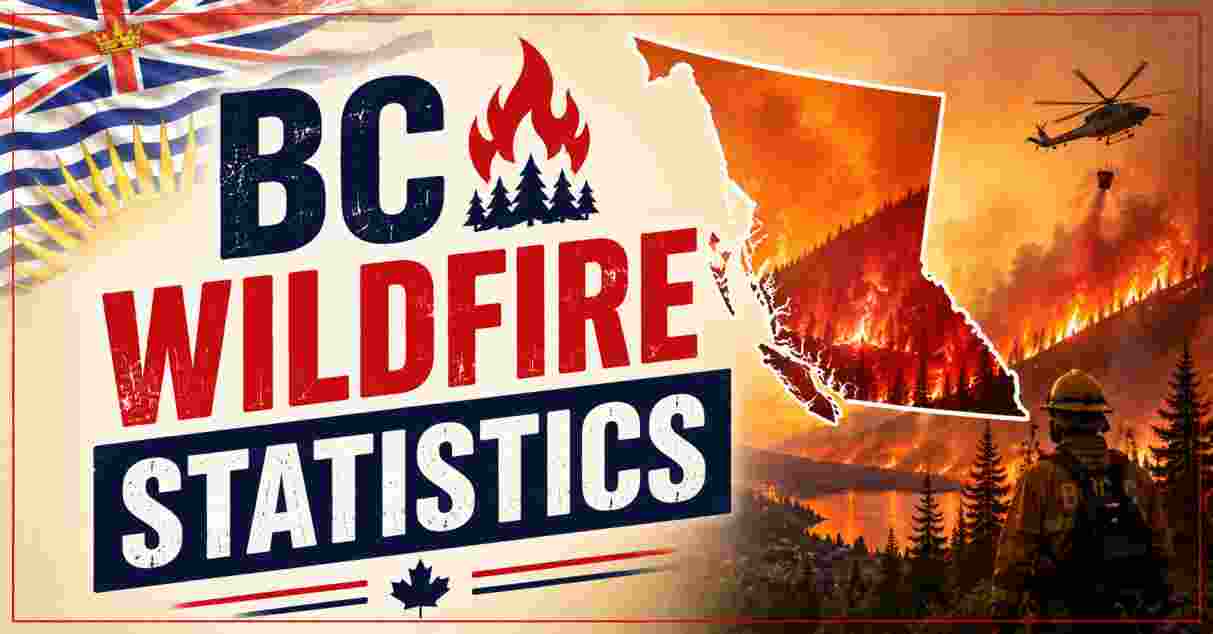
BC Wildfire Statistics in 2026
British Columbia is heading into the 2026 wildfire season facing some of the most severe drought conditions the province has seen since the record-breaking 2017 wildfire season, according to the BC Wildfire Service’s own seasonal outlook. With multi-year drought gripping the Northeast, Chilcotin, South Thompson, Okanagan, and Vancouver Island regions, officials have warned that British Columbia will face the highest and most sustained wildfire risk in Canada this year, with fire activity expected to peak through July and August. For residents, property owners, and anyone tracking Canada’s wildfire outlook, understanding exactly how current conditions compare to past historic seasons is essential, particularly as emergency planners, insurers, and local governments all rely on the same underlying drought and fire-danger data to decide how much preparation this summer genuinely warrants.
This article compiles the most current, government-verified BC wildfire statistics for 2026, covering drought codes, hectares burned, evacuation figures, and direct comparisons to the historic 2017, 2018, and 2021 fire seasons. All data is sourced directly from the BC Wildfire Service, the Government of British Columbia, and Natural Resources Canada, offering a clear, fact-based picture of the risks facing the province as the 2026 core wildfire season unfolds. Given how quickly conditions can change once lightning activity and sustained heat combine over the summer months, each section below is designed to separate the underlying data, such as snowpack levels and historical burn totals, from what those figures mean in practice for residents, emergency planners, and anyone monitoring the season as it develops.
Interesting Facts About BC Wildfire Statistics 2026
| Fact | Figure |
|---|---|
| Provincial snowpack (June 1, 2026) | 64% of normal |
| Snowpack same date in 2025 | 44% of normal |
| Active wildfires (June 25, 2026) | 37 |
| 10-year average annual wildfires (2014–2024) | 1,527 |
| Human-caused wildfires (10-year average) | 40% |
| Worst BC wildfire season on record | 2023 (2.84 million hectares) |
| 2017 record hectares burned | 1.2 million |
| 2025 hectares burned | 886,300 |
The most important fact underpinning BC’s 2026 wildfire season is that current drought conditions are comparable to, and in some regions worse than, those recorded ahead of the historic 2017, 2018, and 2021 fire seasons, according to BC Wildfire Service superintendent Neal McLoughlin. While the province’s overall snowpack improved to 64% of normal by June 1, 2026, up from just 44% at the same point in 2025, this masks persistent regional deficits, with record low snow at valley bottoms increasing the risk of early season grass fires in Interior valleys. As of June 25, 2026, 37 active wildfires were already burning across the province, even before the traditional core wildfire season of July and August had fully begun.
Long-term context makes clear why officials are treating 2026 with such caution. The province’s 10-year average stands at 1,527 wildfires annually, with roughly 40% human-caused and 60% lightning-caused, yet BC has recorded three of its most destructive seasons within the last decade: the 2.84 million hectares burned in 2023 remains the worst on record, followed by 2018’s 1.35 million hectares and the 1.2 million hectares burned during the historic 2017 season, which forced 65,000 people from their homes and triggered the province’s longest-ever state of emergency. Taken together, these figures show that BC’s fire regime has fundamentally shifted over the past decade, with five of its worst ten seasons since records began in 1950 occurring within just the last several years, a trend that scientific attribution studies increasingly link to human-driven climate change rather than natural year-to-year variability.
Source: BC Wildfire Service, Government of British Columbia
Drought Conditions Statistics BC 2026
Provincial Snowpack, June 1 (% of Normal)

2025 | ████████████████████ 44%
2026 | ██████████████████████████████ 64%
| Drought Metric (2026) | Detail |
|---|---|
| Overall provincial snowpack (June 1, 2026) | 64% of normal |
| Regions with above-average drought | Chilcotin, Lower Thompson, Okanagan, Vancouver Island, Northeast |
| Drought Code comparison years | 2017, 2018, 2021 |
| Winter freezing levels | Higher than normal |
| Forecast summer temperature deviation | 0.5–1°C above average (April–July) |
| Highest-risk months | July and August |
The BC Wildfire Service’s Summer 2026 Seasonal Outlook explicitly compares this year’s Drought Code values with those recorded in 2017, 2018, and 2021, three of the province’s most damaging fire seasons, concluding that current conditions are similar to, or worse than, the drought that preceded those historic years. Long-term precipitation deficits have created above-average drought conditions across the Chilcotin, Lower Thompson, Okanagan, Vancouver Island, and Northeast regions, and forecasters say the amount of rain needed to meaningfully ease these conditions is unlikely to fall before the end of summer. Forecasters note that while December and March 2026 brought wetter-than-normal conditions that helped alleviate drought across the Coast and Southeast, the Northeast region continued to carry elevated Drought Code values into spring despite higher-than-average summer rainfall the previous year, illustrating just how persistent this particular region’s multi-year moisture deficit has become.
Compounding the drought risk, higher-than-normal winter freezing levels produced record low snow at valley bottoms, which increases the likelihood of early season grass fires in Interior valleys well before the traditional fire season begins. With long-range guidance favouring a warmer-than-normal summer across most of the province, and temperatures projected 0.5 to 1°C above average from April through July, the BC Wildfire Service has identified July and August as carrying the highest risk for significant, difficult-to-control fire activity, particularly across the Central and Southern Interior and South Coast. Officials have cautioned that long-range precipitation forecasting carries little reliability, meaning the amount of rain that falls in the coming weeks, rather than any single seasonal model, will ultimately determine how severe the summer becomes.
Source: BC Wildfire Service, Summer 2026 Seasonal Outlook
Historical Wildfire Season Comparison Statistics BC 2026
Hectares Burned by Season (millions)

2017  | ████████████████████ 1.20M
2018  | ██████████████████████ 1.35M
2023  | ███████████████████████████████████████████ 2.84M
2024  | ██████████████████ 1.08M
2025  | ███████████████ 0.89M
| Historic Season Metric | Figure |
|---|---|
| 2017 hectares burned | 1.2 million |
| 2017 people evacuated | 65,000 |
| 2017 state of emergency length | 10 weeks (longest on record) |
| 2018 hectares burned | 1.35 million |
| 2023 hectares burned (worst on record) | 2.84 million |
| 2025 hectares burned | 886,300 |
The 2017 wildfire season remains the historic benchmark against which BC’s current drought is being measured. That year, 1.2 million hectares burned across the province, roughly 10 times the then 10-year average, forcing the evacuation of 65,000 residents and prompting the first provincial state of emergency in 14 years, one that was extended four times and lasted a record 10 weeks. The 2017 season was also notable for the Plateau Fire complex, formed from roughly 20 merging fires near Williams Lake, which became the largest wildfire in BC history at the time, covering 545,151 hectares, an area roughly the size of Prince Edward Island. That single season also closed Highway 97 from Kersley all the way south to Pavilion, alongside stretches of the Bella Coola Highway, and led an independent provincial review team to conclude that the events of 2017 represented a genuine turning point in how British Columbia needed to plan for future fire seasons.
Subsequent seasons have shown just how much worse conditions can become: the 2018 season surpassed 2017’s record with 1.35 million hectares burned, and 2023 became the worst season ever recorded at 2.84 million hectares, more than double the previous benchmark. By comparison, 2024 and 2025 were comparatively milder at 1.08 million and 886,300 hectares respectively, though both remained well above the province’s 10-year average, underscoring that even a “quieter” year in the current climate still produces a historically significant burn area. In 2025, 85% of all wildfires were contained under four hectares before they could spread further, a reminder that rapid initial-attack response remains one of the most effective tools available, even in seasons where underlying drought and late-season heat combine to push a smaller number of fires to extreme size.
Source: BC Wildfire Service, Wildfire Season Summary Reports
Current Wildfire Activity Statistics BC 2026
Active Wildfires by Date, 2026 Season

Mid-May   | ████████████████████████████ 108 nationally
June 25   | ██████████ 37 (BC)
| 2026 Season Activity Metric | Figure |
|---|---|
| Active wildfires in BC (June 25, 2026) | 37 |
| Active wildfires nationally (mid-May 2026) | 108+ |
| Notable early BC evacuation | Kalamoir Park Fire, West Kelowna |
| People evacuated (Kalamoir Park Fire) | ~800 |
| Properties affected | 357 |
| Fire cause | Suspected human-caused |
By June 25, 2026, BC Wildfire Service reported 37 active wildfires burning across the province, with fire danger already elevated enough to trigger Category 2 and 3 open-fire prohibitions in the Coastal, Kamloops, and Cariboo fire centres, alongside parts of the Northwest and Prince George fire centres. One of the season’s earliest significant incidents was the Kalamoir Park Fire near West Kelowna, which broke out on June 16, 2026, burning approximately 8 hectares and prompting the tactical evacuation of roughly 800 people across 357 properties before the order was lifted; the fire is suspected to have been human-caused. Officials have stressed that these open-fire prohibitions are likely to continue expanding as summer conditions intensify, and residents across the affected fire centres are being urged to check current restrictions before lighting any fire, given that most new wildfires at this time of year remain entirely preventable.
Nationally, the 2026 Canadian wildfire season began at high risk despite a slow start, with over 108 active wildfires reported across the country by mid-May 2026, concentrated primarily in Alberta, British Columbia, and Saskatchewan. While the season’s opening months tracked below average for total activity, government officials have cautioned that fire danger is expected to build through July, with British Columbia forecast to face the highest and most sustained risk of any province as the summer progresses. Tragically, the human cost of this fire season was already evident by early summer, with a firefighter’s death in Nova Scotia and a plane crash that killed a pilot and three firefighters near Fort Simpson, Northwest Territories, prompting renewed calls from wildfire researchers and a Senate report for a dedicated federal emergency management agency to better coordinate firefighting resources across jurisdictions.
Source: BC Wildfire Service, 2026 Canadian Wildfire Season Reports
Wildfire Prevention and Response Statistics BC 2026
BC Wildfire Service Response Capacity, 2026

Firefighters (2025 baseline)   | ████████████████████████████ 1,300
Support staff                  | █████████████████ 900
| Response Capacity Metric | Figure |
|---|---|
| Firefighters entering the season (2025 baseline) | ~1,300 |
| Permanent support staff | 600 |
| Seasonal support staff | 300 |
| FireSmart community grants invested since 2018 | $190 million |
| Budget 2026 FireSmart top-up | $15 million |
| Disaster-preparedness funding since 2017 | $580 million+ (2,940 projects) |
Heading into the 2026 season, the BC Wildfire Service carried forward a response capacity built around approximately 1,300 firefighters, supported by 600 permanent and 300 seasonal support staff, a structure reinforced by new investment in trucks, water-delivery trailers, pumps, and advanced fire-behaviour prediction systems. The provincial government has also expanded its FireSmart community funding, having invested $190 million in FireSmart BC grants since 2018, including an additional $15 million boost confirmed in Budget 2026, aimed at helping communities reduce wildfire risk before fires start rather than only responding once they do. This expanded capacity also includes new camp infrastructure, designed to make it easier for firefighting crews to deploy across more locations and for longer stretches at a time, alongside continued investment in enhanced wildfire camera networks intended to give predictive services teams earlier warning of new fire starts across remote parts of the province.
Beyond firefighting capacity, the province has committed over $580 million since 2017 toward nearly 2,940 disaster-preparedness and mitigation projects delivered through the Ministry of Emergency Management and Climate Readiness, alongside a $100 million Watershed Security Fund and a further $100 million Agriculture Water Infrastructure Program supporting close to 700 projects to improve water storage in drought-prone areas. Nationally, Natural Resources Canada has also secured 10 new firefighting aircraft through the Canadian Interagency Forest Fire Centre for 2026, reflecting a broader federal recognition that consecutive severe fire years have strained provincial resources beyond what any single jurisdiction can manage alone. Additional federal commitments include $55.4 million over four years to modernise the National Public Alerting System, $285 million over five years to expand FireSmart Canada guidance nationally, and $108 million over three years to renew the Humanitarian Workforce Program, which supports non-governmental organizations providing trained civilian responders during large-scale emergencies.
Source: Government of British Columbia, Government of Canada Wildfire Season Preparedness Update
Wildfire Risk Reduction Statistics BC 2026
Wildfire Risk Reduction Projects, 2024/25

Projects completed    | ████████████████████████████ Nearly 200
Hectares treated      | ██████████████████ 2,440
Prescribed burns      | ██████ 16 (790 hectares)
| Risk Reduction Metric (2024/25) | Figure |
|---|---|
| Risk reduction projects completed | Nearly 200 |
| Hectares treated | 2,440 |
| Prescribed burns completed | 16 (790 hectares) |
| Projects planned/underway for 2025/26 | ~200 |
| Leading fire centre by hectares treated | Prince George |
| First Nations/departments trained in cultural burning | 1,700+ |
Ahead of the 2026 season, the BC Wildfire Service and its partners completed nearly 200 wildfire risk reduction projects during 2024/25, treating approximately 2,440 hectares of land by removing flammable vegetation and woody debris, including 16 prescribed burns covering an additional 790 hectares. The Prince George Fire Centre led this effort, completing 14 projects covering more than 3,393 hectares on its own, with strong supporting activity in the Southeast, Kamloops, and Cariboo fire centres, and a further 200 projects planned or already underway heading into 2025/26. By October of the 2025/26 cycle, 69 projects had already been completed, treating around 4,756 hectares, figures that show this fuel-management work continuing to scale year over year as the province tries to reduce the volume of flammable material available to feed future fires before drought conditions like this year’s can turn a routine fire start into a large-scale, difficult-to-control incident.
Indigenous-led fire management has become an increasingly central part of this prevention strategy. The province has now provided training in cultural burning and wildfire response to over 1,700 departments and First Nations organizations, recognising that First Nations communities are disproportionately affected by wildfire evacuations, with research showing more than 42% of wildfire evacuations nationally have involved majority-Indigenous communities. Programmes like the Kootenay ʔaʔkinq̓uku TREX (Prescribed Fire Training Exchange) continue to expand this capacity-building work, aiming to integrate traditional land management practices more deeply into the province’s overall wildfire risk reduction strategy. Between 1980 and 2021, sixteen Canadian communities were evacuated five or more times due to wildfire, and all but two of those were First Nations reserves, a statistic that underscores why cultural burning knowledge and closer partnership with Indigenous communities are increasingly treated as core components of BC’s long-term wildfire strategy rather than a supplementary measure.
Source: BC Wildfire Service, Climate Institute of Canada
Wildfire Smoke and Air Quality Statistics BC 2026
Air Quality Impact Comparison, Historic Seasons

2017 | ████████████████████████████████ Multiple advisories, province-wide smoke blanket
2018 | ████████████████████████████████████ Record area burned, prolonged smoke events
2023 | ████████████████████████████████████████████████ National smoke reached Eastern Canada/US
| Smoke and Health Metric | Detail |
|---|---|
| 2017 air quality advisories | Multiple, province-wide |
| Smoke composition risk | Fine particulate matter, PAHs, heavy metals |
| Vulnerable groups most affected | Children, elderly, respiratory/cardiac patients |
| 2023 national smoke reach | Eastern Canada and northeastern US |
| Recommended protective equipment | N95 masks, HEPA air purifiers |
| BC Wildfire Service smoke monitoring tool | BC Wildfire Service app, Environment Canada AQHI |
Wildfire smoke has become an increasingly prominent public health concern during major BC fire seasons, and 2026’s elevated drought and fire-danger outlook means widespread smoke events are considered a realistic possibility if the summer follows a pattern similar to 2017 or 2018. During those historic seasons, multiple air quality advisories blanketed large parts of the province for weeks at a time, with smoke containing fine particulate matter, polycyclic aromatic hydrocarbons, and trace heavy metals that pose particular risk to children, elderly residents, and people with existing respiratory or cardiac conditions. The scale of these events is not confined to BC alone: in 2023, smoke from Canada’s worst-ever wildfire season travelled as far as Eastern Canada and the northeastern United States, prompting air quality alerts in major cities thousands of kilometres from the actual fires, a reminder that the consequences of a severe BC or wider Canadian fire season now regularly extend well beyond the province’s own borders.
Public health guidance for the 2026 season echoes recommendations refined over the past decade of severe fire years: residents in affected regions are encouraged to monitor the Air Quality Health Index (AQHI) issued by Environment Canada, keep N95 masks and, where possible, a HEPA air purifier on hand for smoke events, and limit outdoor activity when advisories are in effect. The BC Wildfire Service app now integrates smoke forecasting alongside its existing fire-location and evacuation-alert features, reflecting a broader shift toward treating air quality as a core part of wildfire communications rather than an afterthought, particularly as research continues to link repeated smoke exposure during consecutive severe fire seasons to cumulative long-term respiratory health risks for residents in the most frequently affected regions of the province. Local health authorities across the Interior and Southern regions have also expanded the availability of designated clean-air spaces in community centres and libraries during past high-smoke seasons, a measure officials say could be activated again this year if the current drought outlook translates into the kind of sustained, large-scale fire activity seen in 2017 and 2018.
Source: BC Wildfire Service, Public Health Agency of Canada
Wildfire Cost and Economic Impact Statistics BC 2026
Provincial Firefighting Costs by Season (approx.)

2017 | ████████████████████████████████████ $564 million
2018 | ██████████████████████████████████████████ $649 million (surpassed 2017)
2023 | ████████████████████████████████████████████████ Record season costs
| Cost and Impact Metric | Figure |
|---|---|
| 2017 firefighting costs | $564 million |
| 2017 buildings destroyed | 300+ |
| 2023 hectares burned (national) | 16.5 million |
| 2025 hectares burned (national) | 8.3 million (2nd worst on record) |
| Jasper wildfire insured damages (2024, Alberta) | $1.23 billion |
| BC share of total provincial area burned (2017) | 1.3% |
Source: Climate Institute of Canada, Government of British Columbia
The financial toll of BC’s worst wildfire seasons has climbed steadily over the past decade. The 2017 season alone cost the province $564 million in direct firefighting expenses and destroyed over 300 buildings, ranging from homes and barns to commercial structures, while closing major routes including Highway 97 and the Bella Coola Highway for extended periods. That cost record was broken again the following year, and nationally, Canada’s worst fire seasons have produced damages running into the billions, illustrated starkly by the 2024 Jasper wildfire in neighbouring Alberta, which destroyed a third of the town’s structures and resulted in $1.23 billion in insured losses, among the most expensive natural disasters in Canadian history. Even the response effort itself carries a substantial price tag: at the peak of the 2017 season, nearly 3,906 firefighters were deployed across the province, including 647 out-of-province personnel and 1,606 contractors, supported by 233 helicopters and airplanes and international crews from Australia, New Zealand, and Mexico.
These provincial costs sit within an increasingly alarming national trend. Canada’s 2023 wildfire season burned 16.5 million hectares nationwide, more than double the previous national record and nearly seven times the historical average, while 2025 ranked as the second-worst season on record at over 8.3 million hectares burned across nearly every province and territory. Researchers attribute much of this acceleration to climate change, which is lengthening the burning day by weakening the natural cooling that once slowed fires overnight, allowing wildfires in British Columbia and elsewhere to burn more intensely and for longer than in past decades, a pattern that directly informs why officials are treating the current drought conditions with such urgency. Scientific attribution analysis of the 2017 season found that between 84% and 87% of the record area burned that year could be attributed to anthropogenic climate change, one of the clearest documented links between global warming and a single extreme wildfire season anywhere in the world, reinforcing why the current comparison to 2017-level drought is being treated as a serious warning rather than a routine seasonal fluctuation.
Disclaimer: This research report is compiled from publicly available sources. While reasonable efforts have been made to ensure accuracy, no representation or warranty, express or implied, is given as to the completeness or reliability of the information. We accept no liability for any errors, omissions, losses, or damages of any kind arising from the use of this report.