Strait of Gibraltar 2026
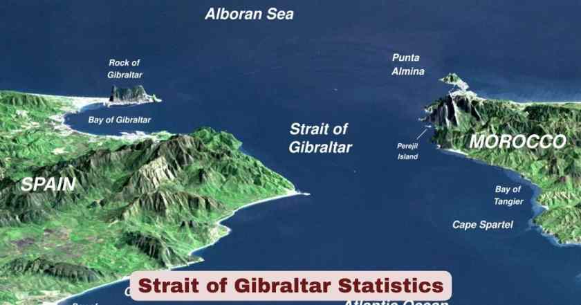
The Strait of Gibraltar is one of the most strategically significant and heavily monitored waterways on the planet. Sitting at the southwestern tip of Europe, it forms the only natural maritime link between the Atlantic Ocean and the Mediterranean Sea, physically separating the continents of Europe and Africa by just 14.2 kilometres (8.9 miles) at its narrowest point. Named after the Rock of Gibraltar, which itself traces its origins to the Arabic Jabal Ṭāriq meaning “Tariq’s Mount,” this 58-kilometre-long strait has served as a critical corridor for trade, military movement, and human migration for thousands of years. It sits in the territorial waters of three entities: Spain, Morocco, and the British Overseas Territory of Gibraltar, and under the United Nations Convention on the Law of the Sea (UNCLOS), all foreign vessels hold the right of transit passage through its waters.
As of 2026, the Strait of Gibraltar remains one of the busiest and most consequential maritime chokepoints in the world. With over 300 vessels crossing every single day — that is roughly one ship every 4.8 minutes — the strait handles more than 10% of global maritime trade valued at approximately $1.1 trillion annually. Unlike other global chokepoints that sometimes have alternative bypass routes, the Strait of Gibraltar is what maritime analysts classify as a “hard chokepoint”: there is simply no viable maritime alternative for ships that need to enter or exit the Mediterranean Sea from the west. This absolute geographic dependency makes the strait not just an important waterway, but a defining artery of the modern global economy, and in 2026, its traffic levels, energy flows, environmental pressures, and ferry operations have all reached historic benchmarks.
Interesting Facts About the Strait of Gibraltar 2026
| Fact Category | Key Data Point |
|---|---|
| Narrowest Width | 14.2 km (8.9 miles) between Point Marroquí (Spain) and Point Cires (Morocco) |
| Widest Point | 44 km at the western entrance |
| Total Length | Approximately 58 kilometres |
| Minimum Depth | Around 300 metres at the Camarinal Sill |
| Maximum Depth | Over 900 metres in the main channel |
| Daily Vessel Transits | Approximately 300 vessels per day |
| Annual Vessel Transits | Over 110,000 vessels per year (including ferries and smaller craft) |
| Merchant Shipping Annual | Approximately 54,000 merchant ships per year |
| Transit Frequency | One vessel every 4.8 minutes on average |
| Share of Global Maritime Trade | More than 10% of all global seaborne trade |
| Annual Trade Value Transiting | Approximately $1.1 trillion |
| Daily Oil Throughput | Approximately 3.3 million barrels per day |
| Share of European Oil Imports | Around 20% of European oil imports |
| Ferry Crossings Per Day | Approximately 80 ferry crossings daily on major routes |
| Operation Crossing Passengers (2024) | Record 3,442,770 passengers — a 6.9% increase from 2023 |
| Operation Crossing Vehicles (2024) | Record 847,429 vehicles — a 9.3% increase, the highest in 30 years |
| Ferry Route — Fastest Crossing | As little as 35 minutes by fast ferry |
| Whale Species Observed Regularly | 7 cetacean species regularly recorded |
| Regularly Occurring Cetacean Species | 8 species confirmed including orca, sperm whale, fin whale |
| Gibraltar Killer Whale Population | Critically Endangered; fewer than 40 individuals estimated |
| Annual Migratory Birds | Hundreds of thousands of seabirds transit annually |
| Proposed Spain-Morocco Tunnel Cost | €6 billion planned for 2040 completion |
| Tunnel Depth Planned | Up to 475 metres below sea level |
| Tunnel Length Planned | 42 kilometres total (~30 km submerged) |
| Russian Vessel Transits (2025) | 299 Russian vessels tracked — including 43 warships, the highest since 2021 |
| Russian Maritime Activity Change | +50% increase in 2025 compared to the previous year |
| Gibraltar Bunkering Rank | Largest bunkering port in the Mediterranean |
| Annual Gross Tonnes Calling Gibraltar Port | At least 240 million gross tonnes per year |
| Levanter Wind Disruptions Annually | 5–10 events per year (March–July), each lasting 24–72 hours |
| HGVs Crossing Via Algeciras Annually | Over 400,000 heavy goods vehicles per year |
| Algeciras–Tarifa Annual Passengers | An average of 6 million passengers per year through both terminals |
| Age of Strait (Geological) | Formed approximately 5.33 million years ago through the Zanclean Flood |
Source: Gibraltar Port Authority; Spanish Civil Protection (Operation Crossing the Strait 2024); Ballast Markets Strait Analysis; Grokipedia Strait of Gibraltar; FIRMM Foundation; Wikipedia – Strait of Gibraltar; Gibraltar-City.com
The facts above reveal just how extraordinary the Strait of Gibraltar is as a geographic and commercial phenomenon. What is striking is not just the sheer volume of maritime activity — over 110,000 vessels annually — but also the ecological richness packed into this narrow corridor. The same stretch of water that carries oil tankers and cargo ships also sustains eight regularly occurring cetacean species, hosts hundreds of thousands of migratory birds each year, and supports a seabed shaped by some of the most dramatic geological events in Earth’s recent history. The fact that a fast ferry can cross from Europe to Africa in just 35 minutes while oil tankers and container ships queue up just minutes apart speaks to the extraordinary density of use that the strait manages every single day.
What makes 2026 particularly notable for the Strait of Gibraltar is the convergence of record-breaking passenger ferry data from the 2024 Operation Crossing season (which feeds directly into 2025 and 2026 planning), the documented 50% surge in Russian vessel activity through the strait in 2025, and the ongoing push towards a proposed €6 billion Spain-Morocco tunnel — a project that, if completed, would reshape cross-strait connectivity forever. The strait in 2026 is simultaneously a record-breaking commercial artery, an ecological hotspot under growing environmental pressure, and a front line of evolving geopolitical dynamics between NATO powers and Russian naval operations in the western Mediterranean.
Physical Geography & Dimensions of the Strait of Gibraltar 2026
| Physical Parameter | Measurement |
|---|---|
| Total Length | ~58 kilometres |
| Minimum Width (Narrowest Point) | 14.2 km / 13 km (between Point Marroquí, Spain and Point Cires, Morocco) |
| Maximum Width (Widest Point) | 44 kilometres |
| Minimum Depth (Camarinal Sill) | ~300 metres |
| Maximum Depth (Main Channel) | Over 900 metres |
| Surface Current Direction | West to East (Atlantic inflow) |
| Deep Countercurrent Direction | East to West (denser Mediterranean outflow) |
| Tidal Current Strength | Strong and variable; wind speeds near rocks can reach 40–50 knots |
| Territorial Jurisdiction | Spain, Morocco, and British Overseas Territory of Gibraltar |
| Governing Maritime Law | UNCLOS — freedom of transit passage applies |
| Geological Formation Event | The Zanclean Flood approximately 5.33 million years ago |
| Northernmost Point Landmark | Rock of Gibraltar (elevation: 426 metres) |
| Southernmost Point Landmark | Jbel Musa, Morocco (Pillar of Hercules) |
Source: Wikipedia – Strait of Gibraltar; IHO (International Hydrographic Organization); FIRMM Foundation; Gibraltar-City.com
The physical dimensions of the Strait of Gibraltar are what make it both fascinating and formidable. The depth gradient alone — ranging from a shallow 300 metres at the Camarinal Sill to over 900 metres in the main channel — creates the extraordinary two-layer current system that keeps the Mediterranean Sea alive. Atlantic water flows in at the surface because it is lighter and less saline, while the heavier, saltier Mediterranean water simultaneously flows out along the bottom in the opposite direction. This density-driven exchange is not just a quirky oceanographic fact — it is the ecological engine of the entire Mediterranean basin, sustaining the nutrients, salinity, and temperature gradients that support fisheries and marine life across 22 nations. The funnel shape of the strait amplifies tidal forces and wind effects, with Levanter (easterly) and Poniente (westerly) winds sometimes reaching 40–50 knots near the Rock of Gibraltar — conditions that can halt vessel traffic and force anchorage of smaller craft for 24 to 72 hours at a time.
Geologically, the strait is a relatively young feature in Earth’s history, having been re-established through the catastrophic Zanclean Flood approximately 5.33 million years ago after a prolonged period of isolation known as the Messinian Salinity Crisis. That event, when Atlantic waters broke through and reflooded the desiccated Mediterranean basin, is considered one of the most dramatic natural events of the Cenozoic era. Today, tectonic forces are still at work: the African Plate continues its slow northward push against the Eurasian Plate, and on geological timescales, the strait is expected to close again — though this is millions of years away. In 2026, the more immediate concern is the anthropogenic pressure on this ancient waterway: 100,000-plus vessel transits per year leave behind noise pollution, hydrocarbon contamination risk, and chronic disturbance to marine mammal populations that evolved long before the first ship ever crossed these waters.
Maritime Traffic Statistics — Strait of Gibraltar 2026
| Traffic Category | Data |
|---|---|
| Total Annual Vessel Transits | Over 110,000 vessels per year |
| Daily Vessel Average | Approximately 300 vessels per day |
| Transit Frequency | One vessel every ~4.8 minutes |
| Annual Merchant Ship Transits | ~54,000 merchant ships |
| Annual Ferry Transits | ~28,000 ferry crossings |
| Annual Smaller Craft Transits | ~28,000 smaller vessels |
| Daily Merchant Vessel Count | ~148 merchant vessels per day |
| Daily Ferry Count | ~80 ferry crossings per day |
| Daily Oil Tanker Count | ~44 tankers per day (30% of merchant traffic) |
| Daily Container Ship Count | ~52 container ships per day (35% of merchant traffic) |
| Daily Bulk Carrier Count | ~22 bulk carriers per day (15% of merchant traffic) |
| Share of Global Maritime Trade | More than 10% of all global seaborne trade |
| Annual Trade Value Transiting | Approximately $1.1 trillion |
| Russian Vessels Transiting (2025) | 299 documented transits, including 43 warships |
| Russian Vessel Increase (2025 vs 2024) | +50% year-on-year increase |
| Gibraltar Port Annual Gross Tonnage | At least 240 million gross tonnes per year |
Source: Gibraltar Port Authority; Ballast Markets Strait of Gibraltar Maritime Analysis (October 2025); Grokipedia Strait of Gibraltar (January 2026); Majorca Daily Bulletin (January 2026)
Few waterways on Earth compress as much commercial activity into as small a geographic footprint as the Strait of Gibraltar. The figure of 300 vessels per day — equivalent to one every 4.8 minutes, around the clock, every day of the year — underscores the relentless operational rhythm of this chokepoint. Container ships carrying consumer electronics and manufactured goods from Asia, oil tankers delivering crude from the Middle East and North Africa to European refineries, bulk carriers loaded with grain and minerals, and ferries connecting two continents are all in constant, simultaneous motion through a waterway that narrows to just 13 kilometres at its tightest point. At this level of density, even a single vessel breakdown or weather closure creates a ripple effect across Mediterranean supply chains within hours.
The 2025 surge in Russian vessel activity adds a geopolitical layer that maritime analysts and NATO command structures are watching closely. With 299 documented Russian transits in 2025 — including 43 warships, the highest count since 2021 — the Strait of Gibraltar has taken on renewed strategic significance beyond commercial shipping. Notably, these figures do not include Russia’s so-called “ghost fleet”: shadow tankers operating outside normal AIS reporting protocols, which means the true level of Russian maritime activity through the strait is likely higher than documented numbers suggest. With the 2026 Strait of Hormuz crisis already redirecting global tanker flows, the Strait of Gibraltar faces unprecedented pressure as the primary western gateway for Mediterranean-bound cargo that can no longer route through the Persian Gulf corridor as readily as before.
Ferry & Passenger Traffic — Strait of Gibraltar 2026
| Ferry & Passenger Metric | Data |
|---|---|
| Operation Crossing Passengers (OPE 2024) | 3,442,770 passengers (highest ever recorded) |
| OPE 2024 Passenger Growth vs 2023 | +6.9% increase |
| OPE 2024 Vehicles Crossed | 847,429 vehicles — highest in 30 years |
| OPE 2024 Vehicle Growth vs 2023 | +9.3% increase |
| OPE 2023 Passengers (baseline) | 3,219,618 passengers |
| OPE Season Duration | 13 June – 15 September annually |
| Algeciras + Tarifa Share of OPE Traffic | ~75% of total OPE activity |
| Algeciras Port Share of OPE Passenger Traffic | Over 55% of total OPE passengers |
| Moroccan Port Passengers (OPE 2024) | 2.8 million through Moroccan ports (+5.5%) |
| Algeciras + Tarifa Annual Passengers (Combined) | Average of 6 million passengers per year |
| HGVs via Algeciras Annually | Over 400,000 heavy goods vehicles |
| Fastest Ferry Crossing Time | As little as 35 minutes |
| Weekly Sailings (Algeciras–Tangier Med alone) | Up to 299 weekly sailings |
| Daily Sailings Across Strait (FRS alone) | Up to 36 daily sailings |
| Ferry Operators Active | FRS, Balearia, Naviera Armas, AML, DFDS and others |
| Operation Established | 1986 — 38 years of operation |
| New DFDS Vessels for Strait (2026) | Capacity expansion via new vessels planned for 2026 |
Source: Spanish Ministry of the Interior – Operation Crossing the Strait 2024; Atalayar News; Ports Europe (September 2024); Port Authority of the Bay of Algeciras (APBA); Direct Ferries; Grokipedia (August 2025)
The annual Operation Crossing the Strait — also known as Operation Marhaba — is by many accounts the largest coordinated movement of people and vehicles by sea anywhere in the world. The 2024 edition set a historic record that directly shapes the operational baseline for 2025 and 2026: 3,442,770 passengers and 847,429 vehicles — figures that have triggered expanded investment by the Spanish government, port authorities, and ferry operators alike. The coordination involved is staggering: 18 shipping lines, nine Spanish ports, and thousands of police officers, Red Cross volunteers, civil protection agents, and transport workers all mobilized across a single three-month window to manage the return journey of millions of Moroccan nationals living in Europe back to their home country for summer. The fact that the port of Algeciras alone handles over 55% of total OPE passenger traffic — and that it simultaneously manages transoceanic container volumes alongside this seasonal human tide — makes it one of the most operationally complex port environments in Europe.
For 2026, the momentum from these record figures has already prompted concrete infrastructure and capacity responses. DFDS is expanding its Ro-Ro and containerized cargo capacity with new vessels entering service, while the Algeciras Port Authority continues to invest in traffic management systems and digital infrastructure. Ferry route density on the Algeciras–Tangier Med corridor alone has reached 299 weekly sailings from multiple operators, reflecting both the commercial demand and the competitive intensity among ferry companies in the strait. The ability to cross from Europe to Africa in as little as 35 minutes by fast ferry keeps the Strait of Gibraltar uniquely accessible in a way that no other intercontinental maritime crossing can match — a geographic reality that will continue to drive passenger and freight growth for years ahead.
Energy & Oil Trade Through the Strait of Gibraltar 2026
| Energy Trade Metric | Data |
|---|---|
| Daily Oil Throughput (Crude + Products) | Approximately 3.3 million barrels per day |
| Share of European Oil Imports | Around 20% of European refinery crude supply |
| Oil Tankers Transiting Daily | ~44 tankers per day |
| Oil Tanker Share of Merchant Traffic | ~30% of all merchant vessels |
| Primary Oil Origins (60% of Gibraltar oil traffic) | Saudi Arabia, Iraq, UAE crude to Mediterranean refineries |
| Secondary Oil Origins (25%) | Algeria, Libya exports to European markets |
| Remaining Atlantic Imports (15%) | West African crude, U.S. petroleum exports |
| Brent-Med Price Spike (Levanter Disruption) | Estimated 3–7% Brent-Med premium spike per weather event |
| Mediterranean Nations Dependent on Strait | 22 nations, 512 million people |
| Estimated GDP Dependent on Western Mediterranean Access | Approximately $3.5 trillion in GDP |
| Levanter Wind Disruptions Per Year | 5–10 events, each delaying 30–60 vessels for 24–72 hours |
| Proposed Suez/Hormuz Disruption Commodity Price Impact | 20–40% commodity price spike within one week if both routes close |
Source: Ballast Markets Strait of Gibraltar Energy Analysis (October 2025); U.S. Energy Information Administration (EIA); Gibraltar Maritime Administration
The Strait of Gibraltar is not merely a shipping lane — it is a critical energy artery that keeps the lights on and the wheels turning across southern and central Europe. Approximately 3.3 million barrels of oil and petroleum products pass through the strait every single day, representing roughly 20% of European refining capacity’s crude supply. The origins of these flows are heavily concentrated in Middle Eastern producers — Saudi Arabia, Iraq, and the UAE together account for around 60% of Gibraltar’s oil traffic — with North African producers (Algeria and Libya) contributing another 25%. This geographic concentration means that any disruption to Gulf oil production, or to the Strait of Hormuz through which much of that Gulf crude first travels, sends an immediate knock-on effect straight to the Strait of Gibraltar. This dynamic is directly relevant in 2026: with the Strait of Hormuz crisis disrupting Persian Gulf flows, Mediterranean refineries that depend on Gulf crude are having to source alternative supplies or draw down strategic reserves, placing additional logistical weight on Atlantic tanker routes entering the Mediterranean through Gibraltar.
The energy interdependency the Strait of Gibraltar represents is captured most starkly in one figure: 512 million people across 22 nations depend on uninterrupted western Mediterranean access for their energy supply chains, food imports, and manufactured goods. Unlike the Strait of Hormuz — which has limited but real pipeline bypass options — the Strait of Gibraltar has zero maritime alternatives. If it were to close, the Mediterranean would be locked from the west, with only the Suez Canal offering an eastern exit point. This binary dependency is precisely why even temporary disruptions caused by Levanter wind events (which can force 30–60 vessels to anchor for up to 72 hours and cause immediate 3–7% Brent-Mediterranean price premiums) attract close attention from energy traders and refinery managers across the region.
Environmental & Marine Ecosystem Statistics — Strait of Gibraltar 2026
| Environmental Metric | Data |
|---|---|
| Regularly Occurring Cetacean Species | 8 species confirmed |
| Species List | Common dolphin, striped dolphin, bottlenose dolphin, pilot whale, killer whale (orca), sperm whale, fin whale, minke whale |
| Gibraltar Killer Whale Population | Fewer than ~40 individuals; classified Critically Endangered |
| Whale Watching Season 2026 | Opens 30th March 2026 |
| Cetacean Species Regularly Sighted | 7 cetacean species observable on whale-watching tours |
| Annual Vessel Transits (Environmental Pressure) | Over 100,000 vessel transits per year |
| Maritime Traffic Share of Local Particulate Emissions | 20–25% of local particulate matter |
| Speed Limit for Vessels (Whale Protection) | 13 knots (24 km/h) — set by Spanish Ministry of Environment |
| Invasive Species Present | Rugulopteryx okamurae (macroalga, introduced ~2015), rapidly proliferating |
| Seabird Transits Annually | Hundreds of thousands — classified Important Bird Area by BirdLife International |
| Migratory Bird Species Present | Scopoli’s shearwater, Balearic shearwater, Audouin’s gull, lesser black-backed gull, and others |
| Mediterranean Temperature Trend | Accelerated warming observed — compounding ecosystem threats |
| Bycatch Threat to Cetaceans | Ongoing — particularly for striped dolphin and common dolphin |
| PCB Pollution Status | Western Mediterranean and SW Iberian Peninsula are global PCB “hotspots” |
Source: FIRMM Foundation; Aquatic Mammals Journal (Herr et al., 2020); ORCA Organisation; BirdLife International; Grokipedia Strait of Gibraltar (January 2026); OceanCare Cetacean Report
The ecological story of the Strait of Gibraltar in 2026 is one of remarkable biodiversity under extraordinary pressure. Eight species of cetaceans are regularly recorded in these waters — a concentration of marine mammal diversity that is rare for such a small and industrially active body of water. The upwelling of nutrient-rich deep water at the Camarinal Sill, driven by the same tidal and density dynamics that define the strait’s oceanography, creates a productive food chain that supports everything from tiny anchovies and sardines to sperm whales, fin whales, and the critically endangered Gibraltar orca population. The whale watching season that opens on 30th March 2026 draws visitors to the town of Tarifa specifically because the chances of encountering multiple cetacean species in a single outing are genuinely high — a testament to the ecological productivity that somehow persists alongside one of the world’s busiest shipping lanes.
Yet the environmental pressures are mounting in ways that cannot be overstated. Maritime traffic contributes 20–25% of local particulate matter emissions, oil spill risk is elevated in the narrow bays flanking the main channel, and underwater noise from hundreds of daily vessel transits disrupts the communication, navigation, and feeding behavior of cetaceans. The Gibraltar killer whale population, estimated at fewer than 40 individuals and classified Critically Endangered by ACCOBAMS and the IUCN, represents one of Europe’s most vulnerable marine mammal populations — a subpopulation that has not recovered despite decades of awareness campaigns and a dedicated conservation plan. Adding to native pressures, the invasive macroalga Rugulopteryx okamurae — introduced around 2015 — has rapidly colonised coastal zones around the strait, smothering native seabed habitats and requiring costly beach cleanup operations involving thousands of tonnes of biomass annually.
Geopolitical & Strategic Significance — Strait of Gibraltar 2026
| Strategic Metric | Data / Context |
|---|---|
| Classification | Hard chokepoint — zero maritime bypass |
| Governing Parties | Spain, Morocco, Gibraltar (UK) |
| NATO Strategic Relevance | Critical western Mediterranean surveillance corridor |
| Russian Vessel Transits in 2025 | 299 vessels including 43 warships — highest warship count since 2021 |
| Russian Activity Increase | +50% year-on-year in 2025 vs 2024 |
| Russia’s Ghost Fleet Presence | Shadow tanker transits suspected but not fully tracked via AIS |
| Spain Military Presence | Offshore patrol vessel Centinela monitors Russian transits |
| US Military Activity | US military aircraft active from Rota air base, overflying monitoring routes |
| Speed Restriction for Vessels | 13 knots in designated cetacean protection zones |
| Transit Passage Rights | Guaranteed under UNCLOS for all foreign vessels and aircraft |
| Spain-Gibraltar Tension Probability | Fewer than 0.1% annual probability of military confrontation |
| Proposed Morocco-Spain Tunnel | €6 billion project targeting 2040 completion |
| Tunnel Length | 42 km (approx. 30 km submerged) at depths up to 475 metres |
| Mediterranean GDP Dependent | ~$3.5 trillion in GDP tied to uninterrupted strait access |
Source: Majorca Daily Bulletin (January 2026); Grokipedia Strait of Gibraltar (January 2026); Gibraltar-City.com; Ballast Markets Analysis (October 2025); UNCLOS Framework
The Strait of Gibraltar’s geopolitical significance in 2026 has intensified in ways that would have seemed unlikely just a few years ago. The dramatic 50% rise in Russian vessel transits documented throughout 2025 — particularly the 43 warship transits, the highest count since 2021 — reflects a deliberate repositioning of Russian naval power in the wake of the loss of its Tartus base in Syria and the escalation of the wider conflict in the eastern Mediterranean. Naval observer Michael J. Sánchez, monitoring the strait via public AIS systems, has provided rare granular visibility into this trend: of the 299 Russian vessels documented, 137 were cargo ships and 107 were oil tankers, many of them associated with Russia’s growing shadow fleet that operates outside Western sanctions. Spain’s offshore patrol vessel Centinela and US military aircraft operating from the Rota air base have both been deployed in active monitoring roles, reflecting the strait’s front-line position in NATO’s southern flank surveillance architecture.
The longer-term structural story remains the proposed €6 billion Spain-Morocco fixed link tunnel, a project that has gathered renewed planning momentum in the post-pandemic era. At 42 kilometres in total length with nearly 30 kilometres submerged at depths reaching 475 metres, this would be the deepest undersea tunnel ever constructed — surpassing even the Channel Tunnel in engineering challenge. If completed by the 2040 target date, it would for the first time offer a land-based crossing between Europe and Africa, fundamentally changing the logistics of cross-strait movement for both freight and passengers. For now, however, the strait remains the sole crossing point, and its management by three separate jurisdictions — Spain, Morocco, and Gibraltar — across a width of just 14.2 kilometres continues to be one of the most diplomatically nuanced geographic arrangements in the world.
Algeciras Port & Hub Statistics — Strait of Gibraltar 2026
| Port & Hub Metric | Data |
|---|---|
| Annual Gross Tonnage (Gibraltar Port) | At least 240 million gross tonnes per year |
| Gibraltar Port Bunkering Status | Largest bunkering port in the Mediterranean |
| Annual Vessel Transits in Strait | ~60,000 vessels per year (Gibraltar Port Authority data) |
| HGVs Through Algeciras Per Year | Over 400,000 heavy goods vehicles |
| Annual Passenger Through Algeciras + Tarifa | Average 6 million passengers per year |
| Algeciras–Tangier Med Weekly Sailings | Up to 299 weekly sailings |
| Gibraltar Hub Container Hubs | Algeciras, TangerMed, Sines, Valencia, Las Palmas |
| Combined Gibraltar Hub Container Volume | Over 11 million TEUs |
| Hub Terminal Capacity Utilisation | Close to 80% of maximum declared capacity |
| Vessel Size Handled | Up to 18,000–21,000 TEU ultra-large container ships |
| Transhipment Traffic Growth (2003–2016 CAGR) | 6.4% per annum |
| Mediterranean Share of Global Transhipment Market | ~15% of total global transhipment |
| Mediterranean Share of Global Container Trade | ~30% of global container maritime traffic |
Source: Gibraltar Port Authority; Port Authority of the Bay of Algeciras (APBA); ALG Global Maritime Analysis; Grokipedia Strait of Gibraltar
The Port of Algeciras and its partner facilities at Tarifa together form what Port Authority president Gerardo Landaluce has described as a “transcontinental maritime bridge” between Europe and Africa — and the numbers bear that description out fully. Over 400,000 heavy goods vehicles cross through Algeciras annually, carrying perishable goods, automobiles, industrial components, and bulk commodities between the two continents. The port handles two fundamentally different types of traffic simultaneously: the massive, year-round commercial flow of containers, tankers, and freight trucks; and the intense, seasonal surge of the Operation Crossing the Strait, when millions of passengers and their vehicles flood through the terminals over three summer months. Managing both simultaneously, with port capacity already running at close to 80% utilisation on the container side, represents an operational challenge that few port systems in the world face at the same scale.
The Gibraltar hub cluster — encompassing Algeciras, TangerMed, Sines, Valencia, and Las Palmas — collectively handles over 11 million TEUs of container traffic, placing the region firmly within the top tier of global transhipment hubs. The Mediterranean accounts for approximately 15% of total global transhipment and around 30% of global container maritime traffic, and a significant share of that volume flows through or near the Strait of Gibraltar. The strategic rationale is simple: the strait sits at the intersection of the East-West deepwater mainline routes connecting Asia and Europe, and the North-South feeder routes serving West Africa and the Iberian Peninsula. For major shipping alliances, having a hub terminal at or near Gibraltar is not optional — it is essential for network efficiency. The near-capacity utilisation rates at key terminals on both sides of the strait, combined with the entry of ultra-large vessels of 18,000–21,000 TEUs that require deepwater berths and advanced equipment, continue to pressure port operators to invest in infrastructure upgrades throughout 2025 and 2026.
Disclaimer: This research report is compiled from publicly available sources. While reasonable efforts have been made to ensure accuracy, no representation or warranty, express or implied, is given as to the completeness or reliability of the information. We accept no liability for any errors, omissions, losses, or damages of any kind arising from the use of this report.