Greenland Weather in 2026
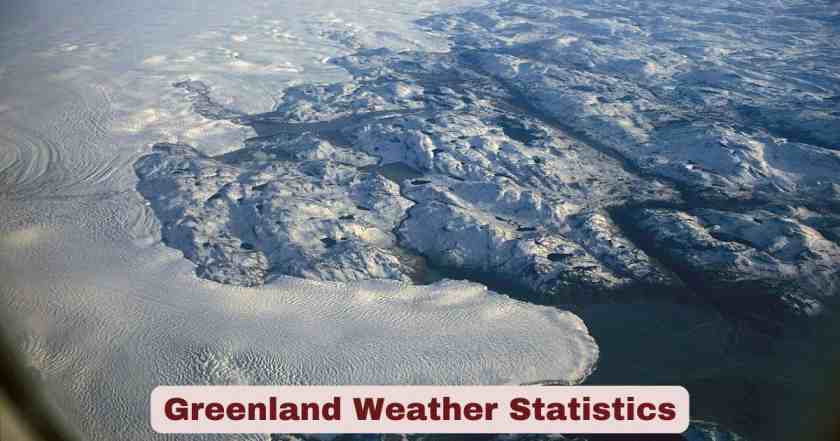
Greenland weather statistics in 2026 reveal one of Earth’s most extreme and diverse climatic environments, where Arctic conditions create temperature variations ranging from the relatively moderate maritime climate of southern coastal settlements to the unforgiving polar desert conditions atop the massive ice sheet interior. The island’s geographic positioning between the Atlantic Ocean and Arctic Ocean, combined with the Greenland Ice Sheet’s dominance over 79-80% of the landmass, generates profound climatic contrasts that make Greenland simultaneously home to some of the planet’s coldest permanently recorded temperatures and occasional record-breaking warm extremes driven by Arctic amplification—the phenomenon where polar regions warm at approximately twice the global average rate. Weather data from the Danish Meteorological Institute (DMI), operating 20 land-based weather stations across Greenland along with 12 stations owned by Mittarfeqarfiit A/S and international research facilities like Summit Station, provide comprehensive monitoring of temperature, precipitation, wind, and ice conditions across this vast 2,166,090 square kilometer territory.
The 2024-2025 weather year demonstrated Greenland’s climatic volatility and the accelerating impacts of climate change on Arctic weather patterns. The 2024 summer melt season produced the second-lowest cumulative daily melt extent in the 21st century, ranking 28th lowest since satellite monitoring began in 1979, yet this relatively cool summer was punctuated by extreme events including a dramatic late-September heatwave where temperatures soared 18°C (32°F) above average over the ice sheet’s highest elevations. Record-breaking heat struck in May 2025 when the Ittoqqortoormiit station in eastern Greenland recorded 14.3°C on May 19—more than 13°C above the May average daily maximum of 0.8°C—while southern Greenland experienced its hottest September night ever on September 22, 2024 with Narsarsuaq reaching 15.3°C, the highest minimum temperature in that region’s recorded history. These temperature extremes occur against a backdrop of sustained warming: average winter temperatures at Swiss Camp monitoring station rose nearly 5.6°C (10°F) between 1991 and 2006, exemplifying the rapid climate transformation affecting Greenland’s weather patterns and fundamentally altering the island’s hydrology, ecology, and habitability in ways that reverberate through local communities dependent on predictable seasonal cycles for hunting, fishing, and transportation across sea ice that increasingly melts earlier and forms later each year.
Interesting Facts and Latest Statistics for Greenland Weather in 2026
| Category | Key Facts & Statistics | Year/Source |
|---|---|---|
| 2024 Ice Sheet Mass Balance | -55 ± 35 gigatons | Sept 2023-Aug 2024 |
| 2025 Ice Sheet Mass Balance | -129 gigatons | Sept 2024-Aug 2025 |
| Record Low Ice Loss 2024 | Lowest annual loss since 2013 | GRACE-FO satellite |
| 2024 Melt Season Ranking | 2nd lowest cumulative melt since 2000 | NSIDC data |
| Satellite Record Ranking | 28th lowest melt extent since 1979 | 47-year record |
| May 2025 Record Heat | 14.3°C at Ittoqqortoormiit (19 May) | 13°C above average |
| Sept 2024 Night Record | 15.3°C at Narsarsuaq (22 Sept) | Hottest Sept night ever |
| Late Sept Temperature Spike | 18°C (32°F) above average | 21-23 Sept 2024 |
| All-Time High Temperature | 30.1°C (86.3°F) at Kangerlussuaq | Historical record |
| All-Time Low Temperature | -66.1°C (-87°F) at Summit Station | Historical record |
| Hottest August Ever | 23.6°C at Tasiilaq (August 2021) | Recent record |
| Record December 2024 | -13.34°C coldest December in 30 years | Since 1994 |
| Record Cold April 2025 | -9.24°C coldest April in 14 years | Since 2011 |
| Record Cold June 2025 | 2.27°C coldest June in 33 years | Since 1992 |
| Arctic Warming Rate | 2x global average (4x in some studies) | Climate research |
| Winter Temp Rise Swiss Camp | 5.6°C (10°F) increase 1991-2006 | Long-term monitoring |
| Kap Morris Jesup Sept Record | +2.2°C anomaly (highest on record) | September 2024 |
| Kap Morris Jesup Dec Record | +3.4°C anomaly (highest on record) | December 2024 |
| Station Nord Winter Snowfall | Highest since records began 1961 | Winter 2023-2024 |
| Tasiilaq Snowfall Ranking | 2nd highest since 1898 | Winter 2023-2024 |
| 2025 Surface Mass Balance | 404 gigatons (15th highest in 45 years) | Above 1981-2010 average |
Data Source: Danish Meteorological Institute (DMI), NOAA Arctic Report Card 2024-2025, National Snow and Ice Data Center (NSIDC), NASA GRACE-FO, Polar Portal, World Weather Attribution, Copernicus, Climate Research Studies
The comprehensive weather statistics for Greenland in 2024-2025 illustrate the paradoxical nature of Arctic climate change, where overall warming trends coexist with significant year-to-year variability and occasional extreme cold events. The 2024-2025 ice sheet mass balance of -129 gigatons measured by NASA’s GRACE-FO satellite continued Greenland’s 27-year unbroken streak of annual ice loss extending back to 1998, yet the 2023-2024 mass balance of -55 ± 35 gigatons represented the lowest annual ice loss since 2013, demonstrating that warming proceeds unevenly rather than in a linear fashion. The relatively modest 2024 ice loss resulted from above-average snowfall and below-average melting caused by persistent summertime low-pressure systems over southern Greenland and Iceland that drove northerly winds along western Greenland, promoting snowfall, cloudiness, and unusually cool conditions that limited ice melt.
The 2024 summer melt season, producing the second-lowest cumulative daily melt extent since 2000 and ranking 28th lowest in the 47-year satellite record beginning in 1979, featured remarkably low daily melt extents along much of the western ice sheet, with up to 15 fewer melt days than average, though east-central regions experienced up to 40 days above average melt near Kangertittivaq (Scoresby Sund). Notably, no melting occurred at elevations above 2,500 meters in northern Greenland—a stark contrast to several recent years when even the highest ice sheet regions experienced surface melt. However, this generally cool summer ended dramatically with a late-September heatwave beginning September 21 when an intense high-pressure system in southern Baffin Bay drove warm air from central Canada onto northwestern Greenland, causing temperatures to soar 10°C (18°F) above average initially and then 18°C (32°F) above average over the ice sheet’s highest elevations during the following three days—though temperatures still didn’t reach melting point at summit elevations due to the late season timing.
The May 2025 heat wave that affected both Iceland and Greenland produced record-breaking temperatures unprecedented in observational history. On May 19, 2025, the Ittoqqortoormiit station in eastern Greenland recorded 14.3°C—more than 13°C above the May average daily maximum temperature of 0.8°C, making it one of the most extreme positive temperature anomalies ever recorded at any Greenlandic station. This event, caused by a steady southerly flow of warm air driven by a high-pressure system near the Faroe Islands and a low-pressure system south of Cape Farewell lasting approximately nine days, stood out for its extraordinary duration and early-season timing. Similarly, on September 22, 2024, Narsarsuaq in southern Greenland experienced its hottest September night on record at 15.3°C—one of the highest minimum temperatures ever recorded anywhere in Greenland and a stark indicator of the rapid climate transformation affecting the Arctic. These extreme warmth events contrast sharply with December 2024 being the coldest December in 30 years at -13.34°C (last colder in 1994), April 2025 being the coldest April in 14 years at -9.24°C, and June 2025 being the coldest June in 33 years at 2.27°C—temperature records demonstrating that while the overall trend is warming, short-term variability remains substantial and individual months or seasons can still produce colder-than-historical-average conditions.
Seasonal Weather Patterns and Monthly Variations for Greenland in 2026
| Season/Month | Temperature Range | Precipitation | Daylight |
|---|---|---|---|
| Winter (Dec-Feb) | -8°C to -30°C (varies by region) | Low (mostly snow) | Polar night in north |
| December Average | -13.34°C (2024 record cold) | 40-60 mm typical | Shortest days |
| January Conditions | -10 to -25°C coastal | 1.42 mm (2025 record dry) | Increasing daylight |
| February Transition | -12 to -20°C coastal | 30-50 mm typical | Rapid daylight gain |
| Spring (Mar-May) | -8°C to +5°C warming trend | Moderate snowfall | Equinox to midnight sun |
| March Conditions | -15 to -5°C coastal | 30-60 mm | Daylight exceeds darkness |
| April Average | -9.24°C (2025 record cold) | 30-50 mm | Long days |
| May Record Heat | 14.3°C at Ittoqqortoormiit (2025) | 40-70 mm | Approaching 24-hr daylight |
| Summer (Jun-Aug) | +5°C to +12°C coastal | Higher (rain increasing) | Midnight sun in north |
| June Average | 2.27°C (2025 record cold) | 50-80 mm | Continuous daylight north |
| July Peak | 8-12°C coastal | 60-90 mm | Warmest month |
| August Transition | 7-10°C coastal | 70-100 mm | Decreasing daylight |
| Autumn (Sep-Nov) | +5°C to -5°C cooling | Increasing (rain/snow mix) | Equinox to polar night |
| September Record | 15.3°C night at Narsarsuaq (2024) | 80-120 mm | Rapid darkness increase |
| October Cooling | -2 to -10°C | 60-100 mm | Approaching polar night |
| November Freeze | -5 to -15°C | 50-80 mm | Polar night begins north |
Data Source: Danish Meteorological Institute, Climate Data Records, Monthly Weather Summaries 2024-2025, NOAA
Seasonal weather patterns and monthly variations across Greenland in 2026 follow a dramatic annual cycle driven by extreme variations in solar radiation from polar night (continuous darkness) during winter to midnight sun (continuous daylight) during summer, combined with the interplay between Arctic air masses, North Atlantic weather systems, and the massive heat sink of the Greenland Ice Sheet. Winter (December-February) brings the coldest and darkest conditions, with average temperatures ranging from -8°C along southern coasts to -30°C or colder in northern settlements and the ice sheet interior, while regions north of the Arctic Circle experience polar night lasting from a few days near 66.5°N latitude to over four months at the northernmost settlements near 77-83°N.
The December 2024 average of -13.34°C marked the coldest December in 30 years, demonstrating that despite overall warming trends, individual months can still produce historically cold conditions through atmospheric circulation anomalies. January 2025 featured record dryness with just 1.42 mm of precipitation—the driest January in 11 years—and only 6.80 days with measurable precipitation, the fewest in 17 years, illustrating how winter precipitation varies enormously from year to year based on storm track patterns. February typically continues harsh conditions but features rapidly increasing daylight as the sun’s elevation angle improves, with psychological and practical benefits for residents emerging from the darkest winter months.
Spring (March-May) brings dramatic warming and rapidly lengthening days, though this transition season remains highly variable with temperatures swinging between late-season cold snaps and early warm spells. March averages -15 to -5°C along coasts with interior areas remaining much colder, while April 2025’s average of -9.24°C ranked as the coldest April in 14 years, showing that spring warming proceeds unevenly with occasional reversals. The May 2025 heat wave, producing the record-breaking 14.3°C at Ittoqqortoormiit on May 19, demonstrated the opposite extreme—temperatures more than 13°C above average creating near-summer conditions in mid-spring. This variability makes spring the most unpredictable season for weather-dependent activities like hunting, fishing, and transportation across weakening sea ice that becomes progressively more dangerous as temperatures fluctuate around freezing.
Summer (June-August) provides the warmest and brightest conditions, with coastal settlements experiencing average temperatures of 7-12°C—cool by global standards but comfortable for Arctic residents accustomed to harsh conditions, and warm enough to support brief growing seasons for hardy vegetables and grasses. June 2025’s average of 2.27°C ranked as the coldest June in 33 years, contributing to the 2025 melt season’s relatively modest ice loss, while July typically represents the warmest month averaging 8-12°C along coasts and occasionally reaching the 20s°C during föhn wind events at interior locations. August sees temperatures beginning to decline as solar radiation decreases, averaging 7-10°C along coasts, with the first snow typically falling at higher elevations during late August signaling autumn’s approach.
Autumn (September-November) brings rapid cooling and darkening, with temperatures dropping from +5°C in early September to -15°C by late November along coasts, while polar night returns to northern regions during October-November. The September 22, 2024 nighttime record of 15.3°C at Narsarsuaq—the hottest September night in recorded history—occurred during a dramatic late-season warm spell, yet just weeks later temperatures plunged below freezing as autumn storms brought the first sustained snow and sea ice began forming in sheltered bays. October marks the transition to predominantly below-freezing conditions with coastal temperatures averaging -2 to -10°C, while November solidifies winter’s grip with temperatures falling to -5 to -15°C and snow cover becoming permanent until the following spring.
Impact of Weather on Daily Life and Infrastructure in Greenland in 2026
| Weather Impact Category | Effect | Adaptation/Challenge |
|---|---|---|
| Transportation Disruption | Frequent flight cancellations | Weather-dependent air travel |
| Sea Ice Travel Routes | Increasingly unreliable | Traditional hunting/transport affected |
| Building Foundation Issues | Permafrost thaw damage | Southern settlement infrastructure |
| Coastal Erosion | Accelerating shoreline loss | Storm surge + sea level rise |
| Heating Fuel Demand | High consumption/cost | Long cold winters |
| Food Security | Import dependence | Weather delays shipping |
| Mental Health | Seasonal affective disorder | Polar night psychological impact |
| Hunting Season Changes | Shifting animal patterns | Climate affecting traditional practices |
| Tourism Disruption | Weather-dependent activities | Economic impact |
| Power Infrastructure | Wind damage, ice loading | Grid vulnerabilities |
| Water Supply Issues | Melting permafrost contamination | Infrastructure challenges |
| Search and Rescue | Extreme weather incidents | Increased emergency response |
| Fishing Industry | Storm-dependent operations | Economic variability |
| Emergency Preparedness | Isolation during storms | Community resilience critical |
| Traditional Knowledge | Weather predictability declining | Cultural adaptation pressure |
| School/Work Closures | Extreme weather events | Social/economic disruption |
| Health Service Access | Medical evacuation weather delays | Life-threatening in emergencies |
Data Source: Greenland Government Reports, Community Surveys, Infrastructure Studies, Health Statistics, Economic Analyses
The impact of weather on daily life and infrastructure in Greenland in 2026 remains profound and pervasive, with meteorological conditions affecting virtually every aspect of existence in this Arctic environment where modern infrastructure and traditional lifestyles both remain vulnerable to climatic extremes. Transportation represents the most weather-sensitive sector, with flight cancellations occurring frequently—sometimes for days at a time—when visibility drops below minimums during blowing snow, when crosswinds exceed aircraft limits, or when rapid temperature fluctuations create icing hazards. This creates cascading disruptions: business travelers miss meetings, medical patients can’t reach hospitals, perishable food shipments spoil, and isolated communities run short of supplies when scheduled deliveries don’t arrive.
Sea ice travel routes, used for thousands of years by Inuit hunters to reach productive hunting grounds and connect communities otherwise separated by open water, are becoming progressively less reliable as climate change reduces ice thickness and extent, delays freeze-up, and accelerates spring breakup. Traditional knowledge passed through generations about safe ice conditions and seasonal timing is increasingly unreliable as the climate system departs from historical patterns, forcing hunters to take greater risks or abandon traditional practices entirely. Several fatalities occur annually when hunters break through unexpectedly thin ice, while others find themselves stranded on ice floes that separate from shore during rapid weather changes—situations requiring expensive and dangerous helicopter rescue operations.
Building infrastructure faces multiple weather-related challenges, particularly in southern regions where permafrost thaw caused by warming temperatures undermines foundations designed assuming permanently frozen ground. Buildings tilt, crack, and sometimes collapse as subsurface ice melts, while roads buckle and airport runways develop dangerous irregularities requiring constant maintenance. Coastal erosion accelerates as reduced sea ice extent allows larger waves to attack shorelines, while thawing permafrost destabilizes coastal bluffs, forcing some communities to consider relocation as homes literally fall into the sea. Storm surge events, historically buffered by extensive sea ice, now penetrate further inland during autumn storms when ice hasn’t yet formed, flooding low-lying areas and damaging infrastructure.
Heating fuel consumption represents an enormous expense for Greenlandic households and institutions, with the long brutal winters requiring constant heating to maintain livable indoor temperatures. Most settlements depend on imported diesel fuel for heating and electricity generation, creating vulnerabilities when weather delays fuel shipments or damages storage infrastructure. The transition to renewable hydroelectric power in some regions has reduced electricity costs, but heating still requires fossil fuels in most locations, and climate change paradoxically may increase peak heating demands during extreme cold snaps even as average temperatures rise.
Food security remains highly weather-dependent, with Greenland importing the vast majority of food from Denmark and other countries via ship during ice-free months (June-October) and expensive air freight year-round. Weather delays to shipping can create shortages of perishable items, while traditional subsistence hunting and fishing providing culturally important country foods (seal, whale, caribou, fish) is increasingly affected by changing animal distributions and seasonal timing driven by climate change. Some fish species are shifting northward into warmer waters, while ice-dependent species like ringed seals face population challenges as sea ice declines, threatening both commercial fisheries and traditional food supplies.
Mental health impacts of weather cannot be overstated, with polar night darkness during winter contributing to Seasonal Affective Disorder (SAD), depression, and social isolation, particularly in northern communities experiencing 3-4 months of continuous darkness. Conversely, the midnight sun’s continuous summer daylight can cause sleep disturbances and mood disruptions for some individuals. The social cohesion of small isolated communities helps buffer these impacts, but alcoholism, substance abuse, and suicide rates remain elevated compared to more temperate regions, with weather-induced isolation exacerbating vulnerability during mental health crises.
Emergency medical services face unique challenges when patients requiring advanced care must be evacuated from remote settlements to Nuuk or Denmark, with weather delays sometimes proving fatal when time-sensitive conditions like heart attacks, strokes, or traumatic injuries can’t be treated locally. The Danish Air Force and private helicopter services conduct medical evacuations, but severe weather grounds aircraft, forcing critically ill patients to wait—sometimes for days—until conditions improve enough for flight, a reality that weighs heavily on both patients and healthcare providers working in resource-limited settings far from definitive medical care.
Temperature Patterns and Regional Variations for Greenland Weather in 2026
| Location/Region | Average January Temp | Average July Temp | Annual Range |
|---|---|---|---|
| Nuuk (Capital) | -8°C (18°F) | 10°C (50°F) | 18°C range |
| Qaanaaq (North) | -30°C (-22°F) | 5-7°C (41-45°F) | 35-37°C range |
| Tasiilaq (East) | -7 to -8°C (19°F) | 7-8°C (46°F) | 15°C range |
| Narsarsuaq (South) | -5 to -9°C (23°F) | 9-11°C (52°F) | 16-20°C range |
| Ilulissat (West) | -14°C (7°F) | 8-9°C (48°F) | 22-23°C range |
| Kangerlussuaq (Interior Access) | -19 to -22°C (-2 to -8°F) | 11-12°C (54°F) | 30-34°C range |
| Summit Station (Ice Sheet) | -40 to -45°C (-40 to -49°F) | -12°C (10°F) | 28-33°C range |
| Danmarkshavn (Northeast) | -23°C (-9°F) | 4-5°C (41°F) | 27-28°C range |
| Upernavik (Northwest) | -18°C (0°F) | 7-8°C (46°F) | 25-26°C range |
| Qaqortoq (South) | -6°C (21°F) | 10°C (50°F) | 16°C range |
| Record High (Any Station) | 30.1°C (86.3°F) | Kangerlussuaq | Historical maximum |
| Record Low (Any Station) | -66.1°C (-87°F) | Summit Station | Historical minimum |
| Record High Summit | 2.2°C (36°F) | Ice sheet interior | Barely above freezing |
| Arctic Warming Trend | 2-4x global average | Across all regions | Climate change |
| Coastal vs. Interior | 15-30°C difference | Winter temperatures | Geographic contrast |
Data Source: Danish Meteorological Institute, Climate Data Online, NOAA Arctic Report Card, Historical Weather Records, Scientific Research Publications
Temperature patterns and regional variations across Greenland in 2026 reflect the island’s extraordinary geographic and topographic diversity, creating climatic zones ranging from subarctic maritime conditions along southern coasts to severe polar continental climate in the interior and northern regions. Nuuk, the capital and largest settlement with about 20,000 residents, experiences relatively moderate conditions for its 64°N latitude due to maritime influences from the relatively warm West Greenland Current (part of the North Atlantic Current system), with average January temperatures around -8°C (18°F) and average July temperatures around 10°C (50°F)—cold by global standards but remarkably temperate compared to interior locations at similar or even lower latitudes.
The east coast endures a harsher climate due to the cold East Greenland Current bringing Arctic Ocean water southward, making settlements like Tasiilaq and Ittoqqortoormiit experience more severe conditions despite lower latitudes than west coast towns. Qaanaaq in northwestern Greenland, one of the world’s northernmost permanently inhabited settlements at approximately 77°N latitude, endures brutal winter conditions with average January temperatures plunging to -30°C (-22°F) or colder, while even summer months average only 5-7°C (41-45°F)—temperatures barely above freezing that support only tundra vegetation and make agriculture impossible.
Kangerlussuaq, located at the head of a long fjord penetrating deep into western Greenland, experiences the most continental climate of any significant settlement with average January temperatures of -19 to -22°C (-2 to -8°F) but July averages reaching 11-12°C (54°F)—an annual temperature range of 30-34°C far exceeding coastal locations. This continental interior location also holds Greenland’s all-time high temperature record of 30.1°C (86.3°F)—a reading that seems almost incongruous with Greenland’s Arctic identity but results from occasional summer föhn winds descending from the ice sheet, compressing and warming adiabatically to produce brief heatwaves. Conversely, Summit Station atop the ice sheet at 3,216 meters elevation recorded Greenland’s all-time low of -66.1°C (-87°F), rivaling interior Antarctica or Siberia for extreme cold, with average January temperatures of -40 to -45°C and even the warmest month (July) averaging -12°C (10°F)—perpetually below freezing temperatures that have accumulated snow layers extending back nearly 1 million years in ice cores.
The phenomenon of Arctic amplification, where polar regions warm at 2 to 4 times the global average rate depending on the metric and time period examined, affects all of Greenland but manifests differently across regions. Coastal stations show warming trends concentrated in autumn and winter months when reduced sea ice cover allows increased ocean-to-atmosphere heat transfer, while interior ice sheet locations show more uniform seasonal warming patterns. Research at Swiss Camp documented a nearly 5.6°C (10°F) increase in average winter temperatures between 1991 and 2006—an extraordinarily rapid warming rate occurring over just 15 years that has profound implications for ice sheet stability, glacier flow rates, and the timing and intensity of melt seasons affecting sea level rise contributions from Greenland.
Precipitation and Snowfall Statistics for Greenland Weather in 2026
| Precipitation Aspect | Measurement/Location | Annual Amount |
|---|---|---|
| Nuuk Annual Precipitation | Capital city | 750-800 mm |
| Southeast Coast | Wettest region | 1,000-2,000 mm |
| Tasiilaq Precipitation | East coast town | ~900-1,100 mm |
| Ice Sheet Interior | Driest region | 100-200 mm |
| North Coast | Second driest | 200-250 mm |
| Ilulissat Precipitation | West coast | ~250-300 mm |
| Qaqortoq (South) | Southern town | ~1,000-1,200 mm |
| Summit Station | Ice sheet peak | ~150 mm (all snow) |
| 2024-2025 SMB | Surface mass balance | 404 gigatons |
| SMB Ranking | Historical comparison | 15th highest in 45 years |
| Above Average Amount | Compared to baseline | +70 gigatons vs. 1981-2010 |
| Station Nord Winter 2023-24 | Record snowfall | Highest since 1961 |
| Tasiilaq Winter 2023-24 | Near-record snowfall | 2nd highest since 1898 |
| June 2025 Interior Snowfall | Unusual summer snow | Notable accumulation |
| Precipitation Form | Coastal vs. interior | Rain/snow mix vs. all snow |
| Winter 2024-25 Northeast | Seasonal pattern | Significantly above average |
| Summer 2025 Precipitation | June-August | Above average |
| January 2025 Dryness | Precipitation deficit | Driest in 11 years (1.42 mm) |
Data Source: Danish Meteorological Institute, Polar Portal, PROMICE Stations, NOAA Arctic Report Card, Historical Climate Records
Precipitation and snowfall patterns across Greenland in 2024-2026 demonstrate extreme geographic variability, with annual precipitation ranging from less than 100 millimeters in the driest interior ice sheet regions—qualifying as polar desert conditions comparable to the Sahara—to over 2,000 millimeters along the southeast coast where moisture-laden storms tracking northward from the North Atlantic deposit heavy precipitation. The southeast coast receives the most precipitation anywhere in Greenland, with locations near Tasiilaq averaging 1,000-1,100 millimeters annually, falling as a mixture of rain and snow depending on season and elevation, while the southern towns like Qaqortoq receive 1,000-1,200 millimeters creating relatively lush tundra vegetation by Greenlandic standards.
Nuuk, positioned on the southwestern coast, receives 750-800 millimeters annually—moderate precipitation that falls predominantly as snow from October through May and as rain or mixed precipitation during the brief June-September summer. In stark contrast, the ice sheet interior represents one of Earth’s driest environments with Summit Station recording only about 150 millimeters of water equivalent precipitation annually, entirely in the form of snow that accumulates over millennia since melting never occurs at this elevation. The north coast similarly experiences polar desert conditions with 200-250 millimeters annually, while west coast towns like Ilulissat receive 250-300 millimeters—relatively low precipitation totals resulting from the rain shadow effect of the ice sheet blocking moisture from the east and the cold Baffin Bay waters providing limited evaporative moisture supply.
The 2024-2025 surface mass balance (SMB) of 404 gigatons ranked as the 15th highest in the 45-year dataset extending back to 1981, exceeding the 1981-2010 average by approximately 70 gigatons and reflecting generally above-average snowfall across much of the ice sheet. The winter 2023-2024 season (December-February) featured significantly above-average precipitation at coastal stations, especially in the northeast, while inland stations recorded near-average amounts. Notably, Station Nord on the north coast recorded its highest winter snowfall in the observation period beginning in 1961, while Tasiilaq in southeast Greenland recorded its second-highest snowfall since record-keeping began in 1898—extraordinary precipitation events that contributed to the elevated SMB despite continuing ice loss through glacier discharge and summer melting.
Summer 2025 (June-August) brought above-average precipitation to Greenland, with several inland ice sheet monitoring stations recording notable June snowfall accumulation—unusual because June typically marks the transition from accumulation to ablation (melting) season, yet 2025 featured significant mid-summer snowfall events that temporarily increased surface mass and suppressed melting through enhanced albedo (reflectivity) from fresh snow cover. Conversely, January 2025 was exceptionally dry with just 1.42 millimeters of precipitation—the driest January in 11 years since 2014—and only 6.80 rainy days, fewer than any January in 17 years. This precipitation variability—swinging from record wetness in some months and regions to extreme dryness in others—exemplifies the chaotic nature of Arctic weather patterns increasingly affected by disrupted jet stream patterns, changing sea ice extent, and warming-induced atmospheric circulation changes that make precipitation forecasting progressively more difficult.
Extreme Weather Events and Records for Greenland in 2024-2026
| Extreme Event | Date | Details |
|---|---|---|
| May 2025 Heat Wave | May 11-19, 2025 | 9-day warm spell, Iceland & Greenland |
| Ittoqqortoormiit Record | May 19, 2025 | 14.3°C (13°C above average) |
| Iceland Record | May 15, 2025 | 26.6°C at Egilsstaðir Airport |
| Narsarsuaq Sept Night Record | September 22, 2024 | 15.3°C hottest Sept minimum ever |
| September 2024 Heat Spike | September 21-23, 2024 | 18°C (32°F) above average on ice sheet |
| Early Melt Event | June 16, 2024 | 3rd highest extent for date in satellite record |
| Extended Summer Melt | Into September 2025 | Unusual late-season melting |
| Kap Morris Jesup Sept | September 2024 | +2.2°C anomaly (highest on record) |
| Kap Morris Jesup Dec | December 2024 | +3.4°C anomaly (highest on record) |
| Coldest December | December 2024 | -13.34°C (coldest in 30 years) |
| Coldest April | April 2025 | -9.24°C (coldest in 14 years) |
| Coldest June | June 2025 | 2.27°C (coldest in 33 years) |
| Station Nord Snowfall | Winter 2023-2024 | Highest since 1961 |
| Tasiilaq Snowfall | Winter 2023-2024 | 2nd highest since 1898 |
| 100-Year Heat Event | May 2025 | Estimated return period for observed temps |
| 3.9°C Warming | Since pre-industrial | Ittoqqortoormiit 1-day May heat trend |
| Late July 2024 Intense Melt | July 2024 | Brief clearing during generally cool summer |
Data Source: World Weather Attribution, Danish Meteorological Institute, Copernicus, NOAA Arctic Report Card, National Snow and Ice Data Center, Climate Research Studies
Extreme weather events in Greenland during 2024-2026 have set multiple records and demonstrated the increasingly volatile nature of Arctic climate under anthropogenic warming. The May 2025 heat wave affecting both Iceland and Greenland produced temperatures more than 13°C above normal across large areas, sustained for approximately nine days—an unprecedented early-season warm spell in both duration and intensity. World Weather Attribution rapid analysis determined that in today’s climate, which has warmed by approximately 1.3°C globally, the 7-day maximum temperatures observed during May 2025 in the study region have a return period of about once every 100 years, meaning such events would be expected roughly once per century under current climate conditions but were virtually impossible in the pre-industrial climate.
The Ittoqqortoormiit station’s May 19 temperature of 14.3°C—exceeding the May average daily maximum by more than 13°C—represents one of the most extreme positive temperature anomalies ever measured at any Greenlandic weather station, with extrapolation back to pre-industrial climate indicating that May temperatures at this location have increased by approximately 3.9°C since pre-industrial times—warming substantially exceeding the global average and exemplifying Arctic amplification’s disproportionate impact on high-latitude regions. In Iceland, Egilsstaðir Airport recorded 26.6°C on May 15, breaking the previous record for Iceland’s highest May temperature and occurring during the same meteorological pattern affecting Greenland, driven by a high-pressure system near the Faroe Islands and a low-pressure system south of Cape Farewell that together created a persistent southerly flow transporting warm air from temperate latitudes deep into the Arctic.
The September 22, 2024 nighttime temperature of 15.3°C at Narsarsuaq in southern Greenland set a record as the hottest September night in that region’s recorded history and ranks among the highest minimum temperatures ever observed anywhere in Greenland regardless of season—a remarkable statistic highlighting that nighttime low temperatures are increasing faster than daytime highs in many Arctic locations due to reduced radiative cooling associated with increased atmospheric moisture, cloud cover, and greenhouse gas concentrations. Similarly, the late-September 2024 heat spike when ice sheet temperatures soared 18°C (32°F) above average occurred at an unusually late point in the season when autumn cooling typically dominates, yet an intense high-pressure system drove Canadian air masses onto northwestern Greenland creating a dramatic but brief warm anomaly.
Paradoxically, the same year featured record cold events: December 2024 was the coldest December in 30 years at -13.34°C (last colder in 1994), April 2025 was the coldest April in 14 years at -9.24°C, and June 2025 was the coldest June in 33 years at 2.27°C—demonstrating that Arctic amplification and overall warming don’t eliminate cold extremes but rather create a climate characterized by increased variability and more frequent excursions to both temperature extremes. The 2024 summer melt season ranking as second-lowest since 2000 occurred partly because persistent low-pressure systems and northerly winds maintained unusually cool conditions, yet this cool summer was punctuated by brief intense melt periods including a late-July event that temporarily cleared accumulated snow and an early June 16 melt event that ranked as the 3rd highest extent for that date in the satellite record—illustrating how even cool years feature episodic extreme warmth.
The winter 2023-2024 snowfall records at both Station Nord (highest since 1961) and Tasiilaq (second-highest since 1898) reflect increased precipitation associated with warmer atmospheric temperatures allowing greater moisture transport into the Arctic, consistent with climate model predictions that Arctic warming will increase both temperature and precipitation extremes even as average conditions warm. These extreme precipitation events have complex implications: heavy snowfall temporarily increases ice sheet mass and albedo (reflectivity), slowing melt, but also signals atmospheric circulation changes and increased moisture availability that could eventually enhance rainfall rather than snowfall as temperatures continue rising, accelerating rather than slowing ice loss.
Wind Patterns and Coastal Weather for Greenland in 2026
| Wind/Coastal Aspect | Characteristics | Locations Affected |
|---|---|---|
| Katabatic Winds | Gravity-driven ice sheet winds | West and east coasts |
| Piteraq Storms | Extreme katabatic events | East Greenland primarily |
| Piteraq Wind Speeds | 50-90 m/s (110-200 mph) | Tasiilaq, Ammassalik |
| Föhn Winds | Warm downslope winds | Western settlements |
| Coastal Storm Frequency | Increasing trend | All coastal areas |
| Average Coastal Winds | 20-40 km/h typical | Variable by location |
| Extreme Event Winds | 100+ km/h (62+ mph) | During severe storms |
| Sea Ice Impact | Moderates coastal winds | Winter vs. summer difference |
| DMI Hectometric System | Coastal wind prediction | South Greenland (since 2018) |
| Ice Patrol Service | Sea ice/iceberg monitoring | Based in Narsarsuaq |
| Storm Track Changes | Shifting patterns | Climate change impact |
| Precipitation Drivers | Low-pressure systems | Atlantic storm tracks |
| High-Pressure Blocks | Heat waves, dry periods | Occasional warm anomalies |
| Wind Chill Hazards | Severe in winter | All exposed areas |
| Infrastructure Damage | Wind-related failures | Buildings, power lines |
Data Source: Danish Meteorological Institute, Greenland Weather Services, Climate Research, Infrastructure Reports, Local Observations
Wind patterns across Greenland create some of the planet’s most violent and dangerous weather conditions, with katabatic winds—gravity-driven downslope flows descending from the ice sheet’s high interior toward the coast—reaching extraordinary speeds that can devastate infrastructure and endanger human life. The most extreme manifestation of katabatic winds occurs in the piteraq storms affecting eastern Greenland, particularly around Tasiilaq and the Ammassalik region, where cold dense air accelerates down steep ice sheet slopes, sometimes reaching sustained wind speeds of 50-90 meters per second (110-200 mph)—velocities comparable to the strongest hurricanes ever recorded but occurring in frigid winter conditions that create uniquely hazardous combinations of extreme wind, blowing snow reducing visibility to zero, and life-threatening wind chill.
The Danish Meteorological Institute recognized the exceptional forecasting challenges posed by these localized extreme winds and in 2018 operationalized the world’s first hectometric-scale numerical weather prediction system—operating at horizontal resolutions of 100 meters rather than the kilometers typical of most weather models—specifically designed to predict the strong coastal winds in southern Greenland. This ultra-high-resolution system captures the complex topographic interactions between the ice sheet, coastal mountains, and fjord systems that generate piteraq events, providing critical advance warning to communities, aviation, and maritime operations that could otherwise be caught unprepared by winds capable of overturning vehicles, destroying buildings, and making outdoor activity lethal.
Föhn winds, occurring when air masses forced up and over topographic barriers descend the lee side, warming adiabatically through compression, affect western Greenland settlements where air flowing over the ice sheet from east to west can produce sudden temperature increases of 10-20°C over just hours, melting snow, creating avalanche hazards, and occasionally producing Greenland’s highest temperatures including the all-time record of 30.1°C at Kangerlussuaq. While less violent than piteraq events, föhn winds create their own hazards including rapid snowmelt that can flood settlements, ice avalanches from warming glacier fronts, and psychological stress from abrupt weather changes.
Sea ice extent around Greenland’s coasts significantly affects coastal weather patterns by modulating air-sea heat exchange: extensive winter sea ice creates a barrier preventing ocean heat from warming the atmosphere, contributing to severe coastal cold, while reduced ice cover during recent years has allowed increased autumn and winter heat transfer from the relatively warm ocean to the atmosphere, moderating coastal temperatures but also providing moisture for increased snowfall. The ongoing decline in Arctic sea ice extent—Greenland is projected to experience ice-free Arctic summers potentially as early as the 2030s according to DMI projections—will fundamentally alter coastal weather patterns, likely increasing storm frequency and intensity while moderating temperature extremes and shifting precipitation patterns in ways that challenge communities adapted to historical climate regimes.
The DMI Ice Patrol Service, based in Narsarsuaq in southern Greenland, operates year-round monitoring sea ice distribution, iceberg locations, and movement patterns, producing ice charts essential for safe marine navigation in Greenlandic waters where icebergs calved from glaciers pose collision hazards to vessels. Climate change has made this service increasingly critical as reduced sea ice allows expanded maritime traffic including tourism, fishing, and potential resource extraction shipping, while simultaneously increasing iceberg production from accelerated glacier calving, creating a paradoxical situation where ice-free waters attract more vessels even as iceberg hazards intensify in some regions.
Climate Change Trends and Future Projections for Greenland Weather in 2026
| Climate Trend | Observed Change | Future Projection |
|---|---|---|
| Continuous Ice Loss Period | 27 years (since 1998) | Continuing indefinitely |
| Warming Rate vs. Global | 2-4x global average | Arctic amplification continuing |
| Swiss Camp Winter Warming | +5.6°C (1991-2006) | Accelerating trend |
| Summer Melt Season Extension | 2-3 weeks longer than 1990s | Continuing extension |
| Annual Ice Loss Average | -219 gigatons (2003-2024) | Sustained high losses |
| Sea Level Contribution | Rising annually | Accelerating contribution |
| Precipitation Increase | Higher atmospheric moisture | +5-10% by mid-century |
| Rainfall vs. Snowfall Shift | More rain, less snow | Continuing transition |
| Extreme Events Frequency | Increasing intensity/frequency | More common extremes |
| Ice-Free Summers Projected | Potentially 2030s-2050s | Regional Arctic Ocean |
| Temperature Increase by 2100 | +4-8°C possible (high emissions) | IPCC projections |
| Irreversible Melt Threshold | 1.7-2.3°C global warming | Already approaching |
| Growing Season Extension | 2-3 weeks longer | Continuing increase |
| Permafrost Thaw | Accelerating southern areas | Infrastructure threats |
| Storm Track Changes | Northward shift | Weather pattern disruption |
| DMI Projection | Ice-free Arctic summers 2030s | Regional prediction |
| 1 Million Year Record | Current warmest period | Ice core evidence |
Data Source: Danish Meteorological Institute, IPCC Reports, NOAA Arctic Report Card, Climate Research Publications, Greenland Climate Network, NASA Studies
Climate change trends and future projections for Greenland weather in 2026 indicate that the island is experiencing environmental transformation unprecedented in at least 1 million years based on ice core paleoclimate records, with warming proceeding at 2 to 4 times the global average rate due to Arctic amplification—a positive feedback loop where melting ice exposes darker surfaces (water, rock, vegetation) that absorb more solar radiation than reflective ice and snow, causing additional warming that accelerates further melting. The unbroken 27-year streak of annual ice sheet mass loss extending from 1998 through 2025 represents a sustained ice loss period unprecedented in the instrumental record and likely unique in thousands of years based on paleoclimate reconstructions, signaling that Greenland has entered a fundamentally new climatic state where ice loss has become the norm rather than an occasional anomaly.
Research at Swiss Camp, a monitoring station on the western ice sheet at approximately 1,150 meters elevation, documented a 5.6°C (10°F) increase in average winter temperatures between 1991 and 2006—an extraordinarily rapid warming rate occurring over just 15 years that demonstrates how quickly Arctic climate can shift. This warming manifests in lengthened melt seasons now extending 2-3 weeks longer than during the 1990s, with surface melting beginning earlier in spring and persisting later into autumn, providing more cumulative days for ice loss and reducing the winter accumulation period when snowfall replenishes the ice sheet. The average annual ice loss of 219 gigatons between 2003 and 2024 contributes approximately 0.6 millimeters per year to global sea level rise—seemingly small individually but compounding annually and representing about 15-20% of total current sea level rise from all sources combined.
Climate models project that under high greenhouse gas emission scenarios (RCP 8.5 or SSP5-8.5), Greenland could experience 4-8°C of additional warming by 2100, while even moderate emission scenarios project 2-4°C of warming—changes that would transform the island’s climate beyond recognition and potentially trigger irreversible ice sheet loss. Climate science indicates that global warming between 1.7°C and 2.3°C above pre-industrial levels (we’re currently at approximately 1.3°C) would likely cross a threshold beyond which the Greenland Ice Sheet’s eventual complete disappearance becomes inevitable over timescales of 1,000 to 10,000 years, even if temperatures subsequently decreased—a terrifying prospect given that we’re rapidly approaching this threshold and current emission trajectories suggest we may exceed it within decades.
Precipitation patterns are shifting as warmer atmospheric temperatures allow greater moisture capacity (approximately 7% more moisture per 1°C of warming according to the Clausius-Clapeyron relation), with climate models projecting 5-10% increases in annual precipitation by mid-century. However, a critical transition is occurring from snowfall to rainfall: as temperatures rise, more precipitation falls as rain rather than snow, particularly at lower elevations and during shoulder seasons (spring and autumn). This shift has profound implications because rain falling on ice immediately runs off contributing to sea level rise, whereas snowfall accumulates and temporarily increases ice mass. The 2024-2025 observation of significant June snowfall at interior ice sheet stations may represent one of the last years when mid-summer snowfall occurs regularly, as continued warming will increasingly shift this precipitation from snow to rain even at high elevations.
Extreme weather events are becoming more frequent and intense, with heat waves like the May 2025 event and the September 2024 ice sheet temperature spike occurring with increasing regularity. World Weather Attribution analysis indicates that the May 2025 seven-day heat wave, with a return period of approximately 100 years in today’s climate, would have been virtually impossible in pre-industrial climate, demonstrating that human-caused warming has made such events dramatically more likely. Paradoxically, climate change may also intensify some cold extremes through disrupted jet stream patterns that allow polar air masses to penetrate southward more frequently, explaining events like the coldest December in 30 years occurring in the same year as record-breaking heat waves.
The Danish Meteorological Institute projects that the regional Arctic Ocean around Greenland could experience ice-free summer conditions as early as the 2030s under current emission trajectories, with “ice-free” defined as less than 1 million square kilometers of sea ice remaining (down from historical September minimums of 6-7 million km²). This transition would fundamentally alter Greenland’s coastal weather by eliminating the moderating influence of sea ice on temperatures, increasing storm intensity through enhanced air-sea heat exchange, and opening waters to shipping, tourism, and resource extraction that would bring economic opportunities accompanied by environmental risks and cultural disruptions to communities whose identities and livelihoods remain deeply connected to the ice that has defined their homeland for millennia.
Disclaimer: This research report is compiled from publicly available sources. While reasonable efforts have been made to ensure accuracy, no representation or warranty, express or implied, is given as to the completeness or reliability of the information. We accept no liability for any errors, omissions, losses, or damages of any kind arising from the use of this report.