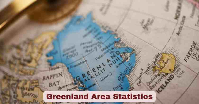
Greenland Area in 2026
Greenland area statistics in 2026 reveal the extraordinary dimensions of the world’s largest island, spanning an immense 2,166,090 square kilometers (836,330 square miles)—a landmass more than three times the size of Texas and larger than the combined territories of France, Germany, Spain, United Kingdom, Italy, Greece, Switzerland, and Belgium. This vast Arctic territory, positioned between the Atlantic Ocean and the Arctic Ocean, extends 2,670 kilometers (1,660 miles) from its northernmost point at Cape Morris Jessup (just 740 kilometers from the North Pole) to its southern tip at Cape Farewell, with a maximum width of 1,100 kilometers (650 miles) at approximately 77°N latitude. Despite its enormous geographic footprint making it the 12th largest country or territory in the world by total area, Greenland supports one of Earth’s smallest populations at approximately 56,000 people as of 2026, creating the planet’s lowest population density of just 0.026 people per square kilometer—a statistic that underscores the territory’s extreme environmental conditions and ice-dominated landscape.
The defining geographic feature of Greenland in 2026 remains the massive Greenland Ice Sheet, which blankets approximately 1,710,000 square kilometers (660,000 square miles)—representing 79-80% of the island’s total surface area and making it the second-largest ice mass on Earth after Antarctica. This colossal ice formation averages 1,500 meters (5,000 feet) in thickness, reaches maximum depths exceeding 3,000 meters (10,000 feet), and contains approximately 2.9 million cubic kilometers (696,000 cubic miles) of frozen water—enough ice that if completely melted would raise global sea levels by approximately 7.4 meters (24 feet). The ice-free areas, totaling roughly 410,000-456,000 square kilometers depending on measurement methodologies, occupy coastal strips where virtually all 56,000 residents cluster in 80 settlements and towns, with the capital Nuuk alone housing approximately 20,000 people or 36% of the entire national population. As climate change accelerates Arctic warming at rates twice the global average, Greenland’s ice sheet lost a net 129 gigatons of ice during the 2024-2025 mass balance year according to NASA’s GRACE-FO satellite measurements, continuing an unbroken pattern of annual ice loss extending back to the late 1990s and fundamentally reshaping this island’s geography, ecology, and geopolitical significance in the 21st century.
Interesting Facts and Latest Statistics for Greenland Area in 2026
| Category | Key Facts & Statistics | Year/Source |
|---|---|---|
| Total Area | 2,166,090 square kilometers (836,330 square miles) | World Bank/UN 2023 |
| World Ranking by Area | 12th largest country/territory globally | Geographic Data |
| Comparison to US State | More than 3 times the size of Texas | Area Comparison |
| Ice Sheet Coverage | 1,710,000 square kilometers (660,000 square miles) | NASA/NSIDC 2025 |
| Ice Coverage Percentage | 79-80% of total land area | NSIDC Data |
| Ice-Free Land Area | 410,000-456,000 square kilometers | Multiple Sources |
| Ice-Free Percentage | 20-21% of total territory | Calculated |
| Ice Sheet Thickness Average | 1,500 meters (5,000 feet) | National Snow & Ice Data Center |
| Maximum Ice Thickness | 3,000+ meters (10,000 feet) | Scientific Measurements |
| Ice Volume | 2.9 million cubic kilometers | NSIDC 2025 |
| Sea Level Rise Potential | 7.4 meters (24 feet) if completely melted | Climate Science |
| North-South Length | 2,670 kilometers (1,660 miles) | Geographic Measurement |
| Maximum Width | 1,100 kilometers (650 miles) at 77°N | Geographic Data |
| Distance to North Pole | 740 kilometers from Cape Morris Jessup | Geographic Data |
| Population 2026 | 55,689-56,885 people | UN/World Bank |
| Population Density | 0.026 people per square kilometer | Lowest in world |
| Urban Population | 90.73% live in urban areas | UN Data 2025 |
| Capital Nuuk Population | 20,113-20,288 people | Statistics Greenland 2025 |
| Nuuk % of Total Population | 35-36% of entire country | Demographic Data |
| 2025 Ice Loss | -129 gigatons net mass balance | GRACE-FO Satellite 2025 |
| National Park Area | 972,000 square kilometers | Greenland National Park |
Data Source: World Bank, United Nations Statistics Division, National Snow and Ice Data Center, NASA, Statistics Greenland, Britannica, NOAA Arctic Report Card 2025
The comprehensive data on Greenland area in 2026 illustrates the dramatic contrast between the island’s massive geographic footprint and its tiny human population. At 2,166,090 square kilometers, Greenland’s total area exceeds that of Mexico (1,964,375 km²), Indonesia (1,904,569 km²), and Libya (1,759,540 km²), yet its population of approximately 56,000 is smaller than many individual neighborhoods in major world cities—creating a population density of 0.026 people per square kilometer that ranks as the absolute lowest of any country or territory on Earth. This extraordinary ratio stems from the Greenland Ice Sheet’s domination of 79-80% of the landmass, leaving only the coastal periphery habitable.
The ice-free areas totaling 410,000-456,000 square kilometers (sources vary slightly based on measurement methodology and whether peripheral glaciers are included separately from the main ice sheet) approximate the size of Norway or California, providing the only terrain suitable for human settlement and infrastructure. This ice-free zone follows the coastline in an irregular ring, widest in the southwest where the capital Nuuk and major towns Sisimiut, Ilulissat, and Qaqortoq are located, narrowing dramatically along the eastern and northern coasts where only scattered settlements like Tasiilaq, Ittoqqortoormiit, and Qaanaaq persist in some of Earth’s most isolated inhabited locations. The concentration of 90.73% of Greenland’s population in designated urban areas, with Nuuk alone containing 35-36% of all residents, reflects the centralization of services, employment, and infrastructure in larger settlements, a pattern accelerating as residents abandon remote villages for economic opportunities in towns.
The 2024-2025 ice loss of 129 gigatons measured by NASA’s GRACE-FO satellite system, while less than the 2003-2024 average annual loss of 219 gigatons, continues the relentless pattern of net ice mass decline occurring every single year since the late 1990s—a sustained loss unprecedented in the observational record. This ice loss contributes directly to global sea level rise, accounts for changing ocean circulation patterns, and exposes previously ice-covered land where vegetation including wetlands and shrub areas now replaces the former frozen landscape, fundamentally altering Greenland’s ecological character and accelerating a feedback loop where darker vegetation and exposed rock absorb more solar radiation than reflective ice, further accelerating warming in a self-reinforcing cycle.
Total Area Measurements and Comparisons for Greenland in 2026
| Measurement Category | Value | Context/Comparison |
|---|---|---|
| Total Land Area | 2,166,090 km² (836,330 mi²) | World Bank/UN Official |
| Rank Among All Countries | 12th largest in world | By total area |
| Comparison to Texas | 3.14 times larger than Texas | Texas: 695,662 km² |
| Comparison to Alaska | 1.3 times larger than Alaska | Alaska: 1,717,856 km² |
| Comparison to Scandinavia | Larger than Sweden + Norway | Combined Scandinavian area |
| European Comparison | France + Germany + Spain + UK + Italy + Greece + Switzerland + Belgium | Exceeds combined area |
| North-South Extent | 2,670 km (1,660 miles) | Cape Morris Jessup to Cape Farewell |
| East-West Maximum Width | 1,100 km (650 miles) | At approximately 77°N latitude |
| Coastline Length | 44,087 kilometers | Highly irregular with fjords |
| Territorial Waters | Extensive Arctic maritime claims | EEZ under negotiation |
| Continental Shelf | Overlapping claims with Canada, Denmark | Arctic resource disputes |
| Northernmost Point | Cape Morris Jessup (83°39’N) | 740 km from North Pole |
| Southernmost Point | Cape Farewell (59°46’N) | Same latitude as Oslo, Norway |
| Westernmost Point | Cape Alexander | Same longitude as New York City |
| Easternmost Point | Nordostrundingen | Extended archipelago |
Data Source: United Nations Statistics Division, World Bank, Statistics Greenland, Britannica Geographic Encyclopedia, CIA World Factbook
Total area measurements for Greenland in 2026 consistently place this Arctic island as the 12th largest country or territory globally, though its political status as an autonomous constituent country within the Kingdom of Denmark rather than a fully independent nation sometimes excludes it from straightforward country-by-area rankings. The official measurement of 2,166,090 square kilometers reported by the World Bank and United Nations Statistics Division represents the total land area excluding territorial waters but including the massive ice sheet covering most of the interior. This figure makes Greenland larger than Saudi Arabia (2,149,690 km²), Mexico (1,964,375 km²), Indonesia (1,904,569 km²), and Libya (1,759,540 km²), while falling short of Kazakhstan (2,724,900 km²) and Algeria (2,381,741 km²).
The comparison to Texas, frequently used to help Americans grasp Greenland’s scale, shows the island is 3.14 times larger than the largest U.S. state (Texas: 695,662 km² including water). Greenland even exceeds Alaska (1,717,856 km²) by approximately 26%, making it significantly larger than the largest American state despite Alaska’s reputation for vastness. The cumulative comparison to multiple European countries—France, Germany, Spain, United Kingdom, Italy, Greece, Switzerland, and Belgium combined—provides another striking perspective on Greenland’s geographic magnitude, as this single island surpasses the combined territories of these eight populous and economically significant nations.
Greenland’s elongated shape extends 2,670 kilometers from north to south, spanning from Cape Morris Jessup at 83°39’N latitude (the northernmost permanent land point in the world, located just 740 kilometers from the geographic North Pole) to Cape Farewell at 59°46’N latitude near the southern tip. This north-south span creates dramatic climatic variation, with the northernmost settlements experiencing 24-hour darkness during winter and 24-hour daylight during summer, while southern regions experience more moderate seasonal light variations. The maximum east-west width of 1,100 kilometers occurs at approximately 77°N latitude, though the island narrows substantially both north and south of this point.
The coastline, measuring 44,087 kilometers according to detailed surveys, ranks among the longest of any country due to Greenland’s profoundly irregular perimeter featuring thousands of fjords—deep, glacially-carved inlets that penetrate far inland and create a fractal-like coastal complexity. The famous Ilulissat Icefjord on the western coast, a UNESCO World Heritage Site, exemplifies these dramatic geographic features where massive icebergs calved from the Jakobshavn Glacier (one of the world’s fastest-moving glaciers at speeds reaching 40 meters per day) drift through narrow channels creating spectacular scenery and navigation hazards. Greenland’s extreme northern location places it at the center of emerging Arctic geopolitical competition, with overlapping continental shelf claims between Denmark (on behalf of Greenland), Canada, and Russia potentially affecting control over vast seabed resources including petroleum deposits, minerals, and fisheries access as melting ice opens previously inaccessible waters to commercial exploitation.
Ice Sheet Coverage and Characteristics for Greenland in 2026
| Ice Sheet Feature | Measurement | Source |
|---|---|---|
| Ice Sheet Area | 1,710,000 km² (660,000 mi²) | NASA/NSIDC 2025 |
| Percentage of Greenland | 79-80% of total land area | Calculated |
| World Ranking | 2nd largest ice mass (after Antarctica) | Global comparison |
| Average Thickness | 1,500 meters (5,000 feet) | NSIDC Data |
| Maximum Thickness | 3,000+ meters (10,000 feet) | Scientific measurement |
| Ice Volume | 2.9 million cubic kilometers | NSIDC 2025 |
| Sea Level Equivalent | 7.4 meters (24 feet) | If completely melted |
| Fastest Glacier Speed | 15 km per year (Jakobshavn) | 21st century measurement |
| Summit Elevation | 3,216 meters (10,551 feet) | Highest point on ice |
| Bedrock Below Sea Level | Significant interior areas | Due to ice weight |
| Age of Ice (Oldest) | ~1 million years | Ice core data |
| Annual Snowfall Accumulation | Variable by region | Replenishes ice |
| 2025 Mass Balance | -129 gigatons net loss | GRACE-FO satellite |
| 2003-2024 Average Loss | -219 gigatons per year | Historical average |
| Continuous Loss Period | Every year since late 1990s | Unprecedented trend |
| Ice Loss 1985-2015 | 28,707 km² area lost | University of Leeds study |
| Peripheral Glaciers | 76,000-100,000 km² | Separate from main ice sheet |
| Greenland National Park | 972,000 km² (partially on ice) | World’s largest national park |
Data Source: National Snow and Ice Data Center, NASA GRACE-FO and ICESat-2, NOAA Arctic Report Card 2025, University of Leeds Climate Research, Britannica
The Greenland Ice Sheet dominates the island’s geography in 2026, covering 1,710,000 square kilometers (660,000 square miles)—an area roughly equivalent to Libya or three times the size of Texas—and constituting approximately 79-80% of Greenland’s total land surface. This massive ice formation represents the second-largest ice mass on Earth after the Antarctic Ice Sheet (which covers ~14 million km²) and contains about 10% of the world’s total freshwater reserves locked in frozen form. The ice averages 1,500 meters (5,000 feet) thick across the ice sheet, but reaches maximum depths exceeding 3,000 meters (10,000 feet) in central regions where accumulated snow compressed over hundreds of thousands of years has created ice layers that preserve climate records extending back approximately 1 million years based on deep ice core drilling projects.
The total ice volume of 2.9 million cubic kilometers contains enough frozen water that complete melting would raise global mean sea level by approximately 7.4 meters (24 feet)—a catastrophic scenario that would inundate coastal cities worldwide including New York, London, Tokyo, Mumbai, Shanghai, and Miami. Climate scientists estimate that global warming between 1.7°C and 2.3°C above pre-industrial levels would likely trigger irreversible melting processes making the ice sheet’s eventual disappearance inevitable over timescales of 1,000 to 10,000 years, while limiting warming to 1.5°C would still cause ice loss equivalent to 1.4 meters of sea level rise—underscoring the critical importance of greenhouse gas emissions reduction in determining Greenland’s glaciological future.
The ice sheet exhibits constant motion, flowing outward from the central dome under its own immense weight, with flow speeds varying from just a few centimeters per year near the summit where slopes are gentlest, to hundreds of meters or even several kilometers annually near the coast where ice funnels into outlet glaciers and ice streams. The Jakobshavn Glacier (Sermeq Kujalleq in Greenlandic) on the western coast exemplifies extreme glacial velocity, having reached speeds as fast as 15 kilometers per year during the 21st century—making it one of Earth’s fastest-moving glaciers and a major contributor to iceberg calving into Disko Bay. The 2024-2025 mass balance measured by NASA’s GRACE-FO satellite system showed a net loss of 129 gigatons of ice, below the 2003-2024 average annual loss of 219 gigatons but continuing the unbroken pattern of negative mass balance extending back to the late 1990s. Research from the University of Leeds analyzing satellite imagery from the 1980s through 2010s documented that approximately 28,707 square kilometers of ice and glacier coverage melted over those three decades—an area equivalent to Albania—representing about 1.6% of Greenland’s total ice and glacier cover and revealing where barren rock, wetlands, and shrub vegetation now replace the former frozen landscape.
Ice-Free Areas and Human Geography for Greenland in 2026
| Ice-Free Category | Area/Statistics | Details |
|---|---|---|
| Total Ice-Free Area | 410,000-456,000 km² | Measurement variations |
| Percentage of Greenland | 20-21% of total area | Habitable zone |
| Comparison | Approximately size of Norway or California | Geographic equivalent |
| Population 2026 | 55,689-56,885 people | UN/World Bank data |
| Population Density (Total) | 0.026 people per km² | World’s lowest |
| Population Density (Ice-Free) | ~0.13 people per km² | Habitable areas only |
| Urban Population | 90.73% (50,575 people) | UN Data 2025 |
| Number of Settlements | Approximately 80 total | Towns and villages |
| Number of Towns | 16 recognized towns | Major population centers |
| Number of Settlements | 64 smaller settlements | Rural communities |
| Capital: Nuuk Population | 20,113-20,288 | Statistics Greenland 2025 |
| Nuuk % of Total | 35-36% of national population | Extreme centralization |
| Sisimiut Population | ~5,600 people | 2nd largest town |
| Ilulissat Population | ~5,000 people | 3rd largest town |
| Qaqortoq Population | ~3,000 people | South Greenland center |
| Coastline Settlement Pattern | All towns on coast | No inland settlements |
| No Roads Between Towns | Travel by sea or air only | Geographic isolation |
| Southwest Concentration | Most population in this region | Milder climate |
Data Source: Statistics Greenland, UN Population Division, World Bank, Worldometer, Countrymeters, Wikipedia Demographics 2026
The ice-free areas of Greenland in 2026, totaling approximately 410,000 to 456,000 square kilometers depending on measurement methodologies and whether peripheral glaciers are counted separately from the main ice sheet, represent the only portion of this massive island where human settlement, infrastructure, and biological productivity can exist. These ice-free zones, constituting roughly 20-21% of Greenland’s total territory, approximate the combined size of Norway (385,207 km²) or California (423,970 km²)—suggesting substantial potential habitable space. However, much of this ice-free area consists of rugged mountains, barren rock, permafrost-affected tundra, and inhospitable terrain that remains practically uninhabitable, leaving only coastal strips with access to marine resources, relatively moderate microclimates, and transportation corridors suitable for permanent settlement.
The total population of 55,689 to 56,885 people (estimates vary slightly by source and date) inhabiting these ice-free zones creates an overall population density of approximately 0.13 people per square kilometer when calculated against ice-free area only, or 0.026 people per square kilometer when calculated against Greenland’s entire 2,166,090 km² total area including the ice sheet—the latter figure ranking as the absolute lowest population density of any country or territory on Earth. For comparison, Mongolia has 2.1 people per km², Iceland has 3.5 per km², Canada has 4.2 per km², and even Western Sahara has 2.4 per km², making Greenland’s population density more than 80 times lower than these already sparsely populated territories.
The extreme urban concentration of 90.73% of the population living in designated urban areas reflects the economic and practical necessity of clustering in larger settlements where employment opportunities, education, healthcare, government services, and modern amenities exist. Nuuk, the capital and largest city with 20,113 to 20,288 residents, contains a remarkable 35-36% of Greenland’s entire national population—one of the highest capital-to-country population ratios globally, comparable to Iceland where Reykjavík contains 37% of national population, or Uruguay where Montevideo holds 42%. This extraordinary concentration in a single city reflects sustained internal migration over the past 50 years as Greenlanders have progressively abandoned remote settlements for Nuuk’s superior employment in government administration, services, education, healthcare, and commercial sectors.
All 80 settlements including 16 recognized towns and 64 smaller villages are located along the coastline, with absolutely no inland settlements existing anywhere in Greenland—a settlement pattern dictated by the ice sheet’s interior domination, the necessity of marine access for food and transportation, and the impossibility of overland travel across the ice. The complete absence of roads connecting towns means that inter-community travel occurs exclusively by boat during ice-free months (June-October in southern regions), airplane year-round to communities with airstrips, helicopter to smaller settlements, or dogsled and snowmobile over frozen sea ice during winter in northern regions—creating a unique transportation geography where a 30-minute flight might be the only way to reach a neighboring town just 50 kilometers away across a fjord.
Climate Change Effects on Greenland Area in 2026
| Climate Impact | Measurement/Change | Time Period |
|---|---|---|
| Ice Sheet Mass Loss 2025 | -129 gigatons | Sept 2024-Aug 2025 |
| Average Annual Loss 2003-2024 | -219 gigatons per year | 22-year average |
| Continuous Loss Period | Every year since late 1990s | ~28 years |
| Total Ice Area Lost 1985-2015 | 28,707 km² melted | 30-year period |
| Percentage of Ice Lost | 1.6% of total ice cover | 1985-2015 |
| Sea Level Contribution | Rising contributor | Ongoing impact |
| Arctic Warming Rate | 2x global average | Accelerated warming |
| Temperature Increase | Significant Arctic amplification | 21st century |
| Vegetation Expansion | 33,774 km² new wetland/shrub | 30 years |
| Barren Rock Exposure | Previously ice-covered land | Ongoing reveal |
| Glacial Retreat Rate | Doubled over past 2 decades | Acceleration |
| 2025 Melt Season | Moderately intense (19th in 47-year record) | May-Sept 2025 |
| Summer Melt Extension | Extended periods in July 2025 | Seasonal variation |
| Precipitation Changes | Above average coastal winter | 2024-2025 |
| Irreversible Threshold | 1.7-2.3°C global warming | Climate science |
| Timeline to Complete Melt | 1,000-10,000 years | At high warming |
| Sea Level if 1.5°C Warming | 1.4 meters contribution | Conservative scenario |
Data Source: NASA GRACE-FO, ICESat-2, NOAA Arctic Report Card 2025, National Snow and Ice Data Center, University of Leeds, Intergovernmental Panel on Climate Change
Climate change effects on Greenland in 2026 are dramatically reshaping the island’s physical geography, with the Greenland Ice Sheet experiencing sustained mass loss at rates unprecedented in the observational record and likely unmatched for thousands of years based on paleoclimate reconstructions. The 2024-2025 mass balance measured by NASA’s GRACE-FO satellite mission showed a net ice loss of 129 gigatons over the September 2024 through August 2025 measurement year—below the 2003-2024 average of 219 gigatons annually but continuing the unbroken pattern of negative mass balance occurring every single year since the late 1990s. This sustained ice loss reflects the cumulative impacts of rising air temperatures, increased surface melting during longer and more intense summer seasons, accelerated glacial flow rates, enhanced calving of icebergs from marine-terminating glaciers, and reduced winter snow accumulation failing to offset summer losses.
Arctic warming proceeds at approximately twice the global average rate due to feedback mechanisms including albedo reduction (melting ice exposes darker water and land that absorb more solar radiation than reflective ice and snow), sea ice loss exposing dark ocean waters, and permafrost thaw releasing methane and carbon dioxide—creating regional temperature increases that dramatically exceed the roughly 1.1-1.2°C of global mean warming since pre-industrial times. Research from the University of Leeds analyzing satellite imagery from the 1980s through 2010s documented that approximately 28,707 square kilometers of ice coverage melted over those three decades—an area equivalent to Albania representing about 1.6% of Greenland’s total ice and glacier cover. Where ice once dominated, the landscape now features barren rock, wetlands, and shrub areas totaling approximately 33,774 square kilometers of newly vegetated terrain—a dramatic ecological transformation as plants colonize previously frozen ground, accelerating warming through reduced surface reflectivity.
The 2025 summer melt season, classified as “moderately intense” and ranking 19th in the 47-year satellite record for cumulative daily melt area according to the National Snow and Ice Data Center, featured an extended period of surface melting during parts of July 2025 and a sharp increase in warmth and melting during mid-August 2025. The melt season typically runs from May through early September, with the extent, intensity, and duration of melting varying substantially from year to year based on atmospheric circulation patterns, cloud cover, and precipitation timing. Notably, 2025 featured above-average precipitation at coastal weather stations, particularly significant winter snowfall in the northeast during December 2024 through February 2025, and unusual June 2025 snowfall accumulation at inland stations—demonstrating that while overall ice loss continues, year-to-year variability in weather patterns creates substantial fluctuations in annual mass balance.
Climate science indicates that global warming between 1.7°C and 2.3°C above pre-industrial levels would likely trigger irreversible processes leading to the Greenland Ice Sheet’s eventual complete disappearance over timescales of 1,000 to 10,000 years, while even limiting warming to 1.5°C (the aspirational target of the Paris Agreement) would still cause ice loss contributing approximately 1.4 meters to sea level rise over coming centuries. The stakes extend beyond Greenland itself: ice loss contributes to global sea level rise already causing coastal erosion, saltwater intrusion into aquifers, tidal flooding, heightened storm surge damage, and eventual permanent inundation of low-lying coastal areas worldwide. Regional impacts include potential disruption of North Atlantic thermohaline circulation (the ocean current system including the Gulf Stream), which could paradoxically cause cooling in northern Europe despite global warming, along with changes in nutrient fluxes affecting marine food webs and fisheries in waters surrounding Greenland.
Greenland National Park Area and Protected Lands in 2026
| Protected Area | Size | Details |
|---|---|---|
| Greenland National Park (Total) | 972,000 km² | World’s largest national park |
| Percentage of Greenland | 45% of total land area | Northeast Greenland |
| World Park Size Ranking | Larger than 163 countries | Area comparison |
| Comparison to France | 1.8 times larger than France | 543,940 km² vs 972,000 km² |
| Comparison to Texas | 1.4 times larger than Texas | Massive protected zone |
| Permanent Human Population | 0 (uninhabited) | Except research stations |
| Sirius Dog Sled Patrol | Danish military presence | Only regular inhabitants |
| Weather Stations | Scientific research facilities | Temporary staff |
| Established | 1974 | 50+ years of protection |
| Expanded | 1988 | Increased to current size |
| Marine Area Protection | Adjacent waters protected | Extended conservation |
| Wildlife | Musk ox, polar bear, arctic wolf, caribou | Arctic megafauna |
| UNESCO Sites in Greenland | 3 total | Ilulissat, Aasivissuit-Nipisat, Kujataa |
| Ilulissat Icefjord | UNESCO World Heritage Site | Glacial calving zone |
| Conservation Status | Multiple protected zones | Beyond national park |
| Indigenous Land Rights | Inuit traditional territories | Throughout Greenland |
| Resource Extraction Limits | Restrictions on mining/drilling | Environmental protection |
Data Source: Greenland National Park Authority, UNESCO World Heritage Centre, Statistics Greenland, Protected Planet Database
Greenland National Park in 2026 remains the world’s largest terrestrial national park, encompassing a staggering 972,000 square kilometers of the island’s remote northeastern interior and coast—an area larger than 163 sovereign countries including France (543,940 km²), Spain (505,990 km²), and Thailand (513,120 km²). Established in 1974 and dramatically expanded to its current dimensions in 1988, this vast protected zone represents approximately 45% of Greenland’s total land area, preserving pristine Arctic wilderness, critical wildlife habitat, and scientific research opportunities in one of Earth’s most extreme and least human-impacted environments.
The park’s 972,000 square kilometers make it approximately 1.4 times larger than Texas and 1.8 times larger than France, yet it harbors virtually no permanent human population except for the Danish military’s Sirius Dog Sled Patrol—an elite unit that conducts long-distance dogsled patrols across the park’s frozen expanses maintaining Danish sovereignty and conducting search and rescue operations—and seasonal staff at scattered weather stations and research facilities. This absence of human settlement reflects the extreme environmental conditions: the park lies entirely within the High Arctic, experiences winter temperatures plunging below -50°C (-58°F), endures 24-hour darkness for months during polar winter, and remains blanketed in ice and snow for much of the year with only brief summer windows when coastal areas become accessible.
Despite harsh conditions, the park supports remarkable Arctic wildlife including approximately 5,000-15,000 musk oxen (the world’s largest population of these Ice Age relicts), polar bears that hunt seals on sea ice and occasionally wander inland, arctic wolves existing at the northernmost edge of their global range, and Peary caribou adapted to extreme cold through specialized physiology and behavior. Marine areas adjacent to the park support walrus, narwhal, beluga whales, and ringed seals—species increasingly affected by sea ice loss as climate change transforms Arctic marine ecosystems.
Beyond the national park, Greenland protects multiple UNESCO World Heritage Sites including the Ilulissat Icefjord inscribed in 2004 for its outstanding natural beauty and scientific significance as one of the most active glacial systems globally, where the Jakobshavn Glacier calves massive icebergs into the fjord creating a constantly changing seascape of floating ice. The Aasivissuit-Nipisat site, inscribed in 2018, preserves an intact Inuit cultural landscape demonstrating 4,200 years of human adaptation to changing Arctic climate, while Kujataa, added in 2017, represents a subarctic farming landscape where Norse and Inuit cultures encountered and influenced one another from the 10th century onward. These protections reflect Greenland’s growing recognition that its extraordinary landscapes, unique ecosystems, and cultural heritage represent globally significant resources worthy of preservation even as economic development pressures intensify with expanding mineral exploration and extraction possibilities as melting ice exposes previously inaccessible deposits.
Territorial Waters and Maritime Zones for Greenland in 2026
| Maritime Zone | Extent/Details | Legal Framework |
|---|---|---|
| Territorial Sea | 12 nautical miles from baseline | UN Convention Law of the Sea |
| Contiguous Zone | 24 nautical miles from baseline | UNCLOS provisions |
| Exclusive Economic Zone | 200 nautical miles from baseline | Fishing and resource rights |
| EEZ Area | Approximately 2.2 million km² | Estimated maritime zone |
| Continental Shelf Claims | Beyond 200 nm in Arctic | Extended shelf submissions |
| Overlapping Claims | With Canada, Iceland, Norway | Disputed boundaries |
| Lomonosov Ridge Dispute | Denmark vs. Russia vs. Canada | Arctic seabed claim |
| Fisheries Zone | 200 nautical miles | Primary economic activity |
| Main Fish Species | Cod, halibut, shrimp, crab | Commercial fisheries |
| Annual Fish Catch | ~200,000-280,000 tons | Economic mainstay |
| Fishing % of Exports | ~90% of total export value | Economic dependence |
| Sea Ice Reduction | Opening new shipping routes | Climate change impact |
| Northwest Passage | Increasingly navigable waters | Geopolitical significance |
| Mineral Rights | Offshore petroleum potential | Unexplored reserves |
| Sovereignty Disputes | International Arctic competition | Strategic importance |
| Danish Defense Responsibility | Kingdom of Denmark military | Security provision |
| Indigenous Rights | Inuit traditional use | Ongoing negotiations |
Data Source: United Nations Convention on the Law of the Sea, Statistics Greenland, Danish Ministry of Foreign Affairs, Arctic Council, Fisheries and Oceans Canada
Territorial waters and maritime zones for Greenland in 2026 extend the island’s effective controlled area far beyond its 2,166,090 square kilometer land territory, with an Exclusive Economic Zone (EEZ) of approximately 2.2 million square kilometers—roughly equal to Greenland’s land area—providing sovereign rights over marine resources, fishing, and seabed mineral extraction. Under the United Nations Convention on the Law of the Sea (UNCLOS), coastal nations including Denmark (exercising sovereignty on behalf of Greenland as part of the Kingdom of Denmark) can claim a 12 nautical mile territorial sea where full sovereignty applies, a 24 nautical mile contiguous zone for customs and immigration enforcement, and a 200 nautical mile EEZ for resource exploitation while maintaining freedom of navigation for other nations.
The fisheries zone constitutes Greenland’s most economically vital maritime resource, with commercial fishing and fish processing accounting for approximately 90% of Greenland’s export earnings as of 2026. Annual catches totaling 200,000 to 280,000 tons include primarily Greenland halibut, Atlantic cod, northern shrimp, and snow crab—species whose populations, distributions, and migration patterns are increasingly affected by warming ocean temperatures and changing sea ice conditions. The shrimp fishery alone generates over 60% of export value, though warming waters have caused shrimp populations to decline in southern areas while potentially expanding their range northward, creating economic uncertainty for communities dependent on this single resource.
Beyond the standard 200 nautical mile EEZ, Denmark has submitted claims to the Commission on the Limits of the Continental Shelf for extended continental shelf areas where the seabed is a natural prolongation of Greenland’s landmass beyond 200 nautical miles. These submissions include controversial claims to the Lomonosov Ridge—an undersea mountain range extending across the Arctic Ocean—where Denmark, Russia, and Canada have submitted overlapping claims that may not be resolved for decades. The potential rewards justify the diplomatic investment: Arctic waters may contain 13% of the world’s undiscovered oil and 30% of undiscovered natural gas according to U.S. Geological Survey estimates, along with valuable mineral deposits and fisheries increasingly accessible as sea ice retreats.
Sea ice reduction driven by climate change has opened previously ice-choked waters to navigation for extended periods, with the Northwest Passage along Greenland’s western coast experiencing record low summer ice extent during recent years. While this creates potential for shorter shipping routes between Europe and Asia (saving thousands of nautical miles compared to routes through the Suez or Panama Canals), it also raises complex sovereignty questions. Canada asserts that the Northwest Passage constitutes internal Canadian waters requiring permission for transit, while the United States and European Union maintain it represents an international strait where freedom of navigation applies—a dispute with significant implications for Greenland’s adjacent waters and potential transit fees, environmental regulations, and search-and-rescue responsibilities as Arctic shipping increases throughout the 21st century.
Geological and Mineral Resources of Greenland Area in 2026
| Resource Category | Deposits/Potential | Development Status |
|---|---|---|
| Rare Earth Elements | World-class deposits (Kvanefjeld) | Development controversial |
| Zinc | Major deposits (historic mining) | Black Angel mine (closed) |
| Lead | Significant reserves | Previously mined |
| Gold | Multiple exploration sites | Limited production |
| Diamonds | Discovered deposits | Not commercially viable |
| Ruby and Sapphire | Pink sapphires (Aappaluttoq) | Small-scale mining |
| Iron Ore | Massive deposits (Isua) | Undeveloped |
| Copper | Various sites | Exploration phase |
| Uranium | Associated with REE deposits | Mining ban until 2024 |
| Nickel | Potential deposits | Exploration ongoing |
| Platinum Group Metals | Possible reserves | Early exploration |
| Petroleum | Offshore potential | Exploration suspended 2021 |
| Natural Gas | Offshore reserves estimated | Unexplored |
| Oil Moratorium | Ended oil exploration 2021 | Climate policy |
| Greenland Mining Companies | Multiple exploration licenses | Awaiting development |
| Environmental Concerns | Radioactive waste, water pollution | Major barrier |
| Indigenous Opposition | Some projects face resistance | Land rights issues |
| 2024 Uranium Ban Lift | Parliament reversed 2013 ban | Policy change |
Data Source: Greenland Ministry of Mineral Resources, U.S. Geological Survey, Geological Survey of Denmark and Greenland, Mining.com, Reuters
Geological and mineral resources of Greenland in 2026 represent one of the island’s most significant potential economic assets, with vast deposits of rare earth elements, zinc, lead, gold, iron ore, copper, uranium, and other valuable minerals embedded in some of Earth’s oldest rocks—the 3.8 billion year old Isua Greenstone Belt contains some of the planet’s most ancient geological formations, providing both scientific insights into early Earth and commercial mineral concentrations formed by ancient geological processes.
The Kvanefjeld deposit in southern Greenland contains one of the world’s largest rare earth element (REE) reserves, with an estimated 1.4 billion tons of ore containing commercially significant concentrations of neodymium, praseodymium, dysprosium, and other elements critical for electric vehicle motors, wind turbines, smartphones, and military applications. However, the deposit’s development remains controversial because the ore also contains uranium—creating radioactive waste concerns and environmental opposition that contributed to the 2021 parliamentary election where the pro-environment Inuit Ataqatigiit party won partly on a platform opposing the Kvanefjeld mine. In 2024, Greenland’s parliament voted to reverse the 2013 uranium mining ban, potentially reopening pathways for Kvanefjeld development, though environmental concerns, water pollution risks affecting nearby communities, and international market conditions continue to delay final investment decisions.
Historic mining operations demonstrated Greenland’s mineral wealth: the Black Angel zinc and lead mine near Maamorilik operated from 1973 to 1990, producing over 12 million tons of high-grade ore before closure due to depleted accessible reserves and low metal prices. The Nalunaq gold mine operated intermittently in the 2000s, while small-scale ruby and pink sapphire mining at Aappaluttoq continues on a limited basis, producing gemstones marketed as “Greenlandic rubies” despite technically being pink corundum (sapphires). The ancient Isua region contains massive iron ore deposits estimated at over 1 billion tons, though remote location, lack of infrastructure, ice conditions, and global iron ore oversupply have prevented development despite decades of exploration.
Petroleum exploration proceeded intermittently from the 1970s through 2021, with international oil companies including Exxon, Shell, Chevron, and ConocoPhillips spending over $1 billion drilling exploratory wells in waters off Greenland’s western and eastern coasts. Despite discovering oil and gas indicators, no commercially viable fields were confirmed before the Greenland government announced in 2021 that it would end all new oil and gas exploration licensing, stating that “the price of oil extraction is too high” given climate change impacts already transforming the island. This decision, while applauded by environmental groups, eliminated a potential revenue source that some economic models suggested could have generated billions in royalties and taxes, creating ongoing political debates about balancing environmental protection, climate leadership, economic development, and the goal of eventual independence from Denmark requiring fiscal self-sufficiency.
The fundamental challenge facing Greenland’s mineral sector in 2026 involves balancing enormous economic potential against environmental risks, indigenous rights, climate change responsibilities, and practical obstacles including lack of infrastructure (no roads connecting mining sites to ports), extreme weather limiting operational windows, high labor costs, distance from markets, and ice conditions affecting marine transportation. As climate change melts ice covering additional territory, previously inaccessible mineral deposits become theoretically exploitable, creating a paradox where global warming simultaneously threatens Greenland’s ice sheet while potentially enabling the resource extraction that would generate emissions accelerating that very warming.
Population Distribution and Demographic Patterns in Greenland in 2026
| Demographic Category | Statistics | Context |
|---|---|---|
| Total Population 2026 | 55,689-56,885 | UN/World Bank estimates |
| Population Growth Rate | -0.03% to +0.13% | Slight decline or minimal growth |
| Urban Population | 90.73% (50,575 people) | Extreme urbanization |
| Rural Population | 9.27% (5,170 people) | Declining rural areas |
| Ethnic Composition (Inuit) | 88-89% of population | Indigenous majority |
| Ethnic Composition (Danish) | 7-8% of population | European minority |
| Mixed Heritage | 3-5% of population | Inuit-Danish background |
| Birth Rate | ~13-14 per 1,000 | Below replacement |
| Death Rate | ~8-9 per 1,000 | Relatively low |
| Life Expectancy | ~73-74 years | Below Nordic average |
| Median Age | ~34-35 years | Young population |
| Youth Emigration | Significant outmigration | Education/employment |
| Gender Ratio | More males than females | Unusual demographic |
| Language (Greenlandic) | Official language, 67,000+ speakers | Inuit language |
| Language (Danish) | Widely spoken second language | Colonial legacy |
| Settlement Abandonment | Ongoing rural-to-urban shift | Centralization trend |
| Immigration | Minimal international migration | Mostly Danish workers |
| Independence Support | Majority favor eventual independence | Political aspiration |
Data Source: Statistics Greenland, UN Population Division, World Bank, CIA World Factbook, Countrymeters, Worldometer
Population distribution and demographic patterns in Greenland in 2026 reveal a society undergoing profound transformation, with sustained rural-to-urban migration concentrating an already tiny population into fewer and larger settlements while abandoning remote villages that have existed for generations. The total population of approximately 55,689 to 56,885 people (estimates vary by source and date) represents essentially flat or slightly declining demographic trends, with annual growth rates hovering between -0.03% and +0.13% depending on the specific year and measurement methodology. This stagnation reflects below-replacement fertility (birth rates of 13-14 per 1,000 population), youth emigration to Denmark and other countries for higher education and employment opportunities, and minimal international immigration beyond temporary Danish workers in specialized government, technical, or resource extraction positions.
The ethnic composition remains overwhelmingly Inuit at 88-89% of the population—descendants of the Thule people who migrated from Arctic Canada approximately 1,000 years ago, displacing or absorbing the earlier Dorset culture and arriving centuries after the Norse (Viking) settlements that existed from roughly 985 to 1450 CE before mysteriously disappearing. Ethnic Danes constitute 7-8% of the population, primarily employed in government administration, education, healthcare, and technical positions, while 3-5% claim mixed Inuit-Danish heritage reflecting centuries of intermarriage since Danish colonization began in 1721. The Greenlandic language (Kalaallisut), an Inuit language related to Canadian Inuktitut and Alaskan Inupiaq, serves as the sole official language since 2009 when it replaced Danish in that status, though Danish remains widely spoken as a second language and continues as the primary language of higher education and specialized government functions.
The extreme urbanization rate of 90.73% ranks among the world’s highest, with Nuuk alone containing 35-36% of the national population in a level of primacy typical of small island nations or city-states rather than vast territories. The second-largest town, Sisimiut, has only ~5,600 residents, while the third-largest, Ilulissat, has ~5,000—creating a steep urban hierarchy where Nuuk dwarfs all other settlements and concentrates governmental, educational, cultural, and economic functions to a degree unusual even by small nation standards. This concentration accelerates as rural settlements progressively lose population to Nuuk and other towns, with several villages abandoned entirely over recent decades as fishing industry mechanization, centralized healthcare and education, and limited economic opportunities made small settlements economically unviable.
Youth emigration represents a critical demographic challenge, with substantial numbers of Greenlanders moving to Denmark for university education, vocational training, or employment in sectors unavailable in Greenland’s limited economy, and a significant portion never returning permanently. This brain drain deprives Greenland of educated professionals exactly when the society aspires toward greater autonomy or eventual independence from Denmark—a goal supported by majority of Greenlanders in polls but requiring economic self-sufficiency currently impossible given Greenland’s dependence on an annual subsidy from Denmark totaling approximately 3.9 billion Danish kroner (~$570 million USD), representing roughly 20-25% of Greenland’s GDP and funding essential government services, infrastructure, and social programs that the tiny tax base cannot independently support.
Transportation and Infrastructure Across Greenland Area in 2026
| Transportation Category | Infrastructure Details | Characteristics |
|---|---|---|
| Roads Between Towns | 0 kilometers | No inter-city roads |
| Total Roads | ~150-200 km total | Only within settlements |
| Longest Road | ~40 km (Ivittuut region) | Not connecting towns |
| Primary Transportation | Air and sea | Only options |
| International Airport | Kangerlussuaq | Main hub |
| Major Airports | Nuuk, Ilulissat, Narsarsuaq | Domestic/regional |
| Airport Total | ~15 airports with scheduled service | Limited network |
| Heliports | ~50+ heliport locations | Remote settlements |
| Dog Sled Routes | Traditional winter transport | Northern regions |
| Snowmobile Use | Widespread winter transport | Modern replacement |
| Coastal Shipping | Essential for freight | Summer season |
| Ferry Services | Inter-settlement connections | Ice-dependent |
| Sea Ice Travel | Winter transportation corridor | Traditional routes |
| Port Facilities | Multiple small ports | Limited capacity |
| Tourism Infrastructure | Growing hotel/guide services | Economic sector |
| Communication Networks | Submarine cables, satellite | Digital connectivity |
| Energy Infrastructure | Primarily hydroelectric | Renewable focus |
Data Source: Statistics Greenland, Greenland Tourism, Transport companies, Infrastructure reports
Transportation and infrastructure across Greenland in 2026 presents one of the world’s most unique and challenging mobility systems, with the complete absence of roads connecting any two towns—a transportation geography unparalleled among territories of Greenland’s size and unmatched even by remote regions like the Canadian Arctic or Siberia, which at least have some overland road connections between settlements. The total road network spans only approximately 150-200 kilometers, consisting entirely of local roads within individual towns and settlements, with the longest continuous stretch of about 40 kilometers in the Ivittuut region serving local mining infrastructure but connecting to absolutely nothing beyond its immediate area.
This absence of overland transportation stems from formidable geographic obstacles: the Greenland Ice Sheet physically blocks the interior, creating an impenetrable frozen barrier 1,500 meters thick on average; the ice-free coastal strip where settlements exist features extremely rugged terrain with steep mountains, deep fjords cutting far inland, unstable permafrost-affected ground, and active glaciers descending to sea level—making road construction technically possible but economically prohibitive given the tiny population and extreme construction costs in Arctic conditions. The result is that traveling between Nuuk and Sisimiut—two towns separated by only about 320 kilometers and visible from one another on clear days across Ameralik Fjord—requires either a 30-45 minute flight or an 8-12 hour boat journey in summer, with no overland option whatsoever.
Air travel serves as the primary long-distance transportation mode, with Kangerlussuaq hosting Greenland’s international airport receiving flights from Denmark, Iceland, and seasonal connections from North America. The airport occupies a former U.S. Air Force base established during World War II, chosen for its location in one of the few areas with relatively stable weather and ice-free conditions year-round. From Kangerlussuaq, passengers must transfer to smaller aircraft operated by Air Greenland to reach Nuuk (no direct international flights serve the capital due to its short runway unable to accommodate large jets, though a new international airport under construction is scheduled to open in 2027), Ilulissat, and other towns. Approximately 15 airports with scheduled passenger service and over 50 heliports provide critical connectivity, with helicopter services reaching remote settlements lacking airstrips—though weather frequently cancels flights for days at a time, stranding passengers and creating supply disruptions.
Marine transportation carries the bulk of freight during the ice-free season (roughly June through October in southern regions, shorter in the north), with coastal shipping vessels delivering fuel, construction materials, vehicles, food, and consumer goods to settlements throughout Greenland. The Royal Arctic Line, Greenland’s national shipping company, operates regular cargo services, while passenger ferries connect some neighboring communities. During winter, sea ice closes most shipping routes, forcing reliance on air freight for perishable and urgent goods at costs many times higher than sea transport. In northern regions, sea ice itself becomes a transportation corridor, with dog sleds (still used in traditional hunting communities particularly around Qaanaaq) and snowmobiles (the modern replacement) traveling across frozen fjords and sea ice to reach locations inaccessible by other means—routes that become progressively less reliable as climate change reduces ice thickness and extent, sometimes creating life-threatening hazards for travelers who break through unexpectedly thin ice.
Economic Activities and Land Use in Greenland Area in 2026
| Economic Sector | Statistics/Details | Importance |
|---|---|---|
| Fishing Industry | 90% of export value | Dominant sector |
| Annual Fish Catch | 200,000-280,000 tons | Economic base |
| Primary Species | Shrimp, halibut, cod, crab | Main catches |
| GDP 2024 | ~$3.2-3.5 billion USD | Total economy |
| GDP per Capita | ~$56,000-62,000 USD | High but subsidized |
| Danish Subsidy | ~$570 million annually | 20-25% of GDP |
| Tourism Sector | Growing economic contributor | Expanding industry |
| Annual Tourists | ~120,000-140,000 visitors | Pre-pandemic recovery |
| Mining Sector | Minimal current production | Future potential |
| Sheep Farming | ~20,000 sheep (South Greenland) | Historic activity |
| Reindeer Herding | Limited commercial scale | Traditional practice |
| Public Sector | ~40% of employment | Government dominant |
| Unemployment Rate | ~9-10% | Labor challenges |
| Subsistence Hunting | Seals, whales, caribou, musk ox | Cultural/nutritional |
| Renewable Energy | ~70% hydroelectric | Sustainable power |
| Land Agriculture | Minimal (climate limits) | Vegetables, potatoes |
| Mineral Exploration | Multiple active licenses | Future development |
| Climate Research | International scientific presence | Growing sector |
Data Source: Statistics Greenland, World Bank, Greenland Tourism, Fisheries reports, Economic analyses
Economic activities and land use in Greenland in 2026 remain narrowly concentrated in the fishing industry, which generates approximately 90% of the territory’s export earnings through commercial harvesting of Greenland halibut, northern shrimp, Atlantic cod, and snow crab from the rich marine waters surrounding the island. Annual catches totaling 200,000 to 280,000 tons support fish processing facilities in major coastal towns, providing direct employment to several thousand workers and indirect economic activity through vessel maintenance, supply services, and related sectors. However, this extreme dependence on a single industry creates economic vulnerability to fish stock fluctuations, climate change impacts on species distributions, and international market prices—with the shrimp fishery alone responsible for over 60% of export value, making any decline in this single species population potentially catastrophic for the economy.
The GDP of approximately $3.2-3.5 billion USD creates a misleadingly high per capita GDP of roughly $56,000-62,000—comparable to wealthy European nations—though this figure obscures that roughly 20-25% of GDP consists of annual subsidies from Denmark totaling about 3.9 billion Danish kroner (~$570 million USD) that fund government services, infrastructure, education, healthcare, and social programs that Greenland’s tiny tax base cannot independently support. The public sector employs approximately 40% of the workforce, a proportion far higher than most economies and reflecting both the government’s role as employer of last resort in a limited private economy and the extensive social welfare system inherited from Danish governance.
Tourism constitutes Greenland’s fastest-growing economic sector, recovering from COVID-19 pandemic disruptions to attract approximately 120,000-140,000 international visitors annually as of 2026. Tourists come primarily to experience the Ilulissat Icefjord, observe the Northern Lights (Aurora Borealis) during winter darkness, visit Viking ruins from the Norse settlement period, encounter massive icebergs, experience traditional Inuit culture, hike in pristine Arctic wilderness, and witness the dramatic effects of climate change on Arctic environments. While tourism revenues remain modest compared to fishing, the sector provides employment opportunities in hotels, guide services, restaurants, handicraft production, and transportation, contributing economic diversification in a society overly dependent on marine resources.
Sheep farming persists as a traditional economic activity in southern Greenland around Qaqortoq and Narsaq, where approximately 45-50 farms maintain a combined flock of about 20,000 sheep grazing in ice-free valleys during brief summers—a practice dating to the Norse settlement era when Erik the Red established Greenland’s first European colonies around 985 CE. Modern farmers produce lamb meat for domestic consumption and limited export, along with wool used in traditional handicrafts. Small-scale vegetable farming occurs in greenhouses and sheltered plots, producing potatoes, turnips, cabbage, and herbs for local markets, though Greenland imports the vast majority of agricultural products from Denmark and other countries.
Subsistence hunting and fishing retain cultural significance and nutritional importance for many Greenlanders, particularly those in smaller settlements where traditional Inuit practices persist alongside modern life. Hunters harvest ringed seals, harp seals, narwhal, beluga whales, caribou, and musk oxen under quota systems designed to ensure sustainability while respecting indigenous rights to traditional resources. The meat from these hunts provides essential protein and nutrients, while sales of sealskins and other products contribute cash income to households in communities with limited wage employment opportunities.
Disclaimer: This research report is compiled from publicly available sources. While reasonable efforts have been made to ensure accuracy, no representation or warranty, express or implied, is given as to the completeness or reliability of the information. We accept no liability for any errors, omissions, losses, or damages of any kind arising from the use of this report.